Area Overview for M21 7NT
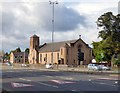
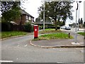
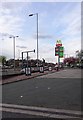
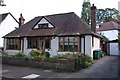
Photos of M21 7NT


Area Information
M21 7NT is a compact residential postcode in England, covering just 4,941 square metres and home to 1,677 residents. Its high population density of 339,415 people per square kilometre reflects a tightly knit community, ideal for those seeking proximity to urban conveniences without sprawling distances. The area’s small size means amenities are within practical reach, though its character is defined by a balance of residential tranquillity and accessible infrastructure. With no significant natural constraints like protected woodlands or wetlands, the area is free from planning restrictions that might complicate development. However, the high crime risk score of 0/100 raises concerns for potential residents. Despite this, the area benefits from excellent broadband connectivity, rated at 100, ensuring seamless digital access. M21 7NT is a microcosm of suburban living, where daily life revolves around nearby shops, transport links, and a mix of local and regional services. Its compact footprint makes it a viable option for buyers prioritising convenience over space.
- Area Type
- Postcode
- Area Size
- 4941 m²
- Population
- 1677
- Population Density
- 3934 people/km²
The property market in M21 7NT is characterised by a 32% home ownership rate, meaning most residents rent rather than own their homes. The accommodation type is predominantly houses, which is notable in a high-density postcode, suggesting a mix of semi-detached or terraced housing. This contrasts with typical urban areas where flats or apartments dominate. For buyers, this implies limited availability of owner-occupied properties, with a focus on rental properties or secondary residences. The small area size means the housing stock is unlikely to expand significantly, making competition for available homes intense. Buyers should consider the local demand for rental properties, as the low ownership rate may indicate strong tenant demand. The presence of multiple railway stations and retail outlets nearby could enhance property value, but the high crime risk may deter some investors.
House Prices in M21 7NT
Showing 11 properties
| Address | Type | Beds | Baths | Last Sale Price | Last Sale Date | |
|---|---|---|---|---|---|---|
| 77 Mersey Bank Avenue, Manchester, M21 7NT | Semi-detached | 3 | 1 | £246,829 | Sep 2020 | |
| 75 Mersey Bank Avenue, Manchester, M21 7NT | Semi-detached | 3 | 1 | £250,000 | Dec 2019 | |
| 67 Mersey Bank Avenue, Manchester, M21 7NT | house | - | - | £144,500 | Nov 2018 | |
| 63 Mersey Bank Avenue, Manchester, M21 7NT | Semi-detached | 3 | - | £152,000 | Oct 2016 | |
| 73 Mersey Bank Avenue, Manchester, M21 7NT | house | - | - | £143,000 | Jul 2015 | |
| 69 Mersey Bank Avenue, Manchester, M21 7NT | Semi-detached | 3 | 1 | £112,000 | Apr 2012 | |
| 65 Mersey Bank Avenue, Manchester, M21 7NT | Semi-detached | - | - | £48,250 | Sep 1999 | |
| 71 Mersey Bank Avenue, Manchester, M21 7NT | Semi-detached | - | - | £35,000 | Jul 1997 | |
| 61 Mersey Bank Avenue, Manchester, M21 7NT | Detached | 3 | 1 | - | - | |
| 85 Mersey Bank Avenue, Manchester, M21 7NT | house | - | - | - | - |
Energy Efficiency in M21 7NT
Residents of M21 7NT have access to a range of retail and transport hubs within walking distance. The area includes five retail outlets, such as Asda West, Co-op Hardy, and Co-op West, providing essential shopping options. For public transport, five metro stops, including Barlow Moor Road and Withington, offer convenient links to Manchester’s tram network. Three railway stations—Burnage, East Didsbury, and Mauldeth Road—connect to regional and national rail services. The proximity to four airport access points, such as Terminal Two Access and Terminal Three Access, may benefit those working in aviation or requiring frequent travel. While the area lacks major parks or leisure facilities, its compact design ensures amenities are close to homes. The presence of multiple retail and transport nodes suggests a practical, efficient lifestyle, though the absence of named parks or recreational spaces may require residents to travel further for leisure activities.
Amenities
Schools
| Rank | School | Type | Entry gender | Ages |
|---|
Explore more schools in this area
Go to Schools tabDemographics
The population of M21 7NT skews heavily towards adults aged 30–64, with a median age of 47. This suggests a community of established professionals and families, rather than students or retirees. Home ownership is relatively low at 32%, indicating a higher proportion of renters compared to owner-occupiers. The predominant accommodation type is houses, which is unusual for a high-density area, suggesting a mix of semi-detached or terraced properties. The dominant ethnic group is White, with no specific data on diversity or minority representation. The high population density, combined with a median age that excludes younger demographics, implies a community with fewer childcare needs but potentially higher demand for services catering to middle-aged residents. This profile may influence local amenities, with fewer schools or youth facilities compared to areas with younger populations.
Household Size
Accommodation Type
Tenure
Ethnic Group
Religion
Household Composition
Age
Household Deprivation
NS-SEC
Explore more demographic insights in this area
Go to Demographics tabPlanning
Planning Constraints
- Flood RiskPremium
- Ramsar Wetland SitesPremium
- Area of Outstanding Natural BeautyPremium
- Protected Nature ReservePremium
- Protected WoodlandPremium