Area Overview for M21 7NU
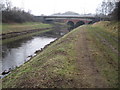
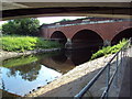
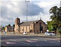
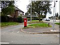
Photos of M21 7NU


Area Information
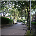
Living in M21 7NU means inhabiting a compact, densely populated residential cluster in England. The area covers 3,191 square metres and is home to 1,677 people, translating to a population density of 525,545 people per square kilometre. This suggests a tightly knit community, though the small size may limit space for expansion. The area’s character is defined by its proximity to transport links and retail hubs, with a mix of local shops and public transit options. While the population is predominantly adults aged 30–64, the median age of 47 indicates a mature demographic. Daily life here is shaped by the availability of nearby amenities, though the area’s small footprint means residents are likely to rely on surrounding neighbourhoods for broader services. The high broadband score of 100 ensures seamless digital connectivity, supporting remote work and online activities, while the mobile coverage score of 85 provides reliable connectivity for most needs. This makes M21 7NU a practical choice for those prioritising convenience and accessibility.
- Area Type
- Postcode
- Area Size
- 3191 m²
- Population
- 1677
- Population Density
- 3934 people/km²
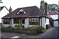
The property market in M21 7NU is characterised by a 32% home ownership rate, meaning most residents rent their homes. The accommodation type is predominantly houses, which may indicate a mix of older, traditional properties and family homes. This suggests the area is not dominated by high-density housing or modern developments but rather by established residential stock. Given the small size of the postcode area, the housing stock is likely limited, and buyers may need to consider nearby neighbourhoods for more options. The low home ownership rate could imply a rental market with potential for investment, though the compact nature of the area may restrict property availability. Those seeking a house in this area should consider proximity to transport links and the limited space for expansion within M21 7NU itself.
House Prices in M21 7NU
Showing 20 properties
| Address | Type | Beds | Baths | Last Sale Price | Last Sale Date | |
|---|---|---|---|---|---|---|
| 1 Waterside Close, Manchester, M21 7NU | Flat | - | - | - | - | |
| 7 Waterside Close, Manchester, M21 7NU | Flat | - | - | - | - | |
| 3 Waterside Close, Manchester, M21 7NU | Flat | - | - | - | - | |
| 15 Waterside Close, Manchester, M21 7NU | Flat | - | - | - | - | |
| 14 Waterside Close, Manchester, M21 7NU | Flat | - | - | - | - | |
| 6 Waterside Close, Manchester, M21 7NU | Flat | - | - | - | - | |
| 21 Waterside Close, Manchester, M21 7NU | Flat | - | - | - | - | |
| 12 Waterside Close, Manchester, M21 7NU | house | - | - | - | - | |
| 19 Waterside Close, Manchester, M21 7NU | Flat | - | - | - | - | |
| 17 Waterside Close, Manchester, M21 7NU | Flat | - | - | - | - |
Energy Efficiency in M21 7NU
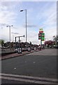
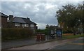
Residents of M21 7NU have access to a range of amenities within practical reach. Retail options include Asda West, Co-op Hardy, and Co-op West, providing everyday shopping needs. The area’s proximity to metro stations like Barlow Moor Road and Withington, along with rail stops such as Burnage and East Didsbury, ensures easy access to Manchester’s urban centres. Nearby airports, including Terminal One and Terminal Three, are within reach for travel. While the bus network is limited to a single stop at Chorlton Street Coach Station, the density of rail and metro links compensates with frequent services. The mix of retail, transport, and connectivity creates a convenient lifestyle, allowing residents to balance local convenience with broader access to services. The area’s compact size means amenities are close, though those seeking more leisure or green spaces may need to venture slightly further.
Amenities
Schools
| Rank | School | Type | Entry gender | Ages |
|---|
Explore more schools in this area
Go to Schools tabDemographics
The community in M21 7NU is predominantly composed of adults aged 30–64, with a median age of 47. This suggests a population skewed towards professionals, families, and older residents, rather than students or young professionals. Home ownership is relatively low at 32%, indicating that a majority of residents rent their homes. The accommodation type is primarily houses, which may reflect a mix of older properties and family homes. The predominant ethnic group is White, though no specific data on diversity or deprivation levels is provided. The high population density, combined with the age profile, suggests a stable but possibly aging community. The lack of detailed socioeconomic data means it is unclear how this affects quality of life, though the low flood risk and absence of environmental constraints may contribute to a sense of security.
Household Size
Accommodation Type
Tenure
Ethnic Group
Religion
Household Composition
Age
Household Deprivation
NS-SEC
Explore more demographic insights in this area
Go to Demographics tabPlanning
Planning Constraints
- Flood RiskPremium
- Ramsar Wetland SitesPremium
- Area of Outstanding Natural BeautyPremium
- Protected Nature ReservePremium
- Protected WoodlandPremium