Area Overview for M21 7QD
Photos of M21 7QD


Area Information
M21 7QD is a small, densely populated residential postcode in England, covering just 1,053 square metres and home to 1,677 people. The area’s compact size means it is a tightly knit community, with a population density of 1,592,276 people per square kilometre. This suggests a high concentration of residents in a limited space, likely creating a close-knit environment. The area is predominantly occupied by adults aged 30–64, with a median age of 47, indicating a mature, stable population. Daily life here is shaped by proximity to amenities and transport links, with easy access to shops, rail, and metro services. The presence of multiple retail outlets like Asda West and Co-op Hardy, alongside several railway stations, suggests a practical, convenience-driven lifestyle. While the area’s small footprint may limit green spaces, its connectivity to major infrastructure, including nearby airports and bus routes, positions it as a functional hub for commuters and those prioritising accessibility.
- Area Type
- Postcode
- Area Size
- 1053 m²
- Population
- 1677
- Population Density
- 3934 people/km²
The property market in M21 7QD is defined by a low home ownership rate of 32%, suggesting that the area is more rental-focused than owner-occupied. The primary accommodation type is houses, which may indicate a mix of semi-detached or terraced properties given the area’s small size. This limited housing stock means the market is likely constrained, with fewer properties available for purchase. For buyers, this could mean competition for a small number of homes, but it also implies that properties here may retain value due to scarcity. The area’s proximity to transport links and amenities may appeal to those seeking convenience over expansive living space. However, the lack of detailed data on property prices or types means buyers should consider the broader Manchester region for more options.
House Prices in M21 7QD
Showing 3 properties
| Address | Type | Beds | Baths | Last Sale Price | Last Sale Date | |
|---|---|---|---|---|---|---|
| 21 Pulford Avenue, Manchester, M21 7QD | house | - | - | - | - | |
| 19 Pulford Avenue, Manchester, M21 7QD | house | - | - | - | - | |
| 23 Pulford Avenue, Manchester, M21 7QD | house | - | - | - | - |
Energy Efficiency in M21 7QD
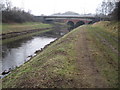
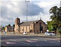
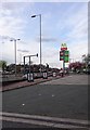
Living in M21 7QD offers access to a range of practical amenities within walking or short transit distance. Retail options include Asda West, Co-op Hardy, and Co-op West, providing everyday shopping needs. The area is served by five metro stops, including Barlow Moor Road and Withington, and five rail stations, such as East Didsbury and Mauldeth Road, facilitating easy travel to Manchester’s business and cultural hubs. Proximity to three airport terminals adds convenience for frequent flyers. The Chorlton Street Coach Station connects to further destinations. While the data does not specify dining or leisure venues, the density of transport and retail suggests a functional, service-oriented lifestyle. Residents can expect a mix of convenience and accessibility, though the area’s small size may limit larger recreational spaces.
Amenities
Schools
| Rank | School | Type | Entry gender | Ages |
|---|
Explore more schools in this area
Go to Schools tabDemographics
The population of M21 7QD is predominantly adults aged 30–64, with a median age of 47. This suggests a community of established professionals and families, rather than a younger or elderly demographic. Home ownership is relatively low at 32%, indicating that a majority of residents are likely renting. The area is characterised by houses as the primary accommodation type, which may reflect a preference for single-family living. The predominant ethnic group is White, though the data does not provide further breakdowns of diversity. The high population density—over 1.5 million people per square kilometre—raises questions about living conditions, though the data does not specify housing quality or deprivation levels. For residents, this density could mean a vibrant, active community but also potential challenges in terms of space and resources.
Household Size
Accommodation Type
Tenure
Ethnic Group
Religion
Household Composition
Age
Household Deprivation
NS-SEC
Explore more demographic insights in this area
Go to Demographics tabPlanning
Planning Constraints
- Flood RiskPremium
- Ramsar Wetland SitesPremium
- Area of Outstanding Natural BeautyPremium
- Protected Nature ReservePremium
- Protected WoodlandPremium