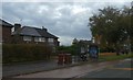
Area Overview for M21 7WN
Photos of M21 7WN


Area Information
Living in M21 7WN means being part of a tightly knit residential cluster in England, where 1,677 people inhabit just 4,789 square metres. This small area has a high population density of 350,157 people per square kilometre, reflecting its compact nature. Daily life here is shaped by proximity to transport networks, with five rail stations, five metro stops, and four airport access points within reach. The area’s compactness ensures amenities are close, though its size means it is best suited for those prioritising convenience over expansive living space. The median age of 47 suggests a mature community, with most residents falling into the 30–64 age range. This demographic balance creates a stable environment where families and professionals coexist. While the area lacks natural reserves or protected landscapes, its strategic location near Manchester’s transport corridors offers easy access to urban opportunities. For buyers, M21 7WN is a niche market, with homes predominantly in private ownership, though the 32% home ownership rate indicates a significant rental presence.
- Area Type
- Postcode
- Area Size
- 4789 m²
- Population
- 1677
- Population Density
- 3934 people/km²
The property market in M21 7WN is characterised by a 32% home ownership rate, indicating that most properties are rented rather than owned. The accommodation type is predominantly houses, which is unusual for a small, high-density area. This suggests a mix of terraced or semi-detached homes, likely catering to families or professionals seeking private living spaces. Given the area’s compact size and limited housing stock, the market is likely constrained, with limited scope for new developments. Buyers should consider the proximity to transport links, including five rail stations and four airport access points, which may enhance property value. However, the small area size means competition for available homes could be fierce. For those seeking rental properties, the 68% rental market offers opportunities, though buyers may find fewer options compared to larger residential zones.
House Prices in M21 7WN
Showing 16 properties
| Address | Type | Beds | Baths | Last Sale Price | Last Sale Date | |
|---|---|---|---|---|---|---|
| 16 Waincliffe Avenue, Manchester, M21 7WN | Terraced | 3 | 1 | £300,000 | Jul 2025 | |
| 26 Waincliffe Avenue, Manchester, M21 7WN | Semi-detached | 3 | 1 | £245,000 | Mar 2023 | |
| 32 Waincliffe Avenue, Manchester, M21 7WN | Semi-detached | - | - | £32,480 | Mar 2004 | |
| 20 Waincliffe Avenue, Manchester, M21 7WN | Semi-detached | 3 | 2 | - | - | |
| 6 Waincliffe Avenue, Manchester, M21 7WN | Semi-detached | - | - | - | - | |
| 10 Waincliffe Avenue, Manchester, M21 7WN | house | - | - | - | - | |
| 2 Waincliffe Avenue, Manchester, M21 7WN | house | - | - | - | - | |
| 22 Waincliffe Avenue, Manchester, M21 7WN | house | - | - | - | - | |
| 28 Waincliffe Avenue, Manchester, M21 7WN | house | - | - | - | - | |
| 8 Waincliffe Avenue, Manchester, M21 7WN | Semi-detached | - | - | - | - |
Energy Efficiency in M21 7WN
Residents of M21 7WN have access to a range of amenities within walking or short transit distance. Retail options include Asda West, Co-op West, and Co-op Palatine, offering everyday shopping needs. The metro system, with stops at Barlow Moor Road, Withington, and Burton Road, provides quick access to urban hubs. Rail links to East Didsbury, Burnage, and Mauldeth Road stations connect to broader regional networks, while proximity to Manchester Airport via Terminal One, Two, and Three access points is a major advantage. The area’s compactness ensures convenience, though leisure options like parks or cultural venues are not explicitly listed in the data. The presence of multiple transport modes and retail outlets supports a lifestyle that balances local convenience with urban connectivity.
Amenities
Schools
| Rank | School | Type | Entry gender | Ages |
|---|
Explore more schools in this area
Go to Schools tabDemographics
The community in M21 7WN is predominantly composed of adults aged 30–64, with a median age of 47. This suggests a mature population, likely with established careers and family structures. The 32% home ownership rate indicates that most residents rent their homes, which may reflect the area’s role as a secondary housing market rather than a primary owner-occupied zone. The accommodation type is primarily houses, though the small area size and high density imply a mix of terraced or semi-detached properties. The predominant ethnic group is White, with no specific data on other demographics provided. The high population density of 350,157 people per square kilometre, combined with the 1,677 residents, highlights a compact, possibly urbanised setting. This density may influence local services and infrastructure, though it does not necessarily correlate with deprivation levels, which are not specified in the data.
Household Size
Accommodation Type
Tenure
Ethnic Group
Religion
Household Composition
Age
Household Deprivation
NS-SEC
Explore more demographic insights in this area
Go to Demographics tabPlanning
Planning Constraints
- Flood RiskPremium
- Ramsar Wetland SitesPremium
- Area of Outstanding Natural BeautyPremium
- Protected Nature ReservePremium
- Protected WoodlandPremium