Area Overview for M21 7BE
Photos of M21 7BE


Area Information
Living in M21 7BE means inhabiting a compact, densely populated postcode area of 824 m², home to 1,677 residents. This small residential cluster is defined by its high population density of 2,034,798 people per square kilometre, reflecting a tightly knit community. The area’s character is shaped by its proximity to transport hubs and retail amenities, with a mix of local shops and public transport options within walking distance. While the postcode is small, it offers practical access to nearby metro, rail, and airport links, making it a convenient base for commuters. The median age of 47 suggests a mature population, with adults aged 30–64 forming the largest demographic group. This area is not defined by sprawling estates but by a concentration of housing stock, which may appeal to those seeking proximity to urban infrastructure without the sprawl of larger suburbs. However, its compact nature means buyers must consider nearby areas for broader housing options.
- Area Type
- Postcode
- Area Size
- 824 m²
- Population
- 1677
- Population Density
- 3934 people/km²
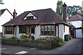
The property market in M21 7BE is characterised by a 32% home ownership rate, which places it firmly in the rental market category. Despite this, the accommodation type is predominantly houses, suggesting a mix of older, possibly larger properties that may be rented out to individuals or small households. This combination of high density and house-based housing is unusual, indicating that the area may have limited housing stock or that properties are shared among multiple occupants. For buyers, this small postcode area may not offer extensive options, necessitating consideration of nearby zones for broader choices. The low home ownership rate also implies that the area may attract tenants seeking proximity to transport links and amenities rather than long-term investment in property.
House Prices in M21 7BE
Showing 5 properties
| Address | Type | Beds | Baths | Last Sale Price | Last Sale Date | |
|---|---|---|---|---|---|---|
| 2 Thyme Close, Manchester, M21 7BE | Flat | - | - | - | - | |
| 5 Thyme Close, Manchester, M21 7BE | Bungalow | - | - | - | - | |
| 3 Thyme Close, Manchester, M21 7BE | Detached | - | - | - | - | |
| 1 Thyme Close, Manchester, M21 7BE | Flat | 3 | - | - | - | |
| 4 Thyme Close, Manchester, M21 7BE | Detached | - | - | - | - |
Energy Efficiency in M21 7BE
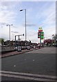
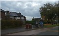
Residents of M21 7BE have access to a range of nearby amenities, including five retail outlets such as Asda West and Co-op Hardy, which provide essential shopping options. The area’s proximity to metro stops like Barlow Moor Road and rail stations such as Burnage Railway Station ensures easy access to public transport, supporting both daily commutes and leisure activities. Nearby airports, including Terminal Two Access and Terminal Three Access, cater to frequent flyers. The presence of multiple transport hubs and retail options contributes to a convenient, urban lifestyle. While the data does not specify parks or leisure facilities, the density of services suggests a focus on practicality over expansive green spaces. This makes M21 7BE suitable for those prioritising accessibility over sprawling recreational areas.
Amenities
Schools
| Rank | School | Type | Entry gender | Ages |
|---|
Explore more schools in this area
Go to Schools tabDemographics
The community in M21 7BE is predominantly composed of adults aged 30–64, with a median age of 47. This suggests a population that is largely established, with fewer young families or retirees compared to other areas. Home ownership stands at 32%, indicating that the majority of residents are renters rather than property owners. The accommodation type is primarily houses, which is notable given the area’s high density. This mix of house-based housing and high population density may reflect a combination of older properties and shared living arrangements. The predominant ethnic group is White, with no specific data provided on other ethnicities. The low home ownership rate and mature age profile may influence the area’s social dynamics, with a focus on stability and long-term residency.
Household Size
Accommodation Type
Tenure
Ethnic Group
Religion
Household Composition
Age
Household Deprivation
NS-SEC
Explore more demographic insights in this area
Go to Demographics tabPlanning
Planning Constraints
- Flood RiskPremium
- Ramsar Wetland SitesPremium
- Area of Outstanding Natural BeautyPremium
- Protected Nature ReservePremium
- Protected WoodlandPremium