Area Overview for M21 7QA
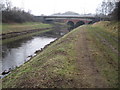
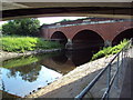
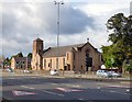
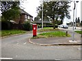
Photos of M21 7QA


Area Information
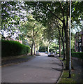
M21 7QA is a compact residential postcode area in England, covering just 1.4 hectares and home to 1,643 residents. Its high population density—120,370 people per square kilometre—suggests a tightly knit community, though the area remains small enough to feel intimate. The postcode’s character is defined by its mix of older homes and a stable population, with a median age of 47 and most residents falling between 30 and 64 years old. This suggests a community of established families and professionals, many of whom own their homes. The area’s proximity to multiple transport hubs, including rail and metro stations, and its access to nearby schools and retail centres make it a practical choice for those prioritising convenience. While the postcode is small, it offers a balance of residential calm and urban connectivity, with homes primarily in single-family structures. For buyers, the challenge lies in its limited size, which means competition for properties is likely.
- Area Type
- Postcode
- Area Size
- 1.4 hectares
- Population
- 1643
- Population Density
- 3745 people/km²
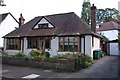
The property market in M21 7QA is dominated by owner-occupied homes, with 65% of properties owned outright. This contrasts with rental markets, where buy-to-let or private rentals are more common. The accommodation type is primarily houses, which are typically larger and more permanent than flats or apartments. This suggests a market suited to families or individuals seeking long-term stability. Given the area’s small size—just 1.4 hectares—the housing stock is limited, which may drive competition among buyers. The high home ownership rate also indicates that properties here are likely to be well-maintained, reflecting the demographic of older, established residents. For buyers, the challenge lies in securing a property in a small area with limited new developments, though proximity to transport and amenities may offset this.
House Prices in M21 7QA
Showing 19 properties
| Address | Type | Beds | Baths | Last Sale Price | Last Sale Date | |
|---|---|---|---|---|---|---|
| 550 Princess Road, Manchester, M21 7QA | Semi-detached | 3 | 1 | £205,000 | Sep 2021 | |
| 540 Princess Road, Manchester, M21 7QA | Terraced | 3 | 2 | £137,500 | Mar 2019 | |
| 532 Princess Road, Manchester, M21 7QA | Semi-detached | 3 | 1 | £161,000 | May 2018 | |
| 552 Princess Road, Manchester, M21 7QA | Semi-detached | - | - | £140,000 | Apr 2008 | |
| 534 Princess Road, Manchester, M21 7QA | house | - | - | £125,000 | Feb 2008 | |
| 562 Princess Road, Manchester, M21 7QA | Semi-detached | 3 | 3 | £124,000 | Mar 2007 | |
| 536 Princess Road, Manchester, M21 7QA | Semi-detached | - | - | - | - | |
| 538 Princess Road, Manchester, M21 7QA | house | - | - | - | - | |
| 548 Princess Road, Manchester, M21 7QA | Semi-detached | - | - | - | - | |
| 544 Princess Road, Manchester, M21 7QA | Semi-detached | - | - | - | - |
Energy Efficiency in M21 7QA
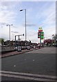
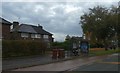
Residents of M21 7QA enjoy a range of amenities within easy reach. The area’s retail options include five shops, such as Asda West and Co-op outlets, providing access to groceries and daily essentials. Transport links are extensive, with five metro stations, five rail stations, and a bus stop at Chorlton Street Coach Station, ensuring flexibility for commuting or leisure. The proximity to three airport terminals enhances connectivity for travel. While the data does not specify parks or leisure facilities, the density of retail and transport options suggests a focus on convenience over expansive green spaces. The mix of shops, transport hubs, and airports creates a practical, fast-paced lifestyle, ideal for those prioritising accessibility over rural tranquillity.
Amenities
Schools
Residents of M21 7QA have access to two notable schools. St Ambrose RC Primary School is a state-funded primary school with an Ofsted rating of 'good', indicating a reliable standard of education. Nearby is the South Manchester Jewish Preparatory School, an independent institution catering to younger students. The mix of school types offers families flexibility, whether they seek a state-run education or the resources of an independent school. The proximity of these institutions suggests that the area is well-served for families with children, though the data does not specify catchment areas or student numbers. For those prioritising a variety of educational options, the combination of state and independent schools is a key advantage.
| Rank | School | Type | Entry gender | Ages |
|---|
Explore more schools in this area
Go to Schools tabDemographics
The population of M21 7QA is predominantly adults aged 30–64, with a median age of 47. This suggests a mature, stable community with a focus on long-term residency. Home ownership is high, at 65%, indicating a strong presence of owner-occupied properties. The accommodation type is primarily houses, reflecting a residential area with larger, more permanent dwellings. The predominant ethnic group is White, though no specific data on diversity or deprivation levels is provided. The high population density—120,370 people per square kilometre—implies a compact, possibly multi-generational living environment. While the data does not quantify deprivation, the high home ownership rate and age profile suggest a community with relatively stable economic conditions. However, the lack of specific diversity metrics means broader demographic insights remain unexplored.
Household Size
Accommodation Type
Tenure
Ethnic Group
Religion
Household Composition
Age
Household Deprivation
NS-SEC
Explore more demographic insights in this area
Go to Demographics tabPlanning
Planning Constraints
- Flood RiskPremium
- Ramsar Wetland SitesPremium
- Area of Outstanding Natural BeautyPremium
- Protected Nature ReservePremium
- Protected WoodlandPremium