Area Overview for L3 5TB
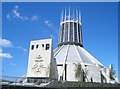
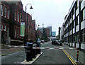
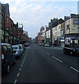
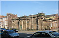
Photos of L3 5TB


Area Information
Living in L3 5TB means being part of a tightly packed residential cluster in England’s north-west. The area covers just 4045 square metres, housing 2403 residents in a dense urban setting. With a population density of nearly 600,000 people per square kilometre, this is a small but intensely populated postcode. Daily life here is shaped by proximity to amenities and transport links, though the compact size means every movement is within a short radius. The area’s character is defined by its mix of practicality and accessibility, with residents relying on nearby retail, rail, and ferry services. While the high density may feel crowded, it also ensures that essential services are never far. The community is young, with a median age of 22, suggesting a dynamic, possibly transient population. For those considering a home here, the focus is on convenience over space, with flats dominating the housing stock and ownership rates remaining low. L3 5TB is not for those seeking solitude — it’s a place where proximity to everything comes at the cost of personal space.
- Area Type
- Postcode
- Area Size
- 4045 m²
- Population
- 2403
- Population Density
- 5816 people/km²
The property market in L3 5TB is defined by its low home ownership rate of 12%, which suggests a rental-dominated market. With flats as the primary accommodation type, the area is likely composed of purpose-built housing or converted units designed for high-density living. This configuration is typical of urban areas with limited space, where landlords and private developers cater to a transient population. For buyers, the small size of the postcode means competition for properties is likely intense, with limited scope for expansion or development. The focus on flats may appeal to those prioritising affordability and proximity to amenities, but it also means individual properties are unlikely to offer the space or privacy of larger homes. Buyers should consider whether the rental market’s dynamics align with their long-term goals, as ownership here remains a niche pursuit. The area’s compact nature also means that property values are influenced heavily by local demand rather than broader regional trends.
House Prices in L3 5TB
Showing 56 properties
| Address | Type | Beds | Baths | Last Sale Price | Last Sale Date | |
|---|---|---|---|---|---|---|
| 103A Mount Pleasant, Liverpool, L3 5TB | Flat | 3 | 1 | £230,566 | Jan 2015 | |
| 101 Mount Pleasant, Liverpool, L3 5TB | Detached | 5 | 4 | £202,000 | Dec 2014 | |
| Rooms, 73 Mount Pleasant, Liverpool, L3 5TB | Flat | 6 | 1 | - | - | |
| 85 Mount Pleasant, Liverpool, L3 5TB | Terraced | 8 | 2 | - | - | |
| Apartment 1, 71 Mount Pleasant, Liverpool, L3 5TB | Flat | 2 | 1 | - | - | |
| Flat, 83 Mount Pleasant, Liverpool, L3 5TB | Flat | 1 | 1 | - | - | |
| 87 Mount Pleasant, Liverpool, L3 5TB | house | 7 | - | - | - | |
| Apartment 2, 71 Mount Pleasant, Liverpool, L3 5TB | Flat | - | - | - | - | |
| Flat Above, 105 Mount Pleasant, Liverpool, L3 5TB | Flat | - | - | - | - | |
| Apartment 4, 71 Mount Pleasant, Liverpool, L3 5TB | Flat | 2 | - | - | - |
Energy Efficiency in L3 5TB
Life in L3 5TB is centred around convenience, with amenities clustered closely. Retail options include Co-op Leece and multiple Tesco branches, ensuring access to groceries and everyday essentials. The area’s rail network connects residents to Liverpool’s broader transport system, while ferry terminals provide direct links to Birkenhead, the Isle of Man, and Dublin. These transport links make commuting or day trips feasible without reliance on cars. Parks or green spaces are not explicitly mentioned, but the proximity to ferry terminals and rail stations suggests a focus on urban connectivity over natural landscapes. For leisure, the presence of multiple schools and higher education institutions hints at a community that values learning and youth engagement. While the area lacks explicit references to dining or entertainment venues, the density of retail and transport options implies a bustling, practical lifestyle. Residents here prioritise accessibility over expansive amenities, making it ideal for those who value ease of movement over sprawling environments.
Amenities
Schools
Residents of L3 5TB have access to a range of educational institutions, from primary schools to higher education. Nearby primary schools include Pleasant Street Primary School, which holds a ‘good’ Ofsted rating, and St Nicholas’s Catholic Primary School, alongside St Nicholas RC Infant School. These schools provide options for younger children, though the absence of secondary schools in the immediate area may require families to travel. For older students, The City of Liverpool College offers sixth-form education, while Liverpool John Moores University is also within reach. The mix of school types suggests that families can find both faith-based and secular options, but the lack of a comprehensive secondary school network could be a drawback. Parents should factor in travel time for secondary education, as the nearest institutions may not be within walking distance. The presence of higher education facilities, however, may appeal to those seeking proximity to academic opportunities.
| Rank | School | Type | Entry gender | Ages |
|---|
Explore more schools in this area
Go to Schools tabDemographics
The community in L3 5TB is overwhelmingly young, with a median age of 22 and 88% of residents falling into the 15-29 age range. This suggests a population skewed toward students, young professionals, or those in early careers. Home ownership is exceptionally low at 12%, indicating that the majority of residents are likely renters. The accommodation type is almost exclusively flats, which aligns with the area’s high density and limited space. The predominant ethnic group is White, though no specific data on diversity or deprivation is provided. The age profile and housing stock suggest a transient population, possibly linked to nearby educational institutions like Liverpool John Moores University. For families or those seeking long-term stability, the demographic makeup may raise questions about the area’s suitability. The lack of data on deprivation or income levels means the quality of life for lower-income residents remains unexplored, but the high proportion of young adults implies a focus on affordability over permanence.
Household Size
Accommodation Type
Tenure
Ethnic Group
Religion
Household Composition
Age
Household Deprivation
NS-SEC
Explore more demographic insights in this area
Go to Demographics tabPlanning
Planning Constraints
- Flood RiskPremium
- Ramsar Wetland SitesPremium
- Area of Outstanding Natural BeautyPremium
- Protected Nature ReservePremium
- Protected WoodlandPremium