Area Overview for L3 5TF
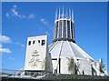
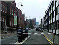
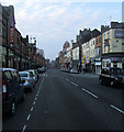
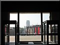
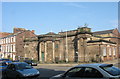
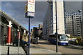
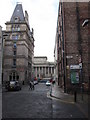
Photos of L3 5TF


Area Information
Living in L3 5TF means inhabiting a tightly packed residential cluster in England, where 2,403 people are spread across just 1.4 hectares. The area’s high population density of 168,137 people per square kilometre reflects its compact nature, typical of inner-city postcode areas. This is a young community, with a median age of 22 and the majority of residents aged between 15 and 29. Daily life here is shaped by proximity to transport hubs, including rail lines and ferry terminals, which connect to Liverpool’s broader network. The area’s small footprint means amenities are closely grouped, but its limited space also means housing is predominantly flats, with only 12% of residents owning their homes. This creates a rental-heavy environment, where transient populations and student influences are common. While the area lacks green spaces or natural constraints, its strategic location near universities and primary schools makes it appealing for young families and students. However, the high crime risk reported in assessments suggests residents must balance convenience with vigilance.
- Area Type
- Postcode
- Area Size
- 1.4 hectares
- Population
- 2403
- Population Density
- 5816 people/km²
The property market in L3 5TF is characterised by low home ownership, with just 12% of residents owning their homes. This indicates a rental market, where flats are the predominant housing type. The area’s small size—only 1.4 hectares—means housing stock is limited, and the focus on flats suggests a lack of larger family homes. Buyers looking at this area should expect a competitive rental market, with limited scope for owner-occupation. The compact nature of L3 5TF also means property values are likely influenced by proximity to transport links and educational institutions. However, the high population density and rental-heavy demographic may make long-term investment less attractive for those seeking stability. For those considering purchasing, the area’s proximity to Liverpool John Moores University and primary schools could be a draw, but the limited housing options and high crime risk may deter some buyers.
House Prices in L3 5TF
Showing 100 properties
Energy Efficiency in L3 5TF
Lifestyle in L3 5TF is shaped by its proximity to retail, transport, and educational hubs. The area’s retail options include Tesco Liverpool, Co-op University of, and Co-op Leece, offering everyday shopping needs within walking distance. Rail connections to Liverpool Lime Street and Moorfields stations provide swift access to the city centre, while ferry terminals like Liverpool Pier Head and Woodside Birkenhead link to nearby towns and islands. This connectivity supports a convenient, active lifestyle, with opportunities for commuting, leisure, and travel. The presence of multiple primary schools and a university adds to the area’s vibrancy, attracting students and families. However, the lack of green spaces or recreational parks means residents must seek outdoor activities elsewhere. The compact nature of L3 5TF ensures amenities are never far, but the density also means living here requires adapting to a fast-paced, urban environment.
Amenities
Schools
Residents of L3 5TF have access to a range of educational institutions, from primary schools to higher education. Nearby primary schools include Pleasant Street Primary School, which holds an Ofsted rating of ‘good’, and St Nicholas’s Catholic Primary School, which serves the local community. St Nicholas RC Infant School caters to younger children, providing early education options. For secondary and further education, The City of Liverpool College offers sixth-form provision, while Liverpool John Moores University is within reach for higher education. This mix of school types ensures families can access education at every stage, from early years to university. However, the concentration of primary schools suggests the area is well-served for younger children, but parents seeking secondary schooling may need to look beyond L3 5TF. The presence of a university also means opportunities for students and professionals seeking postgraduate studies.
| Rank | School | Type | Entry gender | Ages |
|---|
Explore more schools in this area
Go to Schools tabDemographics
The community in L3 5TF is overwhelmingly young, with a median age of 22 and the largest age group being 15–29 years. Only 12% of residents own their homes, indicating a rental-dominated market. The accommodation type is almost entirely flats, reflecting the area’s density and limited space. The predominant ethnic group is White, though specific data on diversity beyond this is not provided. The high population density of 168,137 people per square kilometre means the area feels busy and compact, with shared spaces and communal living as the norm. For quality of life, this demographic profile suggests a dynamic but potentially transient population, with students and young professionals forming a significant portion. The lack of data on deprivation or income levels means it is unclear how this affects access to services, but the presence of multiple schools and transport links implies some level of infrastructure support.
Household Size
Accommodation Type
Tenure
Ethnic Group
Religion
Household Composition
Age
Household Deprivation
NS-SEC
Explore more demographic insights in this area
Go to Demographics tabPlanning
Planning Constraints
- Flood RiskPremium
- Ramsar Wetland SitesPremium
- Area of Outstanding Natural BeautyPremium
- Protected Nature ReservePremium
- Protected WoodlandPremium