Area Overview for L3 5SL
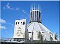
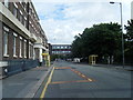
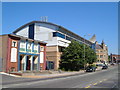
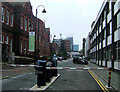
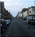
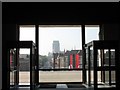
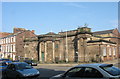
Photos of L3 5SL


Area Information
Living in L3 5SL means inhabiting a densely populated residential cluster in England, where 2403 people reside across 2299 square metres. This small postcode area is characterised by a high population density of 1,045,253 people per square kilometre, reflecting a compact, urban environment. The area’s compact size and proximity to amenities make it practical for those prioritising convenience. Young adults aged 15–29 dominate the population, with a median age of 22, suggesting a community skewed towards students, graduates, and early-career professionals. The presence of multiple schools, including primary institutions and a sixth-form college, indicates a focus on education. While the area lacks natural constraints like protected woodlands or wetlands, its safety profile is mixed: flood risk is negligible, but crime risk is critically high, with a safety score of 1 out of 100. This duality shapes daily life, blending accessibility with the need for caution.
- Area Type
- Postcode
- Area Size
- 2299 m²
- Population
- 2403
- Population Density
- 5816 people/km²
The property market in L3 5SL is overwhelmingly rental-focused, with only 12% of residents owning their homes. This suggests a housing stock dominated by flats, which aligns with the area’s compact, high-density layout. The scarcity of owner-occupied properties indicates limited opportunities for buyers seeking long-term investment or family homes. Flats in this area are likely to be part of larger residential blocks, catering to the young-adult demographic that dominates the population. For prospective buyers, this small postcode area may not offer substantial options, though nearby regions could provide more varied housing. The rental market’s prevalence may also influence property values, with flats potentially being more affordable than in surrounding areas. However, the high crime risk could deter buyers seeking secure, stable environments.
House Prices in L3 5SL
Showing 17 properties
| Address | Type | Beds | Baths | Last Sale Price | Last Sale Date | |
|---|---|---|---|---|---|---|
| 78A Mount Pleasant, Liverpool, L3 5SL | Unknown | - | - | - | - | |
| Basement, 78 Mount Pleasant, Liverpool, L3 5SL | Office | - | - | - | - | |
| Ground Floor, 78 Mount Pleasant, Liverpool, L3 5SL | Office | - | - | - | - | |
| First Floor Office 1, 78 Mount Pleasant, Liverpool, L3 5SL | Office | - | - | - | - | |
| Basement And Ground Floor, 78 Mount Pleasant, Liverpool, L3 5SL | Office | - | - | - | - | |
| First Floor Office 3, 78 Mount Pleasant, Liverpool, L3 5SL | Office | - | - | - | - | |
| First Floor Office 2, 78 Mount Pleasant, Liverpool, L3 5SL | Office | - | - | - | - | |
| Flat 4, 76 Mount Pleasant, Liverpool, L3 5SL | Flat | - | 1 | - | - | |
| Flat 6, 76 Mount Pleasant, Liverpool, L3 5SL | Flat | - | - | - | - | |
| Flat 5, 76 Mount Pleasant, Liverpool, L3 5SL | Flat | - | - | - | - |
Energy Efficiency in L3 5SL
Residents of L3 5SL benefit from a practical array of amenities within reach. Retail options include Co-op Leece and multiple Tesco locations, ensuring grocery and daily needs are easily met. The area’s rail and ferry connections facilitate both commuting and leisure travel, with stations like Liverpool Lime Street and terminals such as Liverpool Pier Head offering direct links to the city and beyond. Educational institutions, from primary schools to a sixth-form college, provide a seamless transition for families. While parks or leisure facilities are not explicitly listed, the proximity to Liverpool John Moores University and The City of Liverpool College suggests a dynamic environment with potential for cultural or academic events. The combination of retail, transport, and educational hubs creates a functional, though compact, lifestyle that prioritises accessibility over expansive recreational spaces.
Amenities
Schools
Residents of L3 5SL have access to a range of educational institutions, including primary schools and a sixth-form college. Pleasant Street Primary School, which holds an Ofsted rating of ‘good’, offers a solid foundation for younger students. St Nicholas’s Catholic Primary School and St Nicholas RC Infant School provide alternative primary education options, though their Ofsted ratings are not specified. The City of Liverpool College serves as a sixth-form institution, while Liverpool John Moores University is located nearby, offering higher education opportunities. This mix of school types caters to families at different stages of education, from early years to post-secondary study. However, the absence of secondary schools within the postcode itself may require students to travel for comprehensive education, which could impact daily commutes.
| Rank | School | Type | Entry gender | Ages |
|---|
Explore more schools in this area
Go to Schools tabDemographics
The community in L3 5SL is predominantly young, with a median age of 22 and 12% of residents owning their homes. The majority of the population falls within the 15–29 age range, reflecting a demographic skewed towards students and early-career individuals. Accommodation is largely flat-based, with no data indicating the presence of detached or semi-detached homes. The predominant ethnic group is White, though specific diversity metrics are not provided. The high population density—over a million people per square kilometre—suggests a tightly packed urban environment, likely influenced by the area’s small size and focus on multi-unit housing. This density may impact social dynamics, fostering a sense of proximity but also potentially straining shared resources. The low home ownership rate implies a rental-dominated market, which could affect long-term stability for residents.
Household Size
Accommodation Type
Tenure
Ethnic Group
Religion
Household Composition
Age
Household Deprivation
NS-SEC
Explore more demographic insights in this area
Go to Demographics tabPlanning
Planning Constraints
- Flood RiskPremium
- Ramsar Wetland SitesPremium
- Area of Outstanding Natural BeautyPremium
- Protected Nature ReservePremium
- Protected WoodlandPremium