Area Overview for L3 5TN
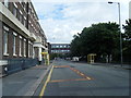
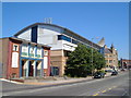
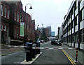
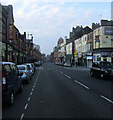
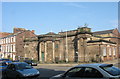
Photos of L3 5TN


Area Information
Living in L3 5TN means inhabiting a compact, densely populated postcode area in England, where 2,403 residents occupy just 2,444 square metres. This small cluster of homes is defined by its proximity to transport networks and educational institutions, making it a practical choice for those prioritising connectivity. The area’s youthful demographic—median age 22, with 12% of the population aged 15–29—suggests a community leaning towards students, young professionals, or those transitioning between life stages. Daily life here is shaped by the need for efficient movement, with rail lines, ferry terminals, and retail hubs within reach. The area’s limited size means residents are likely to know their neighbours, though the high population density may create a sense of shared space. For buyers, L3 5TN offers a snapshot of urban living, with flat-based housing dominating and a rental market prevailing. Its appeal lies in accessibility, though the compact nature means buyers must weigh the trade-offs of proximity against space.
- Area Type
- Postcode
- Area Size
- 2444 m²
- Population
- 2403
- Population Density
- 5816 people/km²
The property market in L3 5TN is dominated by flats, with 12% of residents owning their homes. This low home ownership rate suggests the area is primarily a rental market, with limited opportunities for long-term equity building. The concentration of flats indicates a focus on compact, urban living, which may appeal to students, young professionals, or those prioritising location over space. For buyers, this small postcode area offers limited scope for property investment, as the housing stock is largely occupied by renters. The immediate surroundings may provide more options, but the area’s size means competition for available properties is likely. Buyers should consider the implications of a rental-heavy market, including potential volatility in property values and the need to balance proximity to amenities against the constraints of flat living.
House Prices in L3 5TN
Showing 24 properties
| Address | Type | Beds | Baths | Last Sale Price | Last Sale Date | |
|---|---|---|---|---|---|---|
| 29B Clarence Street, Liverpool, L3 5TN | undefined | - | - | - | - | |
| 29A Clarence Street, Liverpool, L3 5TN | Unknown | - | - | - | - | |
| Flat 2, 21 Clarence Street, Liverpool, L3 5TN | Flat | - | - | - | - | |
| Flat 3, 21 Clarence Street, Liverpool, L3 5TN | Flat | - | - | - | - | |
| Flat 4, 21 Clarence Street, Liverpool, L3 5TN | Flat | - | - | - | - | |
| Flat 5, 27 Clarence Street, Liverpool, L3 5TN | Flat | - | - | - | - | |
| Flat 6, 27 Clarence Street, Liverpool, L3 5TN | Flat | - | - | - | - | |
| Flat 2, 27 Clarence Street, Liverpool, L3 5TN | Flat | - | - | - | - | |
| Flat 3, 27 Clarence Street, Liverpool, L3 5TN | Flat | - | - | - | - | |
| Flat 4, 27 Clarence Street, Liverpool, L3 5TN | Flat | 2 | 3 | - | - |
Energy Efficiency in L3 5TN
Residents of L3 5TN benefit from nearby amenities that cater to daily needs, from shopping to travel. Retail options include Co-op Leece and multiple Tesco stores, ensuring access to groceries and essentials. Rail stations like Liverpool Lime Street and Moorfields provide direct links to major cities, while ferry terminals at Liverpool Pier Head and Woodside Birkenhead connect to Birkenhead and beyond. These transport hubs make commuting or weekend trips feasible. The area’s compact nature means amenities are within walking or short transit distance, fostering convenience. While parks or leisure facilities are not explicitly listed, the proximity to educational institutions and transport networks suggests a focus on practicality over expansive recreational spaces.
Amenities
Schools
Residents of L3 5TN have access to a range of educational institutions, from primary schools to higher education. Nearby primary schools include Pleasant Street Primary School, rated ‘good’ by Ofsted, and St Nicholas’s Catholic Primary School, which serves younger children. St Nicholas RC Infant School caters to even younger students, ensuring early education is within reach. For secondary and further education, The City of Liverpool College offers sixth-form provision, while Liverpool John Moores University provides higher education opportunities. This mix of school types means families can plan for multiple stages of their children’s education without relocating. However, the absence of Ofsted ratings for some schools means parents may need to seek additional information to assess quality. The proximity to these institutions is a key draw for families prioritising education.
| Rank | School | Type | Entry gender | Ages |
|---|
Explore more schools in this area
Go to Schools tabDemographics
L3 5TN’s population is overwhelmingly young, with 22 as the median age and 12% of residents owning their homes. The area’s 12% home ownership rate indicates a rental-heavy market, with flats making up the majority of accommodation. This suggests a transient population, likely drawn by nearby educational institutions or employment opportunities. The predominant ethnic group is White, though no specific data on diversity beyond this is provided. The high population density—983,376 people per square kilometre—raises questions about living conditions, though no explicit data on deprivation or housing quality is available. The youth-driven demographic may influence local amenities, with services tailored to students or young professionals. For families, the lack of higher home ownership rates and the prevalence of flats may present challenges in securing stable, long-term housing.
Household Size
Accommodation Type
Tenure
Ethnic Group
Religion
Household Composition
Age
Household Deprivation
NS-SEC
Explore more demographic insights in this area
Go to Demographics tabPlanning
Planning Constraints
- Flood RiskPremium
- Ramsar Wetland SitesPremium
- Area of Outstanding Natural BeautyPremium
- Protected Nature ReservePremium
- Protected WoodlandPremium