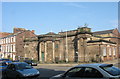
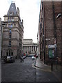
Area Overview for L3 5TT
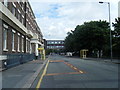
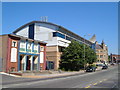
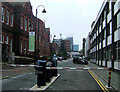
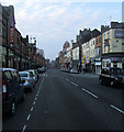
Photos of L3 5TT


Area Information
Living in L3 5TT means being part of a tightly packed residential cluster in England’s north-west, where 2,403 people inhabit just 2,662 square metres. This density creates a compact, walkable environment, though it also means space is at a premium. The area’s character is defined by its young population, with a median age of 22 and most residents aged 15–29. This suggests a community skewed toward students, young professionals, or those in early careers. The postcode’s proximity to Liverpool John Moores University and The City of Liverpool College hints at a student influence, while the high population density implies a focus on shared spaces and communal living. Daily life here is likely punctuated by the rhythm of nearby transport hubs and retail outlets, with residents navigating a mix of flat-based housing and limited private ownership. While the area lacks natural landscapes or protected sites, its connectivity to rail, ferry, and retail networks positions it as a practical base for those prioritising accessibility over open space.
- Area Type
- Postcode
- Area Size
- 2662 m²
- Population
- 2403
- Population Density
- 5816 people/km²
The property market in L3 5TT is characterised by a very low home ownership rate—just 12% of residents own their homes. This suggests that the area is primarily a rental market, with flats forming the predominant accommodation type. The limited number of owner-occupied properties may make it challenging for buyers seeking long-term investment or stable housing. Given the area’s small size and high population density, the housing stock is likely constrained, with competition for available units. Flats, often associated with student or transient populations, may dominate due to their affordability and proximity to transport links. For buyers, this means a focus on rental properties rather than owner-occupied homes, with potential risks related to market volatility and the need for landlords to balance tenant demand with regulatory requirements.
House Prices in L3 5TT
Showing 21 properties
| Address | Type | Beds | Baths | Last Sale Price | Last Sale Date | |
|---|---|---|---|---|---|---|
| 20 May Street, Liverpool, L3 5TT | Flat | 1 | 1 | £165,768 | Dec 2019 | |
| Apartment 18, 5 May Street, Liverpool, L3 5TT | Flat | 1 | 1 | - | - | |
| Apartment 5, 5 May Street, Liverpool, L3 5TT | Flat | 1 | 1 | - | - | |
| Apartment 9, 5 May Street, Liverpool, L3 5TT | Flat | 2 | - | - | - | |
| Apartment 3, 5 May Street, Liverpool, L3 5TT | Flat | - | - | - | - | |
| Apartment 2, 5 May Street, Liverpool, L3 5TT | Flat | 1 | 1 | - | - | |
| Apartment 11, 5 May Street, Liverpool, L3 5TT | Flat | - | - | - | - | |
| Apartment 15, 5 May Street, Liverpool, L3 5TT | Flat | - | - | - | - | |
| Apartment 19, 5 May Street, Liverpool, L3 5TT | Flat | - | - | - | - | |
| Apartment 8, 5 May Street, Liverpool, L3 5TT | Flat | - | - | - | - |
Energy Efficiency in L3 5TT
Life in L3 5TT is shaped by its proximity to retail, transport, and educational hubs. Residents have access to five retail venues, including Co-op Leece and Tesco Liverpool, ensuring everyday shopping needs are met. The area’s rail network includes Liverpool Central Loop Line and Moorfields Railway Station, providing swift connections to Liverpool’s city centre and beyond. Ferry terminals at Liverpool Pier Head and Woodside Birkenhead add maritime accessibility, useful for both commuting and leisure. The presence of multiple schools and universities suggests a focus on education, while the compact layout means amenities are within walking distance. Though the area lacks expansive parks or leisure facilities, its density and connectivity make it practical for those prioritising convenience over open space. The mix of retail, transport, and educational options creates a functional, if small-scale, lifestyle.
Amenities
Schools
Residents of L3 5TT have access to a range of educational institutions, from primary schools to higher education. Nearby primary schools include Pleasant Street Primary School, rated ‘good’ by Ofsted, and St Nicholas’s Catholic Primary School, which serves younger children. St Nicholas RC Infant School caters to the earliest years of education, offering a continuum of primary schooling. For older students, The City of Liverpool College provides sixth-form education, while Liverpool John Moores University offers higher education opportunities. This mix of school types ensures that families can find options for all stages of education, from early years to university. The presence of multiple primary schools may reduce competition for places, though the lack of secondary school data means parents should verify availability for older children.
| Rank | School | Type | Entry gender | Ages |
|---|
Explore more schools in this area
Go to Schools tabDemographics
The community in L3 5TT is overwhelmingly young, with a median age of 22 and 12% of residents owning their homes. This low home ownership rate, combined with the predominance of flats, indicates a rental market skewed toward temporary or student tenancies. The population is predominantly White, though no specific data on diversity or deprivation is provided. With 902,580 people per square kilometre, the area is among the most densely populated in England, which may impact living conditions and access to private space. The age profile suggests a transient population, possibly linked to nearby educational institutions. This demographic mix shapes a dynamic but potentially unstable community, where housing demand outstrips supply and social networks may be more fluid than in older, more established areas.
Household Size
Accommodation Type
Tenure
Ethnic Group
Religion
Household Composition
Age
Household Deprivation
NS-SEC
Explore more demographic insights in this area
Go to Demographics tabPlanning
Planning Constraints
- Flood RiskPremium
- Ramsar Wetland SitesPremium
- Area of Outstanding Natural BeautyPremium
- Protected Nature ReservePremium
- Protected WoodlandPremium