Area Overview for BB12 7HU
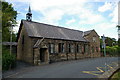
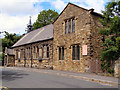
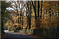
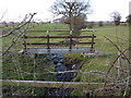
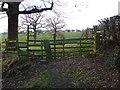
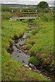
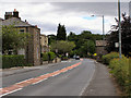
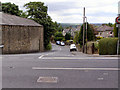
Photos of BB12 7HU

Area Information
Living in BB12 7HU means being part of a small, residential cluster in the Ribble Valley, Lancashire. The postcode covers 8,737 square metres and is home to 1,237 residents, making it a tight-knit community with a distinct character. Situated in a historic parish, the area is steeped in heritage, with 22 listed buildings and ties to families like the Cockshutts, who owned land here since the 1500s. Daily life here is shaped by its rural setting, with a population skewed toward adults aged 30–64 and a median age of 47. The village’s proximity to Padiham and its modest retail options, such as Lidl and Tesco, cater to local needs. While the area lacks major urban amenities, its low crime rate and minimal environmental risks offer a quiet, stable environment. For those seeking a peaceful, historic lifestyle with easy access to rail links, BB12 7HU provides a blend of tradition and practicality. The small size of the area means neighbours are likely to be familiar faces, fostering a close-knit community feel.
- Area Type
- Postcode
- Area Size
- 8737 m²
- Population
- 1237
- Population Density
- 249 people/km²
The property market in BB12 7HU is defined by high home ownership—93% of residents own their homes—and a predominance of houses over flats. This suggests a market skewed toward owner-occupation, with limited rental activity. The small area size and rural setting mean housing stock is likely to be older, with many properties reflecting the village’s historical roots. The scarcity of commercial or industrial land in the area further reinforces its residential focus. For buyers, this means a stable market with fewer speculative developments, though the limited size of the area may restrict options. Surrounding regions, such as Padiham, could offer more variety, but proximity to rail stations like Hapton and Huncoat may enhance connectivity for commuters. The high ownership rate also implies that properties here are likely to be long-term investments, with potential for capital growth tied to the area’s low risk profile and historic appeal.
House Prices in BB12 7HU
Showing 13 properties
| Address | Type | Beds | Baths | Last Sale Price | Last Sale Date | |
|---|---|---|---|---|---|---|
| Red Stacks, 12 Beauley Avenue, Simonstone, BB12 7HU | Detached | 4 | 3 | £493,000 | Jan 2025 | |
| Wingdale, 3 Beauley Avenue, Simonstone, BB12 7HU | Semi-detached | 3 | 2 | £245,000 | Sep 2020 | |
| Wood View, 10 Beauley Avenue, Simonstone, BB12 7HU | Bungalow | 2 | 1 | £215,000 | Oct 2014 | |
| Morningside, 2 Beauley Avenue, Simonstone, BB12 7HU | Semi-detached | - | - | £325,000 | Jun 2008 | |
| Green Bank, 5 Beauley Avenue, Simonstone, BB12 7HU | Semi-detached | - | - | £242,500 | Dec 2007 | |
| Son Vida, 13 Beauley Avenue, Simonstone, BB12 7HU | Bungalow | - | - | £150,000 | Mar 2003 | |
| Casa Mia, 8 Beauley Avenue, Simonstone, BB12 7HU | Detached | - | - | £120,000 | May 2000 | |
| Derwent, 9 Beauley Avenue, Simonstone, BB12 7HU | Detached | - | - | £133,000 | Mar 2000 | |
| Oakridge, 7 Beauley Avenue, Simonstone, BB12 7HU | Detached | - | - | £73,000 | Mar 1997 | |
| Roselea, 1 Beauley Avenue, Simonstone, BB12 7HU | Bungalow | - | - | £82,500 | Feb 1995 |
Energy Efficiency in BB12 7HU
The lifestyle in BB12 7HU is shaped by its proximity to Padiham, where residents can access retail options such as Spar, Lidl Padiham, and Tesco Padiham. These shops provide essentials, though the village itself lacks larger supermarkets or dining venues. The area’s historical character is complemented by its practical amenities, with rail stations offering connections to Hapton, Huncoat, and Whalley. These stations are vital for those seeking employment or social opportunities beyond the village. The absence of parks or leisure facilities within BB12 7HU itself means residents must travel to nearby areas for recreation, but the low crime rate and environmental safety scores suggest a secure environment for outdoor activities. Overall, the lifestyle here balances rural tranquillity with sufficient connectivity to larger centres, making it ideal for those prioritising stability and historical charm over urban convenience.
Amenities
Schools
| Rank | School | Type | Entry gender | Ages |
|---|
Explore more schools in this area
Go to Schools tabDemographics
The community in BB12 7HU is predominantly composed of adults aged 30–64, with a median age of 47. This reflects a mature, established population, with 93% of residents owning their homes—a figure significantly higher than the national average. The area is largely composed of houses rather than flats, aligning with its rural character. The predominant ethnic group is White, though no specific data on diversity or deprivation is available. The high home ownership rate suggests a stable, long-term resident base, with fewer renters. This demographic profile indicates a community focused on family life and continuity, with limited turnover. The absence of detailed diversity metrics means the area’s social fabric remains largely unexplored in public records, but the age distribution and ownership figures point to a population prioritising security and familiarity over transient lifestyles.
Household Size
Accommodation Type
Tenure
Ethnic Group
Religion
Household Composition
Age
Household Deprivation
NS-SEC
Explore more demographic insights in this area
Go to Demographics tabPlanning
Planning Constraints
- Flood RiskPremium
- Ramsar Wetland SitesPremium
- Area of Outstanding Natural BeautyPremium
- Protected Nature ReservePremium
- Protected WoodlandPremium