Area Overview for BB12 7HT
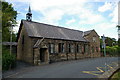
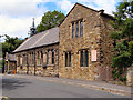
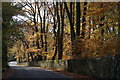
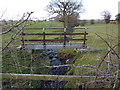
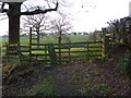
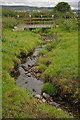
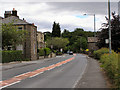
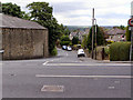
Photos of BB12 7HT
Area Information
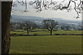
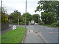
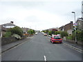
Living in BB12 7HT means being part of a small, tightly knit residential cluster in the Ribble Valley, Lancashire. The area covers 5,651 square metres and is home to 1,237 residents, creating a low-density, village-like atmosphere. Historically tied to the Cockshutt family, who held land here since the 16th century, BB12 7HT retains a quiet, traditional character. Its proximity to Padiham and surrounding villages offers access to broader services while maintaining a sense of seclusion. The area’s small size and modest population density foster a close-knit community, where daily life is shaped by local traditions and the surrounding rural landscape. Residents benefit from nearby railway stations and a range of retail amenities, ensuring practicality without compromising the peaceful setting. With a median age of 47, the area is predominantly inhabited by adults in their prime working years, suggesting a stable and established population. This is a place where history meets modern convenience, offering a rare blend of heritage and accessibility.
- Area Type
- Postcode
- Area Size
- 5651 m²
- Population
- 1237
- Population Density
- 249 people/km²
The property market in BB12 7HT is dominated by owner-occupied homes, with 93% of properties owned by their residents. This high rate of home ownership suggests a community of long-term residents rather than a rental market, reinforcing the area’s stability. The accommodation type is exclusively houses, which is typical of rural or semi-rural settings where larger properties are standard. Given the area’s small size and low population density, the housing stock is likely limited, making it a niche market for buyers seeking a quiet, traditional lifestyle. The scarcity of properties also means that those available may have historical or architectural significance, as the area includes 22 listed buildings. For buyers, this presents both opportunities and challenges: properties may be rare, but they often come with unique character and a strong sense of place.
House Prices in BB12 7HT
Showing 7 properties
| Address | Type | Beds | Baths | Last Sale Price | Last Sale Date | |
|---|---|---|---|---|---|---|
| Sunny Bank, Whalley Road, Simonstone, BB12 7HT | Bungalow | 2 | 1 | £328,000 | Mar 2023 | |
| Mayfield, Whalley Road, Simonstone, BB12 7HT | Bungalow | - | - | £292,000 | Nov 2020 | |
| Roslyn, Whalley Road, Simonstone, BB12 7HT | house | - | - | £317,500 | Apr 2013 | |
| Penbrae, Whalley Road, Simonstone, BB12 7HT | Detached | - | - | £259,000 | Aug 2003 | |
| Brigsteer, Whalley Road, Simonstone, BB12 7HT | Detached | - | - | £95,000 | May 1995 | |
| Beacon Holme, Whalley Road, Simonstone, BB12 7HT | Detached | 3 | 2 | - | - | |
| Littleholme, Whalley Road, Simonstone, BB12 7HT | Detached | - | - | - | - |
Energy Efficiency in BB12 7HT
Residents of BB12 7HT have access to a range of nearby amenities, including five retail outlets such as Spar, Lidl Padiham, and Tesco Padiham, ensuring everyday shopping needs are met. The proximity to Hapton, Huncoat, and Whalley railway stations provides easy access to broader services, including healthcare, education, and leisure facilities in nearby towns. While the area itself is small, its connection to Padiham and surrounding villages offers additional options for dining, entertainment, and community events. The presence of listed buildings and historical sites like Gawthorpe Hall adds cultural value, though the area’s rural character means it is more about practicality and tradition than high-density urban amenities. For those seeking a balance between convenience and tranquillity, BB12 7HT provides a functional lifestyle with a distinct sense of place.
Amenities
Schools
| Rank | School | Type | Entry gender | Ages |
|---|
Explore more schools in this area
Go to Schools tabDemographics
The community in BB12 7HT is characterised by a median age of 47, with the majority of residents falling into the 30–64 age range. This suggests a mature, settled population, likely with strong ties to local employment and long-term residency. Home ownership is exceptionally high at 93%, indicating a community of long-term residents rather than transient renters. The accommodation type is predominantly houses, reflecting a rural or semi-rural setting where larger properties are more common. The predominant ethnic group is White, though no specific data on diversity or deprivation is provided. The population density of 249 people per square kilometre is low, aligning with the area’s small size and residential focus. This demographic profile points to a stable, low-maintenance environment where residents are likely to prioritise property ownership and community continuity over rapid change.
Household Size
Accommodation Type
Tenure
Ethnic Group
Religion
Household Composition
Age
Household Deprivation
NS-SEC
Explore more demographic insights in this area
Go to Demographics tabPlanning
Planning Constraints
- Flood RiskPremium
- Ramsar Wetland SitesPremium
- Area of Outstanding Natural BeautyPremium
- Protected Nature ReservePremium
- Protected WoodlandPremium