Area Overview for BB12 7NX
Photos of BB12 7NX
Area Information
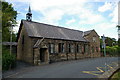
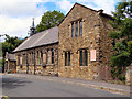
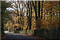
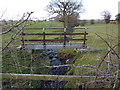
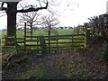
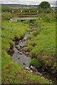
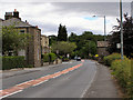
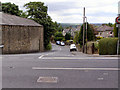
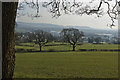
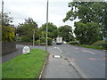
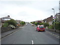
Living in BB12 7NX means being part of a small, tightly knit residential cluster in Simonstone, a village in Ribble Valley, Lancashire. The area covers 9.4 hectares and is home to 1,417 residents, giving it a population density of 250 people per square kilometre. This is a village with historical roots, shaped by centuries of land ownership by families like the Cockshutt and Starkie, who left their mark through agricultural holdings and estate management. Today, the area retains a quiet, village character, with 22 listed buildings and proximity to Gawthorpe Hall, a historic estate. Daily life here is defined by its small-scale charm: local shops, nearby rail links, and a community rooted in tradition. The median age of 47 suggests a mature population, many of whom are long-term residents. For those seeking a peaceful, low-density environment with access to countryside and historical sites, BB12 7NX offers a unique blend of residential comfort and historical significance.
- Area Type
- Postcode
- Area Size
- 9.4 hectares
- Population
- 1417
- Population Density
- 250 people/km²
The property market in BB12 7NX is characterised by high home ownership, with 78% of residents owning their homes. This indicates a strong preference for owner-occupied housing over rental properties, which is typical of small, rural villages. The accommodation type is predominantly houses, reflecting the area’s low-density, suburban nature. Given the small size of the postcode area—9.4 hectares—and the limited number of properties, the housing stock is likely to be modest in scale, with a focus on individual family homes rather than apartments or larger developments. For buyers, this means a market where properties are likely to be in good condition, with a strong sense of community and low turnover. The absence of rental data suggests that the area is not a hotspot for investors, but rather a place where residents prioritise stability and long-term ownership.
House Prices in BB12 7NX
Showing 16 properties
| Address | Type | Beds | Baths | Last Sale Price | Last Sale Date | |
|---|---|---|---|---|---|---|
| Starkies Farm House, Simonstone Lane, Simonstone, BB12 7NX | Detached | 3 | 2 | £475,000 | Jun 2025 | |
| Raydale, Simonstone Lane, Simonstone, BB12 7NX | Semi-detached | 3 | 1 | £300,000 | Mar 2025 | |
| The Nook, Simonstone Lane, Simonstone, BB12 7NX | Semi-detached | 3 | 1 | £337,000 | Jan 2024 | |
| Hurstwood, Simonstone Lane, Simonstone, BB12 7NX | house | - | - | £272,500 | Jun 2022 | |
| Old Barn House, Simonstone Lane, Simonstone, BB12 7NX | Detached | 4 | 2 | £420,000 | Nov 2019 | |
| Summerfield, Simonstone Lane, Simonstone, BB12 7NX | Semi-detached | 4 | 1 | £190,000 | Feb 2019 | |
| Glengarry, Simonstone Lane, Simonstone, BB12 7NX | Semi-detached | 3 | 1 | £200,000 | Nov 2018 | |
| Wilkinsons Farmhouse, Simonstone Lane, Simonstone, BB12 7NX | Detached | 4 | - | £750,000 | Sep 2018 | |
| Caldervale, Simonstone Lane, Simonstone, BB12 7NX | Semi-detached | 3 | 1 | £210,000 | Mar 2016 | |
| Torroen, Simonstone Lane, Simonstone, BB12 7NX | Semi-detached | 3 | 1 | £198,000 | Jun 2015 |
Energy Efficiency in BB12 7NX
The lifestyle in BB12 7NX is shaped by its proximity to essential amenities and a village-scale environment. Within practical reach are five retail outlets, including Spar, Lidl Padiham, and Tesco Padiham, offering everyday shopping needs. The rail network provides access to nearby towns, while the area’s historical character is complemented by its listed buildings and rural surroundings. Though the data does not mention parks or leisure facilities directly, the absence of planning constraints like AONB or protected woodlands suggests open spaces may be available for recreation. The combination of local shops, rail links, and a quiet, low-density setting creates a convenient yet peaceful lifestyle. Residents can enjoy the benefits of small-town living, with access to essentials and the flexibility to travel further for specialist services.
Amenities
Schools
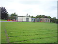
Residents of BB12 7NX have access to two primary schools within practical reach: Read St John’s CofE Primary School and Simonstone St Peter’s Church of England Primary School. Both are rated as 'good' by Ofsted, ensuring a baseline of quality education for younger children. The presence of two primary schools serves the local community well, offering families options for their children’s early education. While the data does not mention secondary schools, the proximity to nearby towns may provide additional educational opportunities. The mix of Church of England schools suggests a community with a strong religious or historical connection to local parishes. For families prioritising primary education, the availability of two well-rated schools is a significant advantage, supporting the area’s appeal as a place to raise children.
| Rank | School | Type | Entry gender | Ages |
|---|
Explore more schools in this area
Go to Schools tabDemographics
The community in BB12 7NX is predominantly composed of adults aged 30 to 64, with a median age of 47. This suggests a population largely in their prime working years, with a strong presence of families and established households. Home ownership is high, with 78% of residents living in their own homes, and the accommodation type is primarily houses, indicating a lack of high-density housing. The predominant ethnic group is White, reflecting the area’s historical and demographic continuity. The population density of 250 people per square kilometre is relatively low, contributing to a spacious, less crowded living environment. This profile suggests a stable, mature community with a focus on long-term residency rather than transient populations. The absence of specific data on deprivation means that quality of life is inferred from the area’s low crime rates and access to amenities, which align with a generally comfortable standard of living.
Household Size
Accommodation Type
Tenure
Ethnic Group
Religion
Household Composition
Age
Household Deprivation
NS-SEC
Explore more demographic insights in this area
Go to Demographics tabPlanning
Planning Constraints
- Flood RiskPremium
- Ramsar Wetland SitesPremium
- Area of Outstanding Natural BeautyPremium
- Protected Nature ReservePremium
- Protected WoodlandPremium