Area Overview for BB12 7JF
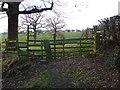
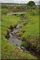
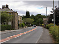
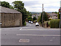
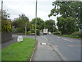
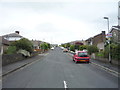
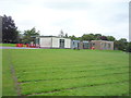
Photos of BB12 7JF

Area Information
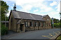
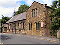
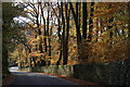
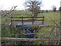
BB12 7JF, a small postcode area in Simonstone, Ribble Valley, Lancashire, is a quiet residential cluster with a population of 1,417 spread over 2 hectares. This village, historically tied to the Cockshutt family and listed buildings, offers a blend of traditional charm and modern convenience. The area’s compact size means it is densely populated at 250 people per square kilometre, yet its low-rise housing and proximity to natural features create a relaxed, community-focused atmosphere. Simonstone’s ecclesiastical roots are evident in its churches and historic sites, such as Gawthorpe Hall, while its modern amenities include nearby supermarkets and rail links. Daily life here is shaped by its rural setting, with easy access to nature and a strong sense of local identity. For those seeking a village with a stable, mature population and a focus on heritage, BB12 7JF provides a distinct alternative to larger urban centres.
- Area Type
- Postcode
- Area Size
- 2.0 hectares
- Population
- 1417
- Population Density
- 250 people/km²
The property market in BB12 7JF is characterised by high home ownership (78%) and a predominance of houses over flats, reflecting a traditional, rural housing stock. This suggests a community that values private, long-term residency over rental properties. The small area size means the housing stock is limited, with fewer new developments, making the market potentially competitive for buyers. The focus on houses, rather than apartments, aligns with the village’s character and the needs of families. For those considering the area, the proximity to nearby towns and rail links may offer additional options for property searches. However, buyers should be mindful of the area’s small footprint and the potential for limited choices within BB12 7JF itself.
House Prices in BB12 7JF
Showing 10 properties
| Address | Type | Beds | Baths | Last Sale Price | Last Sale Date | |
|---|---|---|---|---|---|---|
| 17 Dawson Avenue, Simonstone, BB12 7JF | house | - | - | £330,000 | Jun 2023 | |
| 13 Dawson Avenue, Simonstone, BB12 7JF | Detached | 4 | 1 | £277,500 | Nov 2018 | |
| 5 Dawson Avenue, Simonstone, BB12 7JF | Detached | 3 | 1 | £223,000 | Jun 2018 | |
| 1 Dawson Avenue, Simonstone, BB12 7JF | Bungalow | - | - | £227,000 | Feb 2010 | |
| 11 Dawson Avenue, Simonstone, BB12 7JF | Semi-detached | - | - | £190,000 | Sep 2004 | |
| 3 Dawson Avenue, Simonstone, BB12 7JF | Detached | - | - | £197,000 | Jun 2004 | |
| Tennis 200M From 21 Carleton Avenue 58M From Unnamed Road, Dawson Avenue, Simonstone, BB12 7JF | Leisure | - | - | - | - | |
| 9 Dawson Avenue, Simonstone, BB12 7JF | Semi-detached | - | - | - | - | |
| 15 Dawson Avenue, Simonstone, BB12 7JF | Detached | - | - | - | - | |
| 7 Dawson Avenue, Simonstone, BB12 7JF | Detached | - | - | - | - |
Energy Efficiency in BB12 7JF
The lifestyle in BB12 7JF is shaped by its proximity to practical amenities. Nearby retail options include Spar, Lidl Padiham, and Tesco Padiham, offering everyday shopping needs. The rail stations of Hapton, Huncoat, and Whalley provide access to broader networks, enhancing mobility. While the area itself is small, its historical character—marked by 22 listed buildings and sites like Gawthorpe Hall—adds cultural depth. The combination of local shops, transport links, and heritage creates a balanced lifestyle, blending convenience with a sense of place. Residents can enjoy a rural setting without sacrificing access to essentials, making it suitable for those who value both tranquillity and connectivity.
Amenities
Schools
Residents of BB12 7JF have access to two primary schools: Read St John’s CofE Primary School and Simonstone St Peter’s Church of England Primary School. Both institutions hold a ‘good’ Ofsted rating, ensuring a solid foundation for early education. The presence of two primary schools within the area provides families with choice and convenience, reducing the need for long commutes. However, the data does not mention secondary schools, so parents may need to look beyond BB12 7JF for comprehensive schooling. The quality of primary education here supports the area’s appeal to families, particularly those prioritising a strong start to their children’s education.
| Rank | School | Type | Entry gender | Ages |
|---|
Explore more schools in this area
Go to Schools tabDemographics
The community in BB12 7JF is predominantly composed of adults aged 30–64, with a median age of 47. This suggests a mature, settled population, likely with established careers and family ties. Home ownership is high at 78%, indicating a strong preference for long-term residency over renting. The area is largely composed of houses rather than flats, reflecting a traditional housing stock typical of rural villages. The predominant ethnic group is White, and while no specific data on deprivation is provided, the high home ownership rate and low crime risk suggest a relatively stable and prosperous community. With 1,417 residents in a small area, social interactions are likely frequent, fostering a close-knit environment. The age profile also implies a focus on family life, with schools and local amenities playing a central role in daily routines.
Household Size
Accommodation Type
Tenure
Ethnic Group
Religion
Household Composition
Age
Household Deprivation
NS-SEC
Explore more demographic insights in this area
Go to Demographics tabPlanning
Planning Constraints
- Flood RiskPremium
- Ramsar Wetland SitesPremium
- Area of Outstanding Natural BeautyPremium
- Protected Nature ReservePremium
- Protected WoodlandPremium