Area Overview for BB12 7JG
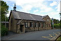
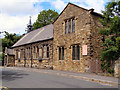
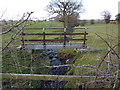
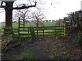
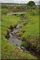
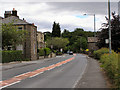
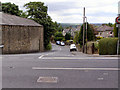
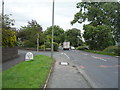
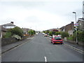
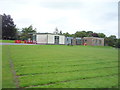
Photos of BB12 7JG


Area Information
Living in BB12 7JG, a small postcode area in Simonstone, Lancashire, offers a quiet, residential lifestyle with a strong sense of local identity. The area covers just 2.1 hectares and is home to 1,417 residents, creating a close-knit community feel. Simonstone itself is a civil parish with a history stretching back centuries, including ties to the Cockshutt family, who built a stone-roofed farmhouse in the late 1500s. The village is part of the Ribble Valley, a region known for its rural charm and historical significance. Daily life here is characterised by proximity to essential amenities, including local shops like Lidl Padiham and Tesco Padiham, and easy access to nearby railway stations. The area’s small size means residents often know their neighbours, and the low population density of 250 people per square kilometre reinforces a peaceful, unspoiled environment. With 78% of homes owned by residents, BB12 7JG is a stable, long-term community, predominantly occupied by families and older adults. Its blend of historical heritage and modern convenience makes it appealing for those seeking a balanced lifestyle.
- Area Type
- Postcode
- Area Size
- 2.1 hectares
- Population
- 1417
- Population Density
- 250 people/km²
The property market in BB12 7JG is characterised by high home ownership (78%) and a predominance of houses, indicating a stable, owner-occupied community. The small area size of 2.1 hectares means the housing stock is limited, with most properties concentrated in a compact residential cluster. This suggests that buyers should consider nearby areas for additional options, though the immediate vicinity offers a mix of family homes. The lack of rental properties implies that the market is not driven by short-term lettings but rather by long-term residents. The presence of listed buildings, including 22 heritage sites, adds historical value to the area, though this may influence property prices or restrictions on modifications. For buyers, the small size of the postcode means that proximity to amenities like schools and transport links is crucial, as the area itself offers limited commercial or industrial development.
House Prices in BB12 7JG
Showing 21 properties
| Address | Type | Beds | Baths | Last Sale Price | Last Sale Date | |
|---|---|---|---|---|---|---|
| 2 Woodside Road, Simonstone, BB12 7JG | Detached | 4 | 1 | £325,000 | Aug 2023 | |
| 9 Woodside Road, Simonstone, BB12 7JG | house | 4 | 1 | £357,500 | May 2023 | |
| 13 Woodside Road, Simonstone, BB12 7JG | house | - | - | £360,000 | Mar 2022 | |
| 14 Woodside Road, Simonstone, BB12 7JG | house | - | - | £265,000 | Jun 2019 | |
| 11 Woodside Road, Simonstone, BB12 7JG | house | - | - | £261,500 | May 2019 | |
| 1 Woodside Road, Simonstone, BB12 7JG | Detached | 3 | 1 | £255,000 | Apr 2019 | |
| 15 Woodside Road, Simonstone, BB12 7JG | Detached | 4 | 1 | £245,000 | Feb 2019 | |
| 18 Woodside Road, Simonstone, BB12 7JG | Bungalow | - | - | £226,000 | Jan 2016 | |
| 17 Woodside Road, Simonstone, BB12 7JG | house | - | - | £245,000 | Jun 2015 | |
| 3 Woodside Road, Simonstone, BB12 7JG | house | 3 | 2 | £250,000 | Sep 2009 |
Energy Efficiency in BB12 7JG
The lifestyle in BB12 7JG is shaped by its proximity to essential amenities and the character of its small community. Within practical reach are retail options such as Spar, Lidl Padiham, and Tesco Padiham, offering everyday shopping convenience. The area’s railway stations—Hapton, Huncoat, and Whalley—connect residents to nearby towns, enabling access to a wider range of services, dining, and leisure activities. While the data does not detail parks or recreational spaces, the low population density and historical listed buildings suggest a mix of natural and cultural environments. The presence of two primary schools adds to the community’s family-friendly appeal, and the small size of the postcode fosters a sense of familiarity among residents. For those who enjoy a quiet, unspoiled lifestyle, BB12 7JG provides a balance between local convenience and the tranquillity of a rural setting.
Amenities
Schools
Residents of BB12 7JG have access to two primary schools: Read St John’s CofE Primary School and Simonstone St Peter’s Church of England Primary School. Both institutions hold a ‘good’ Ofsted rating, reflecting their quality of education and student outcomes. The presence of two primary schools within the area provides families with choice and convenience, though secondary education options are not listed in the data. This suggests that parents may need to look further afield for secondary schooling, potentially impacting the area’s appeal for larger families. The schools’ ratings indicate a commitment to educational standards, which is a key consideration for homebuyers prioritising family-friendly environments. The proximity of these schools to residential properties reinforces the area’s suitability for families seeking a balanced mix of community and educational resources.
| Rank | School | Type | Entry gender | Ages |
|---|
Explore more schools in this area
Go to Schools tabDemographics
The population of BB12 7JG has a median age of 47, with the majority of residents aged between 30 and 64. This suggests a mature, established community with a focus on family life and stability. Home ownership is high at 78%, indicating that most residents are long-term occupants rather than renters. The area is primarily composed of houses, reflecting a preference for larger, more permanent dwellings. The predominant ethnic group is White, though specific data on diversity is not provided. The population density of 250 people per square kilometre is low, contributing to a spacious, less crowded environment. This demographic profile suggests a community with strong local ties, where residents are likely to be familiar with one another. The absence of detailed deprivation data means the area’s quality of life cannot be fully assessed, but the low crime risk and minimal environmental constraints suggest a generally secure and manageable living environment.
Household Size
Accommodation Type
Tenure
Ethnic Group
Religion
Household Composition
Age
Household Deprivation
NS-SEC
Explore more demographic insights in this area
Go to Demographics tabPlanning
Planning Constraints
- Flood RiskPremium
- Ramsar Wetland SitesPremium
- Area of Outstanding Natural BeautyPremium
- Protected Nature ReservePremium
- Protected WoodlandPremium