Area Overview for BR1 2RS
Photos of BR1 2RS
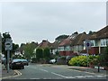
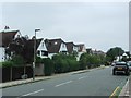
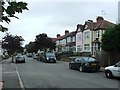
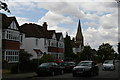
53 photos from this area
Area Information
Key information about the BR1 2RS including its size, population, and administrative classification.
- Area Type
- Postcode
- Area Size
- 4340 m²
- Population
- Not available
- Population Density
- Not available
House Prices in BR1 2RS
30
Properties
£192,909
Average Sold Price
£45,000
Lowest Price
£350,000
Highest Price
Showing 30 properties
| Address | Type | Beds | Baths | Last Sale Price | Last Sale Date | |
|---|---|---|---|---|---|---|
| 95 Tylney Road, Bromley, BR1 2RS | Flat | - | - | £350,000 | May 2023 | |
| 109 Tylney Road, Bromley, BR1 2RS | Flat | 2 | 1 | £250,000 | Mar 2022 | |
| 91 Tylney Road, Bromley, BR1 2RS | Flat | - | - | £300,000 | Dec 2017 | |
| 69 Tylney Road, Bromley, BR1 2RS | Flat | - | - | £243,000 | Oct 2014 | |
| 71 Tylney Road, Bromley, BR1 2RS | Flat | - | - | £249,999 | Sep 2014 | |
| 63 Tylney Road, Bromley, BR1 2RS | Flat | - | - | £150,000 | Sep 2012 | |
| 101 Tylney Road, Bromley, BR1 2RS | Flat | - | - | £170,000 | Sep 2006 | |
| 75 Tylney Road, Bromley, BR1 2RS | Flat | - | - | £150,000 | Aug 2003 | |
| 113 Tylney Road, Bromley, BR1 2RS | Flat | - | - | £155,000 | Jul 2003 | |
| 81 Tylney Road, Bromley, BR1 2RS | Flat | 3 | 1 | £59,000 | Apr 1999 |
Page 1 of 3
Energy Efficiency in BR1 2RS
Amenities
Schools
| Rank | School | Type | Entry gender | Ages |
|---|
Explore more schools in this area
Go to Schools tabDemographics
Household Size
Family (3-5 people)
most common
Accommodation Type
Houses
most common
Tenure
75
majority
Ethnic Group
White
most common
Religion
N/A
most common
Household Composition
N/A
most common
Age
47
median
Adults (30-64 years)
most common
Household Deprivation
N/A
with no deprivation
NS-SEC
48
in Lower managerial occupations
Explore more demographic insights in this area
Go to Demographics tabPlanning
Planning Constraints
- Flood RiskPremium
- Ramsar Wetland SitesPremium
- Area of Outstanding Natural BeautyPremium
- Protected Nature ReservePremium
- Protected WoodlandPremium