Area Overview for BR1 2SA
Photos of BR1 2SA
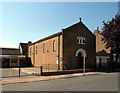
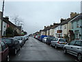
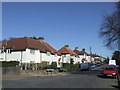
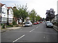
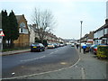
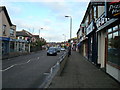
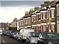
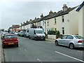
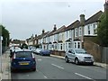
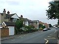
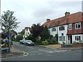
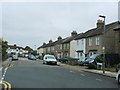
68 photos from this area
Area Information
Key information about the BR1 2SA including its size, population, and administrative classification.
- Area Type
- Postcode
- Area Size
- 8273 m²
- Population
- Not available
- Population Density
- Not available
House Prices in BR1 2SA
34
Properties
£369,096
Average Sold Price
£88,500
Lowest Price
£675,000
Highest Price
Showing 34 properties
| Address | Type | Beds | Baths | Last Sale Price | Last Sale Date | |
|---|---|---|---|---|---|---|
| 57 Nightingale Lane, Bromley, BR1 2SA | Terraced | 4 | 2 | £675,000 | May 2022 | |
| 33 Nightingale Lane, Bromley, BR1 2SA | Terraced | 2 | 1 | £580,000 | Feb 2022 | |
| 55 Nightingale Lane, Bromley, BR1 2SA | house | - | - | £625,000 | Nov 2021 | |
| 83 Nightingale Lane, Bromley, BR1 2SA | house | - | - | £560,000 | Jun 2021 | |
| 21 Nightingale Lane, Bromley, BR1 2SA | house | 3 | - | £513,000 | Oct 2020 | |
| 65 Nightingale Lane, Bromley, BR1 2SA | house | - | - | £525,000 | Jun 2020 | |
| 71 Nightingale Lane, Bromley, BR1 2SA | house | - | - | £450,000 | Jul 2019 | |
| 25 Nightingale Lane, Bromley, BR1 2SA | Semi-detached | 3 | 1 | £535,000 | Mar 2018 | |
| 59 Nightingale Lane, Bromley, BR1 2SA | Terraced | 3 | 1 | £450,000 | Mar 2016 | |
| 79 Nightingale Lane, Bromley, BR1 2SA | Terraced | 4 | - | £449,000 | Sep 2015 |
Page 1 of 4
Energy Efficiency in BR1 2SA
Amenities
Schools
| Rank | School | Type | Entry gender | Ages |
|---|
Explore more schools in this area
Go to Schools tabDemographics
Household Size
Family (3-5 people)
most common
Accommodation Type
Houses
most common
Tenure
75
majority
Ethnic Group
White
most common
Religion
N/A
most common
Household Composition
N/A
most common
Age
47
median
Adults (30-64 years)
most common
Household Deprivation
N/A
with no deprivation
NS-SEC
48
in Lower managerial occupations
Explore more demographic insights in this area
Go to Demographics tabPlanning
Planning Constraints
- Flood RiskPremium
- Ramsar Wetland SitesPremium
- Area of Outstanding Natural BeautyPremium
- Protected Nature ReservePremium
- Protected WoodlandPremium