Area Overview for BR1 2RL
Photos of BR1 2RL
Area Information
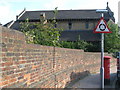
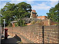
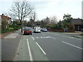
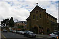
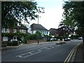
BR1 2RL is a specific postcode area covering a small residential cluster within the Bickley and Sundridge ward of the London Borough of Bromley. This area spans just 5161 m² yet holds a population of 1707 people, creating one of the densest residential clusters in South East London. You are looking at a neighbourhood that blends suburban housing with significant historical depth. The location sits approximately 10.4 miles south-east of Charing Cross, bordered by Bromley Town, Chislehurst, Petts Wood, and Plaistow. Historically, this land combined the medieval manor of Sundridge with the rural forest clearing of Bickley, which only saw urban development after the railway station opened in 1858. Prior to 1965, both districts fell under Kent; the creation of the London Borough of Bromley formalised their current status, with the specific ward established in 2022. Daily life here is characterised by a largely residential, suburban environment. Large detached houses dominate the landscape, set back from the road in a wealthy district. Residents benefit from well-maintained parks, recreation grounds, and access to official cycle routes like the London LOOP. The presence of Jubilee Country Park links you directly to National Trust countryside at Petts Wood and Scadbury Park Nature Reserve. This setting has moved beyond purely rural traditions, offering modern conveniences while retaining the infrastructure of established manor houses and historical sites that once defined the locality.
- Area Type
- Postcode
- Area Size
- 5161 m²
- Population
- Not available
- Population Density
- Not available
The property market in BR1 2RL is defined by exclusive ownership rather than investment rentals. With a home-ownership rate reaching 75%, this is overwhelmingly an area for those purchasing with cash or mortgages for permanent residence. The accommodation type is strictly Houses, meaning there are no flats or purpose-built apartments available within this specific postcode. This concentration of households in freehold or leasehold homes implies that buyers are looking for traditional family living spaces, likely detached or semi-detached properties. The market here does not fluctuate with the typical rental cycles seen in student towns or regeneration zones. Because the area combines the districts of Bickley and Sundridge, the housing stock inherits the legacy of the manor houses built in the early 1700s and the railway-driven expansion of the late 19th century. You are entering a market where sellers are often existing owners downsizing or moving up rather than speculative developers. The small size of the 5161 m² cluster means the inventory at any one time will be limited, requiring preparation to compete against local knowledge. Wealthy families who value large gardens and established tree lines will find this level of tenure security appealing. The lack of rental properties suggests a community where the bulk of the population has significant skin in the game through direct ownership. This stability often translates to better maintenance of parks and streets, supported by a community that values long-term asset preservation over short-term gains.
House Prices in BR1 2RL
Showing 9 properties
Energy Efficiency in BR1 2RL
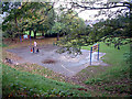
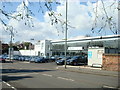
Daily life in BR1 2RL is supported by a wide range of specific amenities within practical reach. Residents have immediate access to five major retail outlets, including Tesco Bromley, M&S Widmore Bromley BP, and Co-op Bromley, ensuring groceries and household goods are always in stock. Transport convenience is high, with five nearby rail stations and five metro stops like the Arena Tram Stop and Beckenham Road Tram Stop. For those who enjoy aviation or quick leisure trips, two airports, including Biggin Hill Airport, are situated nearby. A ferry crossing at Greenwich Pier is also just a short drive away, linking you to the rest of the Thames corridor. Beyond shopping, the area is surrounded by five recreation grounds and parks, allowing for local walking and play. Jubilee Country Park stands out as a 62-acre green space, offering extensive grounds for family walks. You also have direct links to National Trust countryside at Petts Wood and Scadbury Park Nature Reserve. The presence of historical sites like the former Bickley Hall adds cultural depth to your environment. Dining and socialising are covered by the five retail and service hubs. You do not need to travel far for essentials or leisure. The concentration of amenities means your car is used primarily for longer trips, while daily needs are met by local shops. This mix of retail, green space, and transport nodes creates a self-contained lifestyle where time is saved on travel.
Amenities
Schools
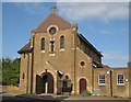
Education is a key consideration for families looking at homes in BR1 2RL, with excellent provision available immediately to your north. The primary school serving this area is St George's, Bickley, Church of England Primary School. This institution holds an Ofsted rating of Outstanding, a top-tier classification that signifies high-quality teaching and student outcomes. As a Church of England Primary School, it caters to stages 1 to 6, offering a faith-based curriculum alongside standard national requirements. This single primary school option is highly regarded and serves children from the immediate catchment area. While specific secondary schools are not listed in the immediate vicinity data, the presence of this outstanding-rated primary school suggests a demand for top-tier early education. Families often keep schools in mind when choosing houses, and the location of St George's makes it a central factor for house choices. The specific Ofsted rating provides a concrete metric for academic quality, removing guesswork for prospective buyers. This rating stands as a verified statistic, confirming the school performs above national averages. For children in this postcode, attendance involves a short commute to this designated facility, reducing travel time and dependency on complex transport schedules at drop-off points.
| Rank | School | Type | Entry gender | Ages |
|---|
Explore more schools in this area
Go to Schools tabDemographics
The community profile for BR1 2RL reflects an established, mature population. Your neighbours will predominantly be in the Adult category, with a median age of 47 years. This demographic skew towards residents aged 30 to 64 indicates a stable household structure free from high student churn. A striking 75% of homes in this postcode are owner-occupied, suggesting deep roots and long-term stability for the local families. This high rate of tenure contrasts sharply with newer, transient developments found elsewhere in the capital. The accommodation type is exclusively Houses, meaning you will find detached or semi-detached property rather than flats or apartment blocks. This housing style aligns with the area's history as a wealthy district developed for families seeking space after the railway expansion in the 1850s. The predominant ethnic group is White, creating a homogenous community where homes have been passed down or settled over several generations. There is no significant youth population under 20, nor a large cohort of retirees over 75, further reinforcing the family-centric nature of the ward. This concentration of middle-aged homeowners in large houses creates a quiet, predictable environment. The area does not suffer from the transient student housing pressures common in older parts of South East London. Instead, the 75% ownership rate ensures that the local infrastructure remains stable and the character of the neighbourhood is well understood by those who live year-round in these specific boundaries.
Household Size
Accommodation Type
Tenure
Ethnic Group
Religion
Household Composition
Age
Household Deprivation
NS-SEC
Explore more demographic insights in this area
Go to Demographics tabPlanning
Planning Constraints
- Flood RiskPremium
- Ramsar Wetland SitesPremium
- Area of Outstanding Natural BeautyPremium
- Protected Nature ReservePremium
- Protected WoodlandPremium