Area Overview for BR1 2TJ
Photos of BR1 2TJ
Area Information
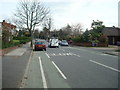
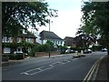
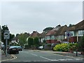
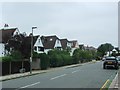
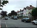
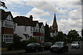
BR1 2TJ is a small residential postcode in the London Borough of Bromley, combining the historic districts of Bickley and Sundridge. With a population of 1707 spread across 985 square metres, it is densely populated yet retains a suburban character. The area is defined by large detached homes, parks, and cycle routes, blending historical roots with modern convenience. Bickley, first mentioned in 1279, and Sundridge, once a medieval manor, now offer residents proximity to Central London via rail and tram networks. The median age of 47 suggests a community of established professionals and families, with 75% owning their homes. This mix of history, green spaces, and connectivity makes BR1 2TJ a distinctive choice for those seeking a balanced lifestyle near London’s core.
- Area Type
- Postcode
- Area Size
- 985 m²
- Population
- Not available
- Population Density
- Not available
BR1 2TJ is predominantly an owner-occupied area, with 75% of homes owned by residents rather than rented. The accommodation type is largely houses, which is typical of suburban Bromley. This suggests a market skewed towards established properties rather than apartments or newer developments. Given the small area size and high population density, property availability is limited, making the local market competitive. Buyers should consider the proximity to Central London via rail and tram links, which enhances the area’s appeal for commuters. The focus on houses also implies higher property values and a preference for private, spacious living. For those seeking rental options, the data does not indicate a strong presence of rental properties, suggesting a need to look beyond the immediate postcode for such opportunities.
House Prices in BR1 2TJ
Showing 1 properties
| Address | Type | Beds | Baths | Last Sale Price | Last Sale Date | |
|---|---|---|---|---|---|---|
| Land And Buildings At St Georges School, Tylney Road, Bromley, BR1 2TJ | commercial | - | - | - | - |
Energy Efficiency in BR1 2TJ
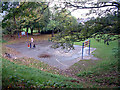
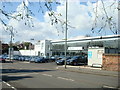
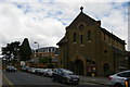
BR1 2TJ offers a mix of retail, transport, and green spaces. Nearby shops include Tesco Bromley, M&S Widmore Bromley BP, and Co-op Bromley, providing everyday convenience. The area’s rail and tram networks connect residents to Bromley, Chislehurst, and beyond, while two airports and a ferry terminal (Greenwich Pier) add to its accessibility. Parks such as Jubilee Country Park and nearby Petts Wood and Scadbury Park Nature Reserve offer recreational opportunities. The suburban character, with large homes and cycle routes, supports an active lifestyle. The presence of historical sites like Sundridge Park Manor and the London LOOP footpaths further enhance the area’s appeal for those valuing both nature and heritage.
Amenities
Schools
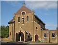
The nearest school to BR1 2TJ is St George’s, Bickley, Church of England Primary School, which serves the local community with primary education. The school has an Ofsted rating of outstanding, reflecting high standards in teaching and student outcomes. As a primary school, it caters to younger children, making it a key consideration for families with young dependents. The absence of secondary schools in the immediate area means residents may need to look to nearby Bromley or Chislehurst for secondary education. However, the outstanding rating at St George’s ensures that primary education is of high quality, supporting the area’s appeal to families prioritising academic excellence.
| Rank | School | Type | Entry gender | Ages |
|---|
Explore more schools in this area
Go to Schools tabDemographics
The population of BR1 2TJ is predominantly adults aged 30–64, reflecting a mature, stable community. With 75% of residents owning their homes, the area leans towards long-term occupancy rather than rental markets. The accommodation type is primarily houses, indicating a focus on larger, private properties. The predominant ethnic group is White, which aligns with the broader demographic trends in Bromley. The high population density of 1,733,012 people per square kilometre suggests a compact, closely knit neighbourhood. This density, combined with the age profile, points to a community where families and professionals coexist, with limited presence of younger or older demographics. The data does not indicate significant deprivation, implying a relatively high quality of life supported by local amenities and infrastructure.
Household Size
Accommodation Type
Tenure
Ethnic Group
Religion
Household Composition
Age
Household Deprivation
NS-SEC
Explore more demographic insights in this area
Go to Demographics tabPlanning
Planning Constraints
- Flood RiskPremium
- Ramsar Wetland SitesPremium
- Area of Outstanding Natural BeautyPremium
- Protected Nature ReservePremium
- Protected WoodlandPremium