Area Overview for NR12 8EG
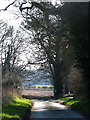
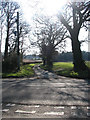
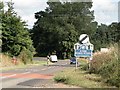
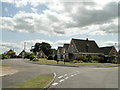
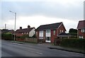
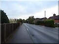
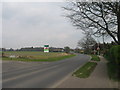
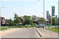
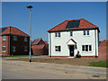
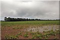
Photos of NR12 8EG


Area Information
Living in NR12 8EG means residing within a very specific residential cluster covering just 45.3 hectares. This small postcode area represents a contained community rather than a broad district, which fosters a distinct sense of locality. You will find approximately 2298 people calling this space home, creating an environment where the village character remains intact despite being close to Norwich. The land use is almost entirely residential, resulting in a quiet atmosphere compared to larger urban sprawls. Because the population density sits at 154 people per square kilometre, open space between properties is likely, offering a degree of privacy that larger towns often lack. This area appeals to those seeking a settled lifestyle with direct access to nearby services without the noise of city living. The boundaries of NR12 8EG are defined by practical reach to Wroxham, a nearby metro hub, meaning that while you live in a contained pocket, your world extends to the wider Norfolk coastline and historical landmarks. Daily life here involves navigating a neighbourhood where the majority of residents already own their properties, reflecting a community established by those who have rooted themselves locally.
- Area Type
- Postcode
- Area Size
- 45.3 hectares
- Population
- 2298
- Population Density
- 154 people/km²
Homes in NR12 8EG form a market defined by stability and ownership rather than speculation. With 74% of properties owner-occupied, the housing stock reflects a community where people have invested in their local surroundings and intend to stay. The predominant accommodation type is houses, which aligns with the area's function as a small residential cluster. This means you will not encounter the high-rise apartments or large private estates found in city centres. The high rate of ownership suggests that turnover is natural but steady, driven by life events rather than quick flips. When you look at the broader surroundings of NR12 8EG, the market remains consistent with this data, reinforcing the reputation of this postcode as a place for settled living. If you are purchasing a property here, you join a majority of buyers who view the house as a long-term home. The market does not cater to the rental demographic significantly, as three-quarters of the stock is already bonded to owners. This creates a neighbourhood where the residents know their neighbours and the value of the area.
House Prices in NR12 8EG
Showing 39 properties
| Address | Type | Beds | Baths | Last Sale Price | Last Sale Date | |
|---|---|---|---|---|---|---|
| 18 Blofeld Loke, Hoveton, NR12 8EG | house | - | - | £89,000 | Jan 2003 | |
| 30 Blofeld Loke, Hoveton, NR12 8EG | Terraced | - | - | £92,500 | May 2002 | |
| 19 Blofeld Loke, Hoveton, NR12 8EG | Terraced | - | - | £43,000 | Jun 1998 | |
| 12 Blofeld Loke, Hoveton, NR12 8EG | Bungalow | - | - | - | - | |
| 14 Blofeld Loke, Hoveton, NR12 8EG | Semi-detached | - | - | - | - | |
| 8 Blofeld Loke, Hoveton, NR12 8EG | Terraced | - | - | - | - | |
| 3 Blofeld Loke, Hoveton, NR12 8EG | Bungalow | - | - | - | - | |
| 34 Blofeld Loke, Hoveton, NR12 8EG | Terraced | - | - | - | - | |
| 38 Blofeld Loke, Hoveton, NR12 8EG | Bungalow | - | - | - | - | |
| 10 Blofeld Loke, Hoveton, NR12 8EG | Bungalow | - | - | - | - |
Energy Efficiency in NR12 8EG
Your daily life in NR12 8EG is shaped by practical access to amenities that are clustered within a short drive. You have five retail options nearby, including the East of England Co-operative Co, Tesco Norwich, and Lidl Sprowston. These supermarkets allow you to handle most weekly shopping without travelling more than a mile to the B1126. For leisure and travel, Wroxham stands as the nearest metro hub, offering access to river cruises and historic headlands. Transport links are reinforced by three nearby railway stations: Hoveton and Wroxham Railway Station, Salhouse Railway Station, and Worstead Railway Station. These stations connect you to Norwich and beyond, making the remote feeling of the postcode manageable for commuters. The presence of these specific retailers and transit points means you do not need to sacrifice convenience for the privacy of house living. When you plan a weekend in NR12 8EG, you can rely on the Co-operative and Tesco for supplies and use the rail network for a longer journey to Wroxham or the coast.
Amenities
Schools
Families considering living in NR12 8EG will find a selection of educational institutions nearby, though options are limited to the immediate vicinity and surrounding towns. The closest primary option is St John's Community Primary School and Nursery, which holds a good Ofsted rating. This school offers a regulated standard of education suitable for young children attending from NR12 8EG. Further along, you will find Broadland High Ormiston Academy, a secondary academy providing education for older students. Broadland High School also serves the area, acting as another pillar for the local education system. The mix of a rated primary school and academy options suggests that while NR12 8EG itself may not have secondary provision, the route to quality education is clear for residents. You must weigh the distance to these facilities against the benefits of commencing school from a quiet postcode. The presence of these specific schools, including the academy and the primary with a good rating, provides a structured path for your children's education without needing to look further afield for most needs.
| Rank | School | Type | Entry gender | Ages |
|---|
Explore more schools in this area
Go to Schools tabDemographics
The community in NR12 8EG reflects a mature population with a median age of 47 years. You will find that the elderly, defined as those aged 65 and over, represent the most common age range within these households. This age profile suggests a neighbourhood where families with school-aged children are in the minority, and long-term residents dominate the street scenes. Home ownership stands at a solid 74%, indicating that the majority of houses are owner-occupied rather than rented properties. This figure points to a stable demographic where residents have chosen to settle permanently in this postcode area. The vast majority of accommodation consists of houses, confirming the absence of high-rise blocks or dense flats typical of urban centres. The predominant ethnic group is White, aligning with the broader demographics of rural Norfolk. For buyers considering NR12 8EG, this data shows a quiet, established setting where the social fabric is woven by older generations and established homeowners rather than transient renters or young professionals.
Household Size
Accommodation Type
Tenure
Ethnic Group
Religion
Household Composition
Age
Household Deprivation
NS-SEC
Explore more demographic insights in this area
Go to Demographics tabPlanning
Planning Constraints
- Flood RiskPremium
- Ramsar Wetland SitesPremium
- Area of Outstanding Natural BeautyPremium
- Protected Nature ReservePremium
- Protected WoodlandPremium