Area Overview for NR12 8EB
Photos of NR12 8EB
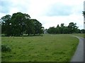
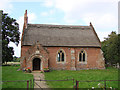
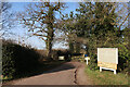
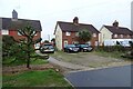
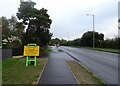
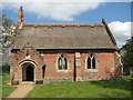
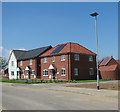
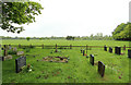
20 photos from this area
Area Information
Key information about the NR12 8EB including its size, population, and administrative classification.
- Area Type
- Postcode
- Area Size
- 18.9 hectares
- Population
- 2298
- Population Density
- 154 people/km²
House Prices in NR12 8EB
63
Properties
£217,325
Average Sold Price
£55,000
Lowest Price
£400,000
Highest Price
Showing 63 properties
| Address | Type | Beds | Baths | Last Sale Price | Last Sale Date | |
|---|---|---|---|---|---|---|
| 64 Grange Close, Hoveton, NR12 8EB | Bungalow | 4 | 3 | £390,000 | Dec 2025 | |
| 124 Grange Close, Hoveton, NR12 8EB | Semi-detached | 3 | 1 | £270,000 | Jun 2025 | |
| 107 Grange Close, Hoveton, NR12 8EB | Semi-detached | 3 | 1 | £240,000 | Feb 2025 | |
| 77 Grange Close, Hoveton, NR12 8EB | Bungalow | 3 | 1 | £285,000 | Sep 2024 | |
| 83 Grange Close, Hoveton, NR12 8EB | Bungalow | 2 | 1 | £272,000 | Oct 2023 | |
| 70 Grange Close, Hoveton, NR12 8EB | Bungalow | 3 | 1 | £340,000 | Jul 2023 | |
| 114 Grange Close, Hoveton, NR12 8EB | Chalet | 5 | 2 | £400,000 | Aug 2022 | |
| 79 Grange Close, Hoveton, NR12 8EB | Bungalow | - | - | £270,000 | Jun 2022 | |
| 119 Grange Close, Hoveton, NR12 8EB | Retail | 2 | 1 | £252,000 | May 2022 | |
| 75 Grange Close, Hoveton, NR12 8EB | Bungalow | 3 | 1 | £328,000 | Feb 2021 |
Page 1 of 7
Energy Efficiency in NR12 8EB
Amenities
Schools
| Rank | School | Type | Entry gender | Ages |
|---|
Explore more schools in this area
Go to Schools tabDemographics
Household Size
Two person
most common
Accommodation Type
Houses
most common
Tenure
74
majority
Ethnic Group
White
most common
Religion
N/A
most common
Household Composition
N/A
most common
Age
47
median
Elderly (65+ years)
most common
Household Deprivation
N/A
with no deprivation
NS-SEC
29
in Lower managerial occupations
Explore more demographic insights in this area
Go to Demographics tabPlanning
Planning Constraints
- Flood RiskPremium
- Ramsar Wetland SitesPremium
- Area of Outstanding Natural BeautyPremium
- Protected Nature ReservePremium
- Protected WoodlandPremium