Area Overview for NR12 8EE
Photos of NR12 8EE
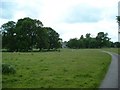
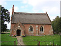
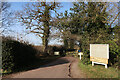
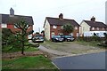
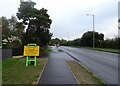
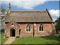
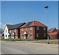
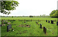
20 photos from this area
Area Information
Key information about the NR12 8EE including its size, population, and administrative classification.
- Area Type
- Postcode
- Area Size
- 9.0 hectares
- Population
- 2298
- Population Density
- 154 people/km²
House Prices in NR12 8EE
38
Properties
£178,961
Average Sold Price
£37,500
Lowest Price
£318,000
Highest Price
Showing 38 properties
| Address | Type | Beds | Baths | Last Sale Price | Last Sale Date | |
|---|---|---|---|---|---|---|
| Fieldview, 162 Stalham Road, Hoveton, NR12 8EE | Semi-detached | 3 | 1 | £318,000 | Nov 2023 | |
| 142 Stalham Road, Hoveton, NR12 8EE | Bungalow | - | - | £312,500 | May 2021 | |
| 158 Stalham Road, Hoveton, NR12 8EE | house | 3 | - | £240,000 | Mar 2021 | |
| 148 Stalham Road, Hoveton, NR12 8EE | Bungalow | 3 | 1 | £307,500 | Dec 2020 | |
| 154 Stalham Road, Hoveton, NR12 8EE | Semi-detached | 3 | 1 | £255,000 | Apr 2018 | |
| 136 Stalham Road, Hoveton, NR12 8EE | Semi-detached | 3 | 1 | £207,000 | Feb 2018 | |
| 144 Stalham Road, Hoveton, NR12 8EE | Bungalow | 2 | - | £185,000 | Apr 2013 | |
| 156 Stalham Road, Hoveton, NR12 8EE | Semi-detached | - | - | £100,000 | Apr 2012 | |
| 160 Stalham Road, Hoveton, NR12 8EE | house | - | - | £150,000 | Nov 2010 | |
| 122 Stalham Road, Hoveton, NR12 8EE | Flat | - | - | £95,000 | Jan 2008 |
Page 1 of 4
Energy Efficiency in NR12 8EE
Amenities
Schools
| Rank | School | Type | Entry gender | Ages |
|---|
Explore more schools in this area
Go to Schools tabDemographics
Household Size
Two person
most common
Accommodation Type
Houses
most common
Tenure
74
majority
Ethnic Group
White
most common
Religion
N/A
most common
Household Composition
N/A
most common
Age
47
median
Elderly (65+ years)
most common
Household Deprivation
N/A
with no deprivation
NS-SEC
29
in Lower managerial occupations
Explore more demographic insights in this area
Go to Demographics tabPlanning
Planning Constraints
- Flood RiskPremium
- Ramsar Wetland SitesPremium
- Area of Outstanding Natural BeautyPremium
- Protected Nature ReservePremium
- Protected WoodlandPremium