Area Overview for NR12 8BY
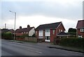
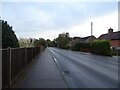
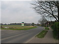
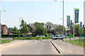
Photos of NR12 8BY


Area Information
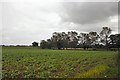
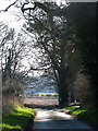
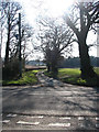
Living in NR12 8BY offers a quiet residential experience within a defined cluster of homes. This specific postcode covers a small settlement in England where exactly 2,298 people call home. The low population density of 154 people per square kilometre means residents enjoy open space and minimal traffic noise compared to urban centres. You will find yourself navigating a community that prioritises a slower pace of life while maintaining reasonable access to essential services. Daily routines involve shorter commutes to nearby towns, yet the area retains a distinct sense of separation from the busy hubs of Norwich and Wroxham. The setting is ideal for those seeking a calm environment without total isolation. While the area does not boast a large population, the compact nature ensures that neighbours often know one another. This makes NR12 8BY a straightforward choice for buyers who value stability and peace over the energy of a major city. The physical footprint of the postcode means you are surrounded by similar housing styles, creating a predictable and manageable neighbourhood structure.
- Area Type
- Postcode
- Area Size
- Not available
- Population
- 2298
- Population Density
- 154 people/km²
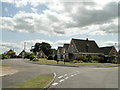
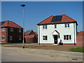
You are stepping into a market defined by stability and private ownership when considering homes in NR12 8BY. With a home ownership rate of 74%, the area functions primarily as an owner-occupied zone rather than a rental hub. This statistic suggests that properties here are often maintained with a focus on long-term value and personalisation. The accommodation type is exclusively houses, which implies a housing stock designed for families or individuals requiring gardens and private grounds. There are no apartments or flats built within the NR12 8BY boundaries, limiting the options to detached, semi-detached, or terraced family homes. This homogeneity makes the market easier to navigate compared to mixed-use urban postcodes. Buyers looking for convenience and space will find their needs met by this singular focus on housing. The high ownership percentage also suggests lower turnover, meaning competition for specific properties might be steady but the resident base is not constantly shifting. For those seeking a traditional suburban or rural living experience with a house and garden, this postcode delivers exactly that profile without the complexity of mixed development types.
House Prices in NR12 8BY
No properties found in this postcode.
Energy Efficiency in NR12 8BY
Your daily lifestyle in NR12 8BY centres on practical reach to key local amenities and transport hubs. You are within easy distance of Wroxham, a notable locality that likely serves as a social and leisure destination for residents. Transport links are solid, with three railway stations serving the broader area: Hoveton & Wroxham Railway Station, Salhouse Railway Station, and Worstead Railway Station. These railheads provide the primary method for commuting to Norwich or Norwich Business Park. Retail options are conveniently located just outside the immediate postcodes, featuring five main outlets including the East of England Co-operative Co, Tesco Norwich, and Morrisons Daily. These supermarkets cover your weekly grocery requirements without the need to travel far. You will find your shopping trips quick and efficient, enhancing the quality of daily life. The combination of rail access and nearby retail creates a balanced environment where you do not need a large car for every errand. Living in NR12 8BY lends itself to a routine defined by local convenience and straightforward travel.
Amenities
Schools
Families living in or near NR12 8BY have access to a mix of educational institutions, though options are limited to three specific names in the immediate vicinity. St John's Community Primary School and Nursery offers primary education and holds an Ofsted rating of good, providing a secure environment for younger children. Broadland High School serves as another primary option for families in this zone, catering to the early stages of compulsory education. As children older school age, Broadland High Ormiston Academy becomes the relevant destination for secondary-level studies. This academy status indicates a modernised curriculum and funding structure compared to traditional local authority schools. The proximity of these institutions means you do not need to travel far for daily schooling, which saves commute time for parents juggling work and domestic duties. The presence of a nursery within the primary school setup adds value for those with very young children entering the system. While the selection is concise, the options provided cover the full spectrum from nursery through to academy-based secondary education, ensuring continuity for local students.
| Rank | School | Type | Entry gender | Ages |
|---|
Explore more schools in this area
Go to Schools tabDemographics
The community profile in NR12 8BY reflects a population skewed towards older generations. The median age sits at 47 years, indicating that the average resident is approaching or has passed their mid-life years. Across the board, the Elderly group, defined as those aged 65 and over, represents the most common age range within this neighbourhood. This demographic shift is significant for understanding the local vibe and demand for specific amenities. Home ownership in NR12 8BY stands at a robust 74%, confirming that the vast majority of residents purchased their properties outright rather than renting. This high ownership rate typically stabilises the local economy and fosters long-term community engagement. Almost all accommodation consists of houses, meaning you will not find apartments or urban flats within this postal boundary. The population is predominantly White, aligning with broader regional trends in rural England. These statistics paint a clear picture of a settled, owner-occupied community where families and retirees have put down roots for the long haul.
Household Size
Accommodation Type
Tenure
Ethnic Group
Religion
Household Composition
Age
Household Deprivation
NS-SEC
Explore more demographic insights in this area
Go to Demographics tabPlanning
Planning Constraints
- Flood RiskPremium
- Ramsar Wetland SitesPremium
- Area of Outstanding Natural BeautyPremium
- Protected Nature ReservePremium
- Protected WoodlandPremium