Area Overview for NR12 8DZ
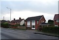
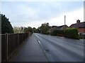
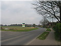
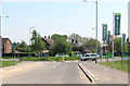
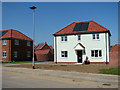
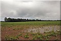
Photos of NR12 8DZ


Area Information
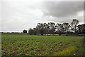
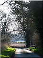
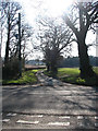
Living in NR12 8DZ means residing within a specific residential cluster covering just 8.2 hectares. This compact area accommodates a population of 2,298 people, resulting in a density of 154 people per square kilometre. Such low density typically suggests a quieter environment where residents value space and seclusion over urban convenience. The postcode represents a quiet pocket of England where daily life moves at a slower pace compared to the wider city. You will find a neighbourhood defined by its exclusivity of space rather than its proximity to high-rise developments or busy thoroughfares. The community functions as a self-contained unit within the broader local landscape. Residents here often prioritise the harmony of their surroundings over the noise of major transport hubs. Living in this specific cluster offers a sense of retreat from the busier areas surrounding Norwich. The small footprint of the area means that neighbours are perhaps inevitable, yet the spread of the housing reduces the likelihood of immediate personal interaction on every street corner. It is a location where the primary attraction is the quietude and the manageable scale of the immediate environment.
- Area Type
- Postcode
- Area Size
- 8.2 hectares
- Population
- 2298
- Population Density
- 154 people/km²
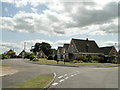
The property market in NR12 8DZ is characterised by a stock dominated by privately owned houses. With 74% of the area's households owned outright, the market operates primarily as a long-term investment vehicle for current residents rather than a hub for rental yields. The accommodation type is strictly houses, meaning you will not find modern flats or conversion units within this specific postcode boundary. This housing style reflects the area's development as a residential cluster intended for standard family living. Buyers looking at homes in this area should expect a traditional property portfolio. The high ownership rate implies that many properties have not changed hands recently, often passed down through generations or retained by retiring couples. This stability can make the market less volatile but may also mean fewer active listings at any given time. The lack of rental stock suggests that this is not a developing student village or a commuter town reliant on tenants. For those seeking a retirement property, the demographic data confirms this is a logical destination. The age profile and ownership patterns suggest that the area caters to wealthier retirees who have accumulated significant assets over their working lives. However, the small land area of 8.2 hectares also limits the sheer volume of new developments. You will be buying into an established environment where the character of the streets is defined by the existing house stock rather than new construction projects.
House Prices in NR12 8DZ
Showing 14 properties
| Address | Type | Beds | Baths | Last Sale Price | Last Sale Date | |
|---|---|---|---|---|---|---|
| 12 Littlewood Lane, Hoveton, NR12 8DZ | Terraced | 3 | 1 | £215,000 | May 2023 | |
| 10 Littlewood Lane, Hoveton, NR12 8DZ | Terraced | 3 | 1 | £225,000 | Mar 2023 | |
| 8 Littlewood Lane, Hoveton, NR12 8DZ | house | - | - | £190,000 | Jul 2018 | |
| 14 Littlewood Lane, Hoveton, NR12 8DZ | Terraced | 3 | - | £143,000 | Jan 2014 | |
| 4 Littlewood Lane, Hoveton, NR12 8DZ | Retail | 3 | 1 | - | - | |
| The Annexe, 2 Littlewood Lane, Hoveton, NR12 8DZ | undefined | - | - | - | - | |
| Paul Holsey Replicas, Unit 5C, Stalham Road Industrial Estate, Littlewood Lane, Hoveton, NR12 8DZ | office_workshop | - | - | - | - | |
| Paul Holsey Replicas, Unit 5D, Stalham Road Industrial Estate, Littlewood Lane, Hoveton, NR12 8DZ | office_workshop | - | - | - | - | |
| Lurista House, Stalham Road Industrial Estate, Littlewood Lane, Hoveton, NR12 8DZ | general_industrial | - | - | - | - | |
| 6 Littlewood Lane, Hoveton, NR12 8DZ | Terraced | - | - | - | - |
Energy Efficiency in NR12 8DZ
Residents of NR12 8DZ benefit from convenient access to key amenities within practical reach, without needing to travel into the city centre. The nearest major market town is Wroxham, which serves as a metro hub for the wider community. This town likely offers the cultural and shopping experiences that residents might seek for special occasions or regular shopping trips. For daily necessities, there are five notable retail options available in the surrounding area. East of England Co-operative Co, Lidl Sprowston, and Tesco Norwich are among the key stores you can access. These supermarkets ensure that fresh food and essential household goods are always nearby, reducing the need for long journeys. Rail connectivity is also strong, with three railway stations acting as primary transport nodes. Hoveton & Wroxham Railway Station, Salhouse Railway Station, and Worstead Railway Station provide vital links to the rest of the region. This railway network allows you to integrate into the broader English transport system efficiently. The combination of these specific shops and stations means that living in NR12 8DZ does not isolate you from essential services.
Amenities
Schools
Families considering NR12 8DZ have access to a specific mix of educational institutions within practical reach. St John's Community Primary School and Nursery holds an Ofsted rating of 'good' and serves as a key educational provider for the younger generation in the locality. Its status is confirmed by the regulator, offering a tangible reassurance regarding the quality of early education for children growing up here. In addition to this primary option, Broadland High School operates as a primary institution within the immediate vicinity. Nearby, Broadland High Ormiston Academy functions as an academy, providing further educational options for older pupils or those seeking secondary-level education in the wider area. The presence of these three specific schools names a clear pathway for schooling from early years through to adolescence. While the primary rating for St John's is explicitly noted as good, the data does not specify Ofsted ratings for the other two institutions. This distinction is important for parents who prioritise verified ratings. The mix of primary and academy types indicates that families in NR12 8DZ do not need to travel far to secure education. The availability of these schools supports the demographic profile of an area that, despite its elderly orientation, still accommodates families who value these local choices.
| Rank | School | Type | Entry gender | Ages |
|---|
Explore more schools in this area
Go to Schools tabDemographics
The community in NR12 8DZ reflects a settled population with a distinct age profile. The median age stands at 47 years, and the most common age range is elderly residents aged 65 and over. This demographic skew indicates a neighbourhood predominantly occupied by older homeowners who have stayed put or moved here for retirement. You are less likely to encounter families with young children or young professionals in typical employment cycles. Home ownership is exceptionally high at 74%, confirming that the vast majority of households own their homes free of mortgage burdens. This statistic aligns perfectly with the accommodation type, which consists almost exclusively of houses rather than flats or purpose-built retirement blocks. The predominant ethnic group is White, matching the broad demographic trend of rural and semi-rural Norfolk. These factors combine to create a very traditional social fabric where long-term residency is the norm. The high rate of ownership suggests a community where residents have invested in the land and property for the long term. With fewer renters, the area lacks the transient nature often found in student zones or high-growth employment centres. You will engage with neighbours who likely know their history in the village and are connected through established local networks. This stability defines the social atmosphere of NR12 8DZ.
Household Size
Accommodation Type
Tenure
Ethnic Group
Religion
Household Composition
Age
Household Deprivation
NS-SEC
Explore more demographic insights in this area
Go to Demographics tabPlanning
Planning Constraints
- Flood RiskPremium
- Ramsar Wetland SitesPremium
- Area of Outstanding Natural BeautyPremium
- Protected Nature ReservePremium
- Protected WoodlandPremium