Area Overview for NR12 8ED
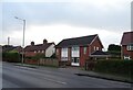
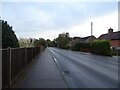
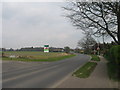
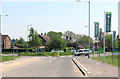
Photos of NR12 8ED


Area Information
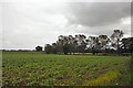
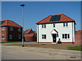
NR12 8ED is a compact residential postcode covering approximately 1.6 hectares. The area accommodates a population of 2,298 people, creating a relatively low population density of 154 people per square kilometre. This specific location represents a small residential cluster within the wider region. Living in NR12 8ED means you are situated in a contained environment far from the noise and density of major urban centres. The postcode defines a clear boundary for this distinct community. You can expect a setting that prioritises quiet over convenience, as the small land area supports a focused number of households. The layout suggests a neighbourhood where residents likely know their neighbours due to the limited size of the cluster. Daily life here revolves around the local street network rather than extensive infrastructure within the immediate bounds. This area serves as a residential hub for those who prioritise space and lower crowd levels. The physical footprint of 1.6 hectares dictates a calm pace of life compared to larger urban districts. You find a stable environment where the community is tightly knit by geographical proximity rather than sprawling development.
- Area Type
- Postcode
- Area Size
- 1.6 hectares
- Population
- 2298
- Population Density
- 154 people/km²
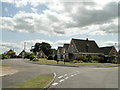
The property market in NR12 8ED is defined by high home ownership, where 74% of residents own their property. This statistic reveals a community characterised by stability rather than rental flux. The accommodation type is predominantly houses, meaning you will find detached, semi-detached, or terraced houses rather than flats or apartments. Living in NR12 8ED typically involves purchasing a standalone family home or a smaller bungalow, fitting the area's residential cluster description. The low population density of 154 people per square kilometre suggests that land availability supports single-family dwellings rather than high-density blocks. Buyers looking at this postcode should expect a traditional housing stock aimed at families and empty nesters. The small area size of 1.6 hectares limits large-scale new developments, preserving the existing architectural style. With such a high ownership rate, the market relies heavily on established properties coming onto the market infrequently. You are competing mainly for existing stock rather than new builds or rental opportunities. The nature of the housing suggests a focus on longevity and maintenance of traditional structures. This market profile makes NR12 8ED attractive for those seeking a buy-to-lodge investment or a retirement purchase rather than a rental option. The composition of homes provides a clear picture of a suburban or semi-rural settlement where property values are tied to land稀缺ity and house quality.
House Prices in NR12 8ED
Showing 2 properties
| Address | Type | Beds | Baths | Last Sale Price | Last Sale Date | |
|---|---|---|---|---|---|---|
| Unit C3, Greengates Way, Hoveton, NR12 8ED | Office | - | - | - | - | |
| Unit C1, Greengates Way, Hoveton, NR12 8ED | Office | - | - | - | - |
Energy Efficiency in NR12 8ED
Your lifestyle in NR12 8ED revolves around access to nearby towns and transport hubs rather than local amenities. Within a short distance, you can reach Wroxham, a notable metro area offering shops, restaurants, and leisure facilities. The area provides access to three railway stations: Hoveton & Wroxham Railway Station, Salhouse Railway Station, and Worstead Railway Station. These transport links allow you to commute to larger cities or travel for leisure without needing a car. For daily shopping needs, five retail options are available, including the East of England Co-operative Co, Lidl Sprowston, and Tesco Norwich. You can purchase groceries and essentials from these established supermarket chains. Living in NR12 8ED means trading local village shops for the convenience of larger retailers in adjacent towns. The railway network connects you efficiently to broader business districts and holiday destinations. You will find that your practical reach extends beyond the small residential cluster to include these major service points. The presence of Lidl and Tesco ensures competitive pricing and product variety for your household requirements. Your travel plans rely heavily on the three nearby stations for regional connectivity. This setup works well for active commuters but may feel detached if you prefer a self-contained village environment. The lifestyle balance hinges on your willingness to travel for retail and civic services.
Amenities
Schools
Families considering NR12 8ED have access to several educational institutions nearby. St John's Community Primary School and Nursery serves the local primary education needs with a 'good' Ofsted rating. This school is a key facility for young children living in the postcode. Broadland High School and Broadland High Ormiston Academy operate as primary and academy formations respectively, catering to different educational stages. The presence of these institutions means you have options for early education and secondary schooling within practical reach. You do not need to travel far for your children to attend primary classes at St John's. The mix of school types indicates a dedicated local education cluster supporting the residential growth around NR12 8ED. Parents can rely on St John's for infant and junior years while older students transition to the academy system. The availability of these three named schools demonstrates a functional education network for the region. Your choice of school will depend on specific catchment areas and current capacity at St John's Community Primary School and Nursery. The proximity of Broadland High Ormiston Academy ensures that secondary education remains accessible without long commutes. This educational infrastructure supports the family demographic found in the area. Schools near NR12 8ED provide a vital resource for the community's children.
| Rank | School | Type | Entry gender | Ages |
|---|
Explore more schools in this area
Go to Schools tabDemographics
The community in NR12 8ED reflects an older demographic, with a median age of 47 years. The most common age range among residents is those aged 65 years and over, indicating a significant elderly population. This age profile suggests the area appeals to retirees or families with older children leaving school. Home ownership remains the dominant tenure, rising to 74% of households in this postcode. This high rate indicates long-term stability, as most residents own their homes outright or with mortgages rather than renting. The accommodation type is almost exclusively houses, reinforcing the established character of the neighbourhood. The predominant ethnic group is White, which aligns with the older demographic trends typical of this region. With a population density of 154 people per square kilometre, residents enjoy personal space with limited congestion. The high percentage of owners contributes to a slower-paced social environment where communities often stay together for decades. You are unlikely to find transient populations here, as the housing stock and tenure model support permanent residency. This demographic mix creates a settled atmosphere where local traditions and social structures remain consistent year after year. The concentration of older adults means local services often cater to mature needs and established lifestyles.
Household Size
Accommodation Type
Tenure
Ethnic Group
Religion
Household Composition
Age
Household Deprivation
NS-SEC
Explore more demographic insights in this area
Go to Demographics tabPlanning
Planning Constraints
- Flood RiskPremium
- Ramsar Wetland SitesPremium
- Area of Outstanding Natural BeautyPremium
- Protected Nature ReservePremium
- Protected WoodlandPremium