Area Overview for AL1 5PN
Photos of AL1 5PN
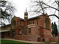
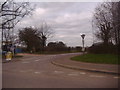
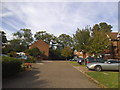
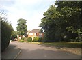
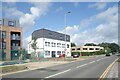
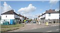
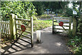
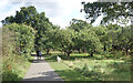
26 photos from this area
Area Information
Key information about the AL1 5PN including its size, population, and administrative classification.
- Area Type
- Postcode
- Area Size
- 5799 m²
- Population
- 1932
- Population Density
- 557 people/km²
House Prices in AL1 5PN
11
Properties
£395,700
Average Sold Price
£182,000
Lowest Price
£840,000
Highest Price
Showing 11 properties
| Address | Type | Beds | Baths | Last Sale Price | Last Sale Date | |
|---|---|---|---|---|---|---|
| 5 Liberty Walk, St Albans, AL1 5PN | Terraced | 3 | 2 | £499,000 | Oct 2025 | |
| 4 Liberty Walk, St Albans, AL1 5PN | Terraced | 3 | 1 | £575,000 | Jun 2025 | |
| 8 Liberty Walk, St Albans, AL1 5PN | Terraced | 3 | 1 | £578,000 | Jul 2023 | |
| 2 Liberty Walk, St Albans, AL1 5PN | Detached | 4 | 2 | £840,000 | Mar 2021 | |
| 6 Liberty Walk, St Albans, AL1 5PN | house | 3 | - | £305,000 | Aug 2010 | |
| 10 Liberty Walk, St Albans, AL1 5PN | Terraced | - | - | £292,000 | Nov 2005 | |
| 7 Liberty Walk, St Albans, AL1 5PN | Terraced | 3 | 2 | £275,000 | Dec 2004 | |
| 1 Liberty Walk, St Albans, AL1 5PN | Detached | - | - | £225,000 | Jun 2001 | |
| 9 Liberty Walk, St Albans, AL1 5PN | Terraced | - | - | £182,000 | Jun 2001 | |
| 3 Liberty Walk, St Albans, AL1 5PN | Terraced | - | - | £186,000 | Apr 2001 |
Page 1 of 2
Energy Efficiency in AL1 5PN
Amenities
Schools
| Rank | School | Type | Entry gender | Ages |
|---|
Explore more schools in this area
Go to Schools tabDemographics
Household Size
Family (3-5 people)
most common
Accommodation Type
Houses
most common
Tenure
82
majority
Ethnic Group
White
most common
Religion
N/A
most common
Household Composition
N/A
most common
Age
47
median
Adults (30-64 years)
most common
Household Deprivation
N/A
with no deprivation
NS-SEC
54
in Lower managerial occupations
Explore more demographic insights in this area
Go to Demographics tabPlanning
Planning Constraints
- Flood RiskPremium
- Ramsar Wetland SitesPremium
- Area of Outstanding Natural BeautyPremium
- Protected Nature ReservePremium
- Protected WoodlandPremium