Area Overview for AL1 5PB
Photos of AL1 5PB
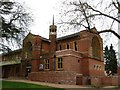
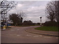
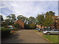
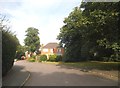
26 photos from this area
Area Information
Key information about the AL1 5PB including its size, population, and administrative classification.
- Area Type
- Postcode
- Area Size
- 6091 m²
- Population
- 1932
- Population Density
- 557 people/km²
House Prices in AL1 5PB
9
Properties
£663,542
Average Sold Price
£45,750
Lowest Price
£1,120,000
Highest Price
Showing 9 properties
| Address | Type | Beds | Baths | Last Sale Price | Last Sale Date | |
|---|---|---|---|---|---|---|
| 328 Camp Road, St Albans, AL1 5PB | Semi-detached | 4 | 3 | £1,119,000 | Jul 2023 | |
| 336 Camp Road, St Albans, AL1 5PB | house | 3 | 2 | £891,500 | Aug 2022 | |
| 326 Camp Road, St Albans, AL1 5PB | house | - | - | £1,120,000 | Jun 2021 | |
| 340 Camp Road, St Albans, AL1 5PB | Semi-detached | 3 | 1 | £385,000 | Apr 2015 | |
| 332 Camp Road, St Albans, AL1 5PB | Semi-detached | 3 | - | £420,000 | Nov 2014 | |
| 338 Camp Road, St Albans, AL1 5PB | Semi-detached | - | - | £45,750 | Dec 1995 | |
| 342 Camp Road, St Albans, AL1 5PB | house | - | - | - | - | |
| 334 Camp Road, St Albans, AL1 5PB | Semi-detached | - | - | - | - | |
| 330 Camp Road, St Albans, AL1 5PB | Semi-detached | - | - | - | - |
Energy Efficiency in AL1 5PB
Amenities
Schools
| Rank | School | Type | Entry gender | Ages |
|---|
Explore more schools in this area
Go to Schools tabDemographics
Household Size
Family (3-5 people)
most common
Accommodation Type
Houses
most common
Tenure
82
majority
Ethnic Group
White
most common
Religion
N/A
most common
Household Composition
N/A
most common
Age
47
median
Adults (30-64 years)
most common
Household Deprivation
N/A
with no deprivation
NS-SEC
54
in Lower managerial occupations
Explore more demographic insights in this area
Go to Demographics tabPlanning
Planning Constraints
- Flood RiskPremium
- Ramsar Wetland SitesPremium
- Area of Outstanding Natural BeautyPremium
- Protected Nature ReservePremium
- Protected WoodlandPremium