Area Overview for South Derbyshire District
Photos of South Derbyshire District

Area Information
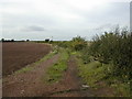
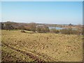
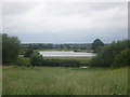
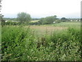
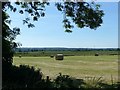
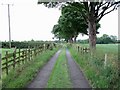
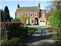
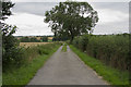
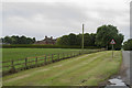
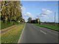
South Derbyshire District is a local authority district in East Midlands, England, covering a total area size of 338.4 km². The district sits at coordinates 52°48′N 1°32′W and features undulating arable land interspersed with meadowland in the valleys of the Rivers Derwent, Dove and Trent. You will find it home to about 107,200 people, with market towns like Swadlincote, Melbourne, and Hilton serving as key population centres. Villages such as Aston-on-Trent, Repton, Weston-on-Trent, Willington, Etwall, Hatton and Milton blend with these towns to create a landscape that mixes well-developed urban areas with historic rural settlements. Since formation on 1 April 1974 under the Local Government Act 1972, the district has transformed from a clay and mining area into a thriving place to live, work and visit. Major employers include JCB, Nestlé, and Toyota Motor Manufacturing UK, ensuring the unemployment rate remains very low. The area covers about a third of the National Forest, drawing over two million visitors yearly to attractions like Calke Abbey, Mercia Marina, Rosliston Forestry Centre, and Sharpe's Pottery Museum. Living in South Derbyshire District means enjoying a community that is home to famous figures like Thomas Cook, who was born in Melbourne in 1808, while benefiting from a welcoming spirit amidst picturesque countryside.
- Area Type
- District/Borough
- Area Size
- 338.4 km²
- Population
- Not available
- Population Density
- Not available
Demographics
The community profile of South Derbyshire District shows a notable shift towards an older population, with a median age of 70 years. This demographic trend indicates that the area attracts or retains older residents more than younger families. When you consider living in South Derbyshire District, you would be joining a region where the age distribution is skewed compared to the national average for younger demographics. The district has recorded over 75% home ownership, which defines the character of the housing stock. A high level of home ownership suggests stability and a long-term commitment to the area by those residing here. The household composition data indicates that total households form the baseline for community planning and resource allocation. While specific details on ethnic groups and religious affiliations are not explicitly quantified in the available records, the area includes a diverse mix of people living in historic rural settlements and market towns. The accommodation type data covers the total stock, reflecting a range of properties from historic cottages to modern homes developed around major employers. This demographic landscape creates a stable environment where quality of life is often defined by established local services and a sense of permanence rather than rapid churn.
Household Size
Accommodation Type
Tenure
Ethnic Group
Religion
Household Composition
Age
Household Deprivation
NS-SEC
Explore more demographic insights in this area
Go to Demographics tabPlanning
Planning Constraints
- Flood RiskPremium
- Ramsar Wetland SitesPremium
- Area of Outstanding Natural BeautyPremium
- Protected WoodlandPremium