Area Overview for DE56 0NG
Photos of DE56 0NG


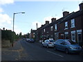
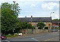
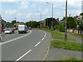
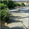
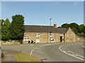

31 photos from this area
Area Information
Key information about the DE56 0NG including its size, population, and administrative classification.
- Area Type
- Postcode
- Area Size
- 64.4 hectares
- Population
- 1745
- Population Density
- 591 people/km²
House Prices in DE56 0NG
70
Properties
£177,694
Average Sold Price
£22,000
Lowest Price
£505,000
Highest Price
Showing 70 properties
| Address | Type | Beds | Baths | Last Sale Price | Last Sale Date | |
|---|---|---|---|---|---|---|
| 66 Derby Road, Lower Kilburn, Belper, DE56 0NG | Terraced | 2 | 1 | £170,000 | Oct 2025 | |
| 46 Derby Road, Lower Kilburn, Belper, DE56 0NG | Terraced | 2 | 1 | £172,500 | Aug 2025 | |
| 28 Derby Road, Lower Kilburn, Belper, DE56 0NG | Terraced | 2 | 2 | £165,000 | Mar 2025 | |
| 8 Derby Road, Lower Kilburn, Belper, DE56 0NG | Detached | 2 | 2 | £325,000 | Sep 2024 | |
| 42 Derby Road, Lower Kilburn, Belper, DE56 0NG | Terraced | 2 | 1 | £185,000 | Jul 2024 | |
| 19 Derby Road, Lower Kilburn, Belper, DE56 0NG | house | - | - | £363,755 | Mar 2023 | |
| 16 Derby Road, Lower Kilburn, Belper, DE56 0NG | Retail | 2 | 1 | £165,000 | Dec 2022 | |
| 63 Derby Road, Lower Kilburn, Belper, DE56 0NG | Detached | 3 | - | £250,000 | Oct 2022 | |
| 18 Derby Road, Lower Kilburn, Belper, DE56 0NG | Terraced | 2 | 1 | £125,000 | Jan 2022 | |
| 35 Derby Road, Lower Kilburn, Belper, DE56 0NG | house | - | - | £225,000 | Dec 2021 |
Page 1 of 7
Energy Efficiency in DE56 0NG
Amenities
Schools
| Rank | School | Type | Entry gender | Ages |
|---|
Explore more schools in this area
Go to Schools tabDemographics
Household Size
Two person
most common
Accommodation Type
Houses
most common
Tenure
81
majority
Ethnic Group
White
most common
Religion
N/A
most common
Household Composition
N/A
most common
Age
47
median
Adults (30-64 years)
most common
Household Deprivation
N/A
with no deprivation
NS-SEC
36
in Lower managerial occupations
Explore more demographic insights in this area
Go to Demographics tabPlanning
Planning Constraints
- Flood RiskPremium
- Ramsar Wetland SitesPremium
- Area of Outstanding Natural BeautyPremium
- Protected Nature ReservePremium
- Protected WoodlandPremium