Area Overview for DE56 0LL
Photos of DE56 0LL
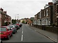
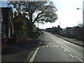
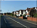
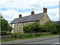
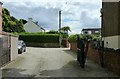
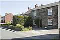

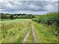
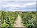
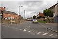
20 photos from this area
Area Information
Key information about the DE56 0LL including its size, population, and administrative classification.
- Area Type
- Postcode
- Area Size
- 32.3 hectares
- Population
- 2008
- Population Density
- 209 people/km²
House Prices in DE56 0LL
61
Properties
£139,872
Average Sold Price
£31,250
Lowest Price
£190,000
Highest Price
Showing 61 properties
| Address | Type | Beds | Baths | Last Sale Price | Last Sale Date | |
|---|---|---|---|---|---|---|
| Brickland Forge, 1 Brickyard Lane, Kilburn, Belper, DE56 0LL | Semi-detached | 3 | - | £153,108 | Jun 2017 | |
| 5A Brickyard Lane, Kilburn, Belper, DE56 0LL | Detached | 4 | - | £190,000 | Feb 2012 | |
| 1B Brickyard Lane, Kilburn, Belper, DE56 0LL | Detached | 3 | 2 | £175,000 | Apr 2007 | |
| 1A Brickyard Lane, Kilburn, Belper, DE56 0LL | house | 2 | - | £150,000 | Dec 2006 | |
| Somerby, Brickyard Lane, Kilburn, Belper, DE56 0LL | Bungalow | - | - | £31,250 | May 1997 | |
| 12 Brickyard Lane, Kilburn, Belper, DE56 0LL | Semi-detached | 2 | 1 | - | - | |
| 29 Brickyard Lane, Kilburn, Belper, DE56 0LL | Semi-detached | 3 | 1 | - | - | |
| 21 Brickyard Lane, Kilburn, Belper, DE56 0LL | Terraced | 3 | 1 | - | - | |
| 23 Brickyard Lane, Kilburn, Belper, DE56 0LL | Semi-detached | 2 | 1 | - | - | |
| Willow House, 2A Brickyard Lane, Kilburn, Belper, DE56 0LL | Detached | 4 | 1 | - | - |
Page 1 of 7
Energy Efficiency in DE56 0LL
Amenities
Schools
| Rank | School | Type | Entry gender | Ages |
|---|
Explore more schools in this area
Go to Schools tabDemographics
Household Size
Two person
most common
Accommodation Type
Houses
most common
Tenure
81
majority
Ethnic Group
White
most common
Religion
N/A
most common
Household Composition
N/A
most common
Age
47
median
Adults (30-64 years)
most common
Household Deprivation
N/A
with no deprivation
NS-SEC
36
in Lower managerial occupations
Explore more demographic insights in this area
Go to Demographics tabPlanning
Planning Constraints
- Flood RiskPremium
- Ramsar Wetland SitesPremium
- Area of Outstanding Natural BeautyPremium
- Protected Nature ReservePremium
- Protected WoodlandPremium