Area Overview for DE56 0NF
Photos of DE56 0NF
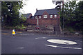
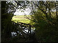
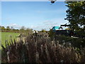

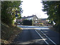

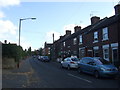
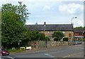
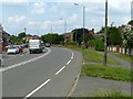
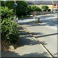
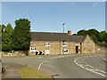

31 photos from this area
Area Information
Key information about the DE56 0NF including its size, population, and administrative classification.
- Area Type
- Postcode
- Area Size
- 14.4 hectares
- Population
- 1533
- Population Density
- 208 people/km²
House Prices in DE56 0NF
16
Properties
£206,092
Average Sold Price
£55,000
Lowest Price
£380,000
Highest Price
Showing 16 properties
| Address | Type | Beds | Baths | Last Sale Price | Last Sale Date | |
|---|---|---|---|---|---|---|
| 108 Horsley Road, Kilburn, Belper, DE56 0NF | Detached | 3 | 1 | £365,000 | Oct 2023 | |
| 51 Horsley Road, Kilburn, Belper, DE56 0NF | house | 4 | - | £380,000 | Apr 2021 | |
| 86 Horsley Road, Kilburn, Belper, DE56 0NF | Detached | 3 | 1 | £215,000 | Jun 2019 | |
| 100 Horsley Road, Kilburn, Belper, DE56 0NF | Detached | 3 | 1 | £277,500 | Jul 2018 | |
| 53 Horsley Road, Kilburn, Belper, DE56 0NF | Semi-detached | 4 | 1 | £290,000 | Feb 2018 | |
| 90 Horsley Road, Kilburn, Belper, DE56 0NF | Semi-detached | 3 | 1 | £185,000 | Jul 2017 | |
| 82 Horsley Road, Kilburn, Belper, DE56 0NF | Semi-detached | 3 | 2 | £248,750 | May 2016 | |
| 92 Horsley Road, Kilburn, Belper, DE56 0NF | Semi-detached | 3 | 1 | £155,000 | Mar 2016 | |
| 96 Horsley Road, Kilburn, Belper, DE56 0NF | Semi-detached | 2 | - | £125,000 | May 2014 | |
| 88 Horsley Road, Kilburn, Belper, DE56 0NF | Detached | - | - | £236,000 | Aug 2007 |
Page 1 of 2
Energy Efficiency in DE56 0NF
Amenities
Schools
| Rank | School | Type | Entry gender | Ages |
|---|
Explore more schools in this area
Go to Schools tabDemographics
Household Size
Two person
most common
Accommodation Type
Houses
most common
Tenure
84
majority
Ethnic Group
White
most common
Religion
N/A
most common
Household Composition
N/A
most common
Age
47
median
Adults (30-64 years)
most common
Household Deprivation
N/A
with no deprivation
NS-SEC
40
in Lower managerial occupations
Explore more demographic insights in this area
Go to Demographics tabPlanning
Planning Constraints
- Flood RiskPremium
- Ramsar Wetland SitesPremium
- Area of Outstanding Natural BeautyPremium
- Protected Nature ReservePremium
- Protected WoodlandPremium