Area Overview for DE56 0NH
Photos of DE56 0NH
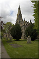
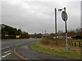
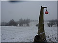
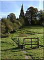
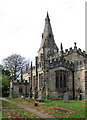
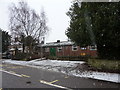

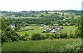
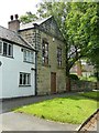
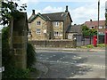

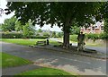
71 photos from this area
Area Information
Key information about the DE56 0NH including its size, population, and administrative classification.
- Area Type
- Postcode
- Area Size
- 32.9 hectares
- Population
- 1533
- Population Density
- 208 people/km²
House Prices in DE56 0NH
30
Properties
£222,821
Average Sold Price
£64,250
Lowest Price
£475,000
Highest Price
Showing 30 properties
| Address | Type | Beds | Baths | Last Sale Price | Last Sale Date | |
|---|---|---|---|---|---|---|
| 95 Derby Road, Lower Kilburn, Belper, DE56 0NH | Detached | 4 | 2 | £475,000 | Sep 2025 | |
| 89 Derby Road, Lower Kilburn, Belper, DE56 0NH | Bungalow | 3 | 1 | £290,000 | Oct 2022 | |
| 68 Derby Road, Lower Kilburn, Belper, DE56 0NH | Terraced | 2 | 1 | £220,000 | Nov 2020 | |
| 73 Derby Road, Lower Kilburn, Belper, DE56 0NH | Detached | 3 | 1 | £292,500 | Jul 2020 | |
| 91 Derby Road, Lower Kilburn, Belper, DE56 0NH | Bungalow | 4 | 2 | £185,000 | Dec 2016 | |
| 68A Derby Road, Lower Kilburn, Belper, DE56 0NH | Bungalow | 3 | 1 | £306,000 | Oct 2016 | |
| 83 Derby Road, Lower Kilburn, Belper, DE56 0NH | Detached | 3 | - | £140,000 | Jul 2014 | |
| 87 Derby Road, Lower Kilburn, Belper, DE56 0NH | Bungalow | - | - | £150,250 | Mar 2010 | |
| Caerlaverock Springs, 76 Derby Road, Lower Kilburn, Belper, DE56 0NH | Detached | - | - | £321,000 | Mar 2008 | |
| 85 Derby Road, Lower Kilburn, Belper, DE56 0NH | Bungalow | 3 | 2 | £175,500 | Apr 2007 |
Page 1 of 3
Energy Efficiency in DE56 0NH
Amenities
Schools
| Rank | School | Type | Entry gender | Ages |
|---|
Explore more schools in this area
Go to Schools tabDemographics
Household Size
Two person
most common
Accommodation Type
Houses
most common
Tenure
84
majority
Ethnic Group
White
most common
Religion
N/A
most common
Household Composition
N/A
most common
Age
47
median
Adults (30-64 years)
most common
Household Deprivation
N/A
with no deprivation
NS-SEC
40
in Lower managerial occupations
Explore more demographic insights in this area
Go to Demographics tabPlanning
Planning Constraints
- Flood RiskPremium
- Ramsar Wetland SitesPremium
- Area of Outstanding Natural BeautyPremium
- Protected Nature ReservePremium
- Protected WoodlandPremium