Area Overview for LL12 8NS
Photos of LL12 8NS

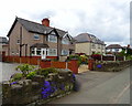
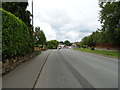
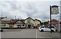
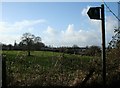
17 photos from this area
Area Information
Key information about the LL12 8NS including its size, population, and administrative classification.
- Area Type
- Postcode
- Area Size
- 1.3 hectares
- Population
- 1534
- Population Density
- 314 people/km²
House Prices in LL12 8NS
30
Properties
£171,826
Average Sold Price
£50,000
Lowest Price
£378,000
Highest Price
Showing 30 properties
| Address | Type | Beds | Baths | Last Sale Price | Last Sale Date | |
|---|---|---|---|---|---|---|
| 14 Annefield Park, Gresford, Wrexham, LL12 8NS | Bungalow | - | - | £315,000 | Jun 2024 | |
| 24 Annefield Park, Gresford, Wrexham, LL12 8NS | Terraced | 3 | 1 | £213,000 | Oct 2023 | |
| 23 Annefield Park, Gresford, Wrexham, LL12 8NS | house | - | - | £156,000 | Jul 2023 | |
| Rosewen, 20 Annefield Park, Gresford, Wrexham, LL12 8NS | Terraced | 2 | 1 | £205,000 | Nov 2022 | |
| 27 Annefield Park, Gresford, Wrexham, LL12 8NS | Bungalow | - | - | £218,000 | Sep 2022 | |
| 1 Annefield Park, Gresford, Wrexham, LL12 8NS | Bungalow | - | - | £378,000 | Nov 2021 | |
| 4 Annefield Park, Gresford, Wrexham, LL12 8NS | Bungalow | - | - | £252,000 | Nov 2020 | |
| 10 Annefield Park, Gresford, Wrexham, LL12 8NS | Bungalow | - | - | £250,000 | Mar 2020 | |
| 2 Annefield Park, Gresford, Wrexham, LL12 8NS | Semi-detached | 3 | - | £170,000 | Jan 2019 | |
| 11 Annefield Park, Gresford, Wrexham, LL12 8NS | Bungalow | 2 | 1 | £237,500 | Dec 2018 |
Page 1 of 3
Energy Efficiency in LL12 8NS
Amenities
Schools
| Rank | School | Type | Entry gender | Ages |
|---|
Explore more schools in this area
Go to Schools tabDemographics
Household Size
Two person
most common
Accommodation Type
Houses
most common
Tenure
80
majority
Ethnic Group
White
most common
Religion
N/A
most common
Household Composition
N/A
most common
Age
47
median
Adults (30-64 years)
most common
Household Deprivation
N/A
with no deprivation
NS-SEC
39
in Lower managerial occupations
Explore more demographic insights in this area
Go to Demographics tabPlanning
Planning Constraints
- Flood RiskPremium
- Ramsar Wetland SitesPremium
- Area of Outstanding Natural BeautyPremium
- Protected Nature ReservePremium
- Protected WoodlandPremium
- Crime RiskPremium