Area Overview for LL12 8NN
Photos of LL12 8NN
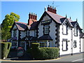
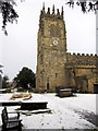
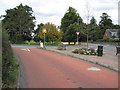
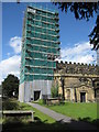
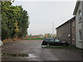
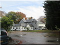
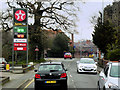
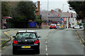
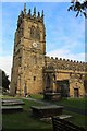
45 photos from this area
Area Information
Key information about the LL12 8NN including its size, population, and administrative classification.
- Area Type
- Postcode
- Area Size
- 1.5 hectares
- Population
- 1260
- Population Density
- 1171 people/km²
House Prices in LL12 8NN
42
Properties
£105,850
Average Sold Price
£42,000
Lowest Price
£210,000
Highest Price
Showing 42 properties
| Address | Type | Beds | Baths | Last Sale Price | Last Sale Date | |
|---|---|---|---|---|---|---|
| 40 Newtown, Gresford, Wrexham, LL12 8NN | house | - | - | £150,000 | Aug 2023 | |
| 51 Newtown, Gresford, Wrexham, LL12 8NN | Semi-detached | 4 | - | £210,000 | Mar 2022 | |
| 53A Newtown, Gresford, Wrexham, LL12 8NN | Maisonette | - | - | £124,000 | Sep 2019 | |
| 38 Newtown, Gresford, Wrexham, LL12 8NN | house | - | - | £143,000 | May 2018 | |
| 70 Newtown, Gresford, Wrexham, LL12 8NN | Semi-detached | 3 | 1 | £59,500 | Dec 2014 | |
| 69 Newtown, Gresford, Wrexham, LL12 8NN | house | - | - | £60,000 | Jun 2010 | |
| 49 Newtown, Gresford, Wrexham, LL12 8NN | house | - | - | £125,000 | Sep 2009 | |
| 75 Newtown, Gresford, Wrexham, LL12 8NN | house | - | - | £85,000 | May 2005 | |
| 76 Newtown, Gresford, Wrexham, LL12 8NN | Semi-detached | - | - | £60,000 | May 1999 | |
| 39 Newtown, Gresford, Wrexham, LL12 8NN | house | 2 | - | £42,000 | Feb 1998 |
Page 1 of 5
Energy Efficiency in LL12 8NN
Amenities
Schools
| Rank | School | Type | Entry gender | Ages |
|---|
Explore more schools in this area
Go to Schools tabDemographics
Household Size
Two person
most common
Accommodation Type
Houses
most common
Tenure
79
majority
Ethnic Group
White
most common
Religion
N/A
most common
Household Composition
N/A
most common
Age
47
median
Adults (30-64 years)
most common
Household Deprivation
N/A
with no deprivation
NS-SEC
38
in Lower managerial occupations
Explore more demographic insights in this area
Go to Demographics tabPlanning
Planning Constraints
- Flood RiskPremium
- Ramsar Wetland SitesPremium
- Area of Outstanding Natural BeautyPremium
- Protected Nature ReservePremium
- Protected WoodlandPremium
- Crime RiskPremium