Area Overview for LL11 2BW
Photos of LL11 2BW
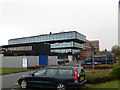
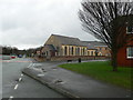
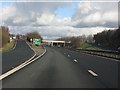
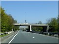
58 photos from this area
Area Information
Key information about the LL11 2BW including its size, population, and administrative classification.
- Area Type
- Postcode
- Area Size
- 2.8 hectares
- Population
- 1524
- Population Density
- 1766 people/km²
House Prices in LL11 2BW
13
Properties
£100,000
Average Sold Price
£95,000
Lowest Price
£105,000
Highest Price
Showing 13 properties
| Address | Type | Beds | Baths | Last Sale Price | Last Sale Date | |
|---|---|---|---|---|---|---|
| Cae Mynydd, Plas Coch Road, Wrexham, LL11 2BW | house | - | - | £105,000 | Mar 2005 | |
| Imperia, Plas Coch Road, Wrexham, LL11 2BW | house | - | - | £95,000 | May 2000 | |
| Plas Coch Hall Of Residence, Plas Coch Road, Wrexham, LL11 2BW | commercial | - | - | - | - | |
| The Flat, Dean Villa, Plas Coch Road, Wrexham, LL11 2BW | Flat | - | - | - | - | |
| Managers Accommodation, The Plas Coch, Plas Coch Retail Park, Plas Coch, Wrexham, LL11 2BW | Flat | - | - | - | - | |
| Tennis 52M From Wrexham Tennis Centre Ltd, Plas Coch Road 16M From Unnamed Road, Lodge Road, Wrexham, LL11 2BW | Leisure | - | - | - | - | |
| Tennis 59M From Wrexham Tennis Centre Ltd, Plas Coch Road 16M From Unnamed Road, Fleming Drive, Wrexham, LL11 2BW | Leisure | - | - | - | - | |
| 2, Orchard Cottages, Plas Coch Road, Wrexham, LL11 2BW | Semi-detached | - | - | - | - | |
| Magnolias, Plas Coch Road, Wrexham, LL11 2BW | Detached | - | - | - | - | |
| Dean Villa, Plas Coch Road, Wrexham, LL11 2BW | Semi-detached | - | - | - | - |
Page 1 of 2
Energy Efficiency in LL11 2BW
Amenities
Schools
| Rank | School | Type | Entry gender | Ages |
|---|
Explore more schools in this area
Go to Schools tabDemographics
Household Size
One person
most common
Accommodation Type
Flats
most common
Tenure
31
majority
Ethnic Group
White
most common
Religion
N/A
most common
Household Composition
N/A
most common
Age
47
median
Adults (30-64 years)
most common
Household Deprivation
N/A
with no deprivation
NS-SEC
23
in Lower managerial occupations
Explore more demographic insights in this area
Go to Demographics tabPlanning
Planning Constraints
- Flood RiskPremium
- Ramsar Wetland SitesPremium
- Area of Outstanding Natural BeautyPremium
- Protected Nature ReservePremium
- Protected WoodlandPremium
- Crime RiskPremium