Area Overview for NP19 7GJ
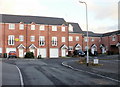
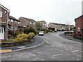
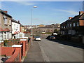
Photos of NP19 7GJ


Area Information
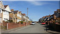
Living in NP19 7GJ means residing in a compact residential cluster defined by a specific postcode in Wales. This small area covers just 1.2 hectares, creating a concentrated neighbourhood where daily life moves quickly. The population stands at 1,108 people, resulting in a high population density of 95,029 people per square kilometre. Such density suggests a tightly knit community where residents are likely to know their neighbours well. Despite the limited physical space, the layout accommodates a stable resident base. You will find yourself in a setting that prioritises residential comfort over sprawl. The proximity of homes suggests a quiet, local focus rather than a commuter-dependent lifestyle. This area represents a distinct pocket within the wider region, offering privacy within a walkable footprint. Understanding the scale of NP19 7GJ helps you appreciate the intimacy of living here. It is a place where the immediate surroundings define your life, not distant city centres.
- Area Type
- Postcode
- Area Size
- 1.2 hectares
- Population
- 1108
- Population Density
- 3343 people/km²
The housing market in NP19 7GJ is characterised by exclusive ownership and traditional housing styles. An impressive 84% of properties are owner-occupied, creating a market dominated by long-term residents rather than tenant turnover. All accommodation in this postcode area consists of houses, meaning you will not find any flats or terraced apartments. This homogeneity suggests buyers are looking for standalone family homes or bungalows suitable for ageing in place. The small area size of 1.2 hectares limits inventory, making each property sale a significant event for the local estate market. High ownership rates typically correlate with formal neighbourhood investment and maintenance standards. When buying homes in NP19 7GJ, you are entering a market defined by stability and continuity. The lack of social housing or private rental stock means competition for purchases is the primary driver of transactions. Sellers in this area often know their community well and may negotiate based on local knowledge rather than national trends. You should prepare for a quiet, predictable market free from the volatility of student housing or short-term lets. The accommodation type ensures that every buyer finds a house to suit their specific needs.
House Prices in NP19 7GJ
Showing 23 properties
| Address | Type | Beds | Baths | Last Sale Price | Last Sale Date | |
|---|---|---|---|---|---|---|
| 6 St Julians Road, Newport, NP19 7GJ | Semi-detached | 4 | 1 | £313,000 | Aug 2022 | |
| 23 St Julians Road, Newport, NP19 7GJ | house | - | - | £330,000 | Sep 2021 | |
| 18 St Julians Road, Newport, NP19 7GJ | Detached | 3 | 1 | £289,000 | Dec 2020 | |
| 11 St Julians Road, Newport, NP19 7GJ | Semi-detached | 3 | 1 | £180,000 | Mar 2019 | |
| 19 St Julians Road, Newport, NP19 7GJ | Semi-detached | 5 | 1 | £350,000 | Feb 2019 | |
| 7 St Julians Road, Newport, NP19 7GJ | house | - | - | £166,000 | Dec 2017 | |
| 17 St Julians Road, Newport, NP19 7GJ | house | - | - | £230,000 | Jun 2017 | |
| 21 St Julians Road, Newport, NP19 7GJ | Semi-detached | 4 | 1 | £254,000 | Aug 2016 | |
| 1 St Julians Road, Newport, NP19 7GJ | house | - | - | £172,000 | Jul 2014 | |
| 10 St Julians Road, Newport, NP19 7GJ | house | - | - | £155,000 | Apr 2004 |
Energy Efficiency in NP19 7GJ
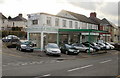
Residents of NP19 7GJ enjoy practical access to a variety of retail and transport hubs within practical reach. Five retail options are available nearby, including specific venues like Spar, Tesco Caerleon, and Asda Casnewydd. These supermarkets provide your weekly groceries and household essentials without the need to travel far. Five railway connections link the area to the wider network, with Newport Railway Station, Pye Corner Railway Station, and Rogerstone Railway Station serving as key interchange points. The Newport Ferry Terminal offers one additional ferry option, connecting to destinations across the river. This blend of rail and water transport ensures you have multiple routes to leave the immediate area. Daily life in NP19 7GJ balances local convenience with regional accessibility. You can shop at Spar while having major supermarkets like Asda and Tesco just a short drive away. The proximity to Newport Railway Station means major city centres are within commuting distance. All these amenities sit within a manageable range for the local population. Life here combines the quiet of a small cluster with the utility of major transport links.
Amenities
Schools
Families living in NP19 7GJ have access to local educational institutions, though higher education is the primary school option listed. St Julian's School is the nearest school to this postcode area. The data categorises this institution as 'other', indicating it is not a primary or secondary school for the standard age groups. This classification aligns with the area's mature demographic where children are less prevalent. If you are looking for schools near NP19 7GJ for younger children, the immediate vicinity offers no primary or secondary colleges in the provided dataset. St Julian's School likely serves a different age bracket, perhaps further education or specialized training. For parents with pre-university-aged children, this area presents a gap in local schooling options within the immediate cluster. You may need to look for education facilities in neighbouring towns to access full school-age provisions. The presence of just one listed school reinforces the residential nature of this specific 1.2-hectare zone. Families often rely on broader community networks for educational needs or commute to nearby larger towns.
| Rank | School | Type | Entry gender | Ages |
|---|
Explore more schools in this area
Go to Schools tabDemographics
The community in NP19 7GJ reflects a mature demographic profile centred on established residents. The median age is 47 years, with most common age ranges falling between 30 and 64 years. This skew indicates an area populated by working families and professionals nearing retirement. Home ownership levels are exceptionally high at 84%, meaning the vast majority of residents own their property outright or with a mortgage. Most homes in NP19 7GJ are houses rather than flats, catering to families seeking space. The predominant ethnic group is White, reflecting the traditional makeup of the Welsh rural and suburban landscape. There are no recorded mixed ownership or rental-only households within the provided figures. This established ownership base means property values tend to remain stable compared to high-turnover rental zones. You can expect a settled environment where long-term roots run deep. The low percentage of younger residents under 30 suggests fewer single-person households. Instead, you will encounter bustling family life or semi-retirement periods. The demographic data confirms a neighbourhood built for stability and permanence.
Household Size
Accommodation Type
Tenure
Ethnic Group
Religion
Household Composition
Age
Household Deprivation
NS-SEC
Explore more demographic insights in this area
Go to Demographics tabPlanning
Planning Constraints
- Flood RiskPremium
- Ramsar Wetland SitesPremium
- Area of Outstanding Natural BeautyPremium
- Protected Nature ReservePremium
- Protected WoodlandPremium
- Crime RiskPremium