Area Overview for NP19 7GG
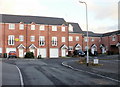
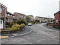
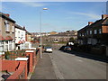
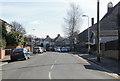
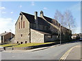
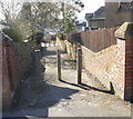
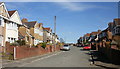
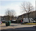
Photos of NP19 7GG


Area Information
NP19 7GG occupies a specific residential cluster in Newports, Wales. This postcode covers a tiny geographical footprint of just 8466 square metres. Despite its small size, the area is home to 1289 residents. This results in an extremely high population density of 152259 people per square kilometre. Living in NP19 7GG means experiencing a tight-knit urban environment where neighbours are close by. The site description confirms this is a small residential cluster rather than a sprawling suburb. You will find little open space between properties given the sheer density. Daily life here revolves around the immediate building blocks and street-level community. There is no room for large gardens or expansive grounds within the boundary. The location prioritises proximity to town centres over spaciousness. It is a place where footpaths and local roads define the daily routine. The compact nature of the postcode makes it exceptionally convenient for quick trips to local amenities. You do not need a car for many short errands in such a dense setting. However, the lack of physical space is a defining characteristic of the area. The high number of people packed into less than a hectare creates a unique living rhythm. This is an urban microcosm within the wider Newport landscape.
- Area Type
- Postcode
- Area Size
- 8466 m²
- Population
- 1289
- Population Density
- 9341 people/km²
Homes in NP19 7GG are predominantly houses rather than flats or apartments. This architectural style suits the high ownership rate observed in the area. The figure shows that 70% of people here own their homes free or mortgage-less. This suggests a property market driven by owner-occupiers rather than landlords. You will find a stock of residential houses that likely have individual gardens or driveways. The low area size of 8466 square metres limits the scope for large estates or suburban sprawl. The market here is characterised by compact living solutions within a dense cluster. When looking at homes in this postcode, expect properties designed for efficient use of space. The high concentration of owner-occupied houses means transactions often depend on private sales between individuals. This market segment can be less volatile than rental-heavy neighbourhoods. Local buyers know the specific streets and properties well. The prevalence of houses over flats creates a distinct feel from newer city centre developments. If you are searching for a single-family home in a small footprint, this area fits the criteria. The lack of rental data in the profile reinforces the dominance of the private market. Homebuyers here value established titles over new builds.
House Prices in NP19 7GG
Showing 36 properties
| Address | Type | Beds | Baths | Last Sale Price | Last Sale Date | |
|---|---|---|---|---|---|---|
| 10 Richmond Road, Newport, NP19 7GG | Terraced | 4 | 2 | £282,000 | May 2025 | |
| 14 Richmond Road, Newport, NP19 7GG | Terraced | 3 | 1 | £238,900 | Sep 2024 | |
| 4 Richmond Road, Newport, NP19 7GG | house | - | - | £122,500 | Jan 2023 | |
| 5 Richmond Road, Newport, NP19 7GG | Flat | - | - | £162,500 | Aug 2022 | |
| 27 Richmond Road, Newport, NP19 7GG | house | - | - | £202,000 | Dec 2019 | |
| 32 Richmond Road, Newport, NP19 7GG | Terraced | 3 | 1 | £220,000 | Oct 2019 | |
| 22 Richmond Road, Newport, NP19 7GG | Terraced | 4 | 1 | £228,000 | Jul 2019 | |
| 30 Richmond Road, Newport, NP19 7GG | Terraced | 3 | 2 | £162,000 | Jun 2018 | |
| 17 Richmond Road, Newport, NP19 7GG | Terraced | 4 | - | £198,000 | Feb 2018 | |
| 25 Richmond Road, Newport, NP19 7GG | house | - | - | £140,000 | Mar 2016 |
Energy Efficiency in NP19 7GG
Life in NP19 7GG brings major retail and transport hubs within practical reach. Residents have five retail options nearby, including Spar, Tesco Caerleon, and Asda Casnewydd. These supermarkets offer everything from groceries to general household needs. You can fill your shopping weekly plans without travelling far. There are also five rail stations accessible, such as Newport Railway Station, Pye Corner Railway Station, and Rogerstone Railway Station. Regular commuter trains connect you to the wider region. Additionally, one ferry terminal, Newport Ferry Terminal, provides services across the water. This mix of shops and transport links supports a self-sufficient lifestyle. Daily errands take minutes rather than hours. The presence of Asda and Tesco indicates large-scale supermarkets are available for bulk buying. Spar adds convenience for quick morning purchases. Rail connectivity means employment opportunities are not limited to the local cluster. The ferry option offers recreational travel or alternative transport routes. Living here provides a balance of large retail shopping and local convenience stores. You do not need a car for essential weekly shop or a train ticket. The proximity to these named venues defines the convenience factor of the area. The combination of supermarkets and railway stations creates a robust community infrastructure.
Amenities
Schools
Families in NP19 7GG have access to specific educational institutions nearby. The closest options include Durham Road Junior School and Durham Road Infant School. These schools fall under the category of other types within the local education system. The presence of both infant and junior designations indicates a site that serves young children through early secondary education. You will not find sixth-form colleges or comprehensive high schools listed on the data for this immediate vicinity. The proximity of these two specific schools offers convenient access for parents in the postcode. Children in the 30-64 year old demographic often bring young children into this household mix. The availability of these named schools supports the family-oriented nature of the community. While the data does not specify Ofsted ratings, the sheer presence of dedicated buildings suggests a functional local network. Prospective parents must look beyond this immediate cluster for comprehensive education. The schools listed represent the primary educational intake point for residents. Durham Road Infant School handles younger students before they transfer. Durham Road Junior School takes over the next stage of the curriculum. This localised education provision is a key factor for those choosing homes near these facilities. The convenience of having these institutions immediately accessible is a practical benefit for daily commuting to lessons.
| Rank | School | Type | Entry gender | Ages |
|---|
Explore more schools in this area
Go to Schools tabDemographics
The community in NP19 7GG is largely defined by a mature demographic profile. The median age for residents is 47 years old. The most common age range consists of adults between 30 and 64 years. This suggests a population of working families or established professionals rather than students or young singles. A significant majority of people here own their own homes at a rate of 70%. This indicates a stable neighbourhood where residents have long-term roots. The predominant ethnic group in this area identifies as White. The accommodation type is overwhelmingly houses, which aligns with the high home ownership rate. You are less likely to find purpose-built flats or portfolio investments here compared to other city zones. The data paints a picture of owners who have settled in their properties. There is a strong sense of permanence among the population. The age profile suggests a community looking towards retirement or late-stage career planning. With nearly three-quarters of households being owner-occupied, resale markets are driven by individual needs rather than large developer portfolios. The demographic makeup reflects a traditional, established residential zone within the borough. Staying in this area appeals to those seeking stability over transient living arrangements.
Household Size
Accommodation Type
Tenure
Ethnic Group
Religion
Household Composition
Age
Household Deprivation
NS-SEC
Explore more demographic insights in this area
Go to Demographics tabPlanning
Planning Constraints
- Flood RiskPremium
- Ramsar Wetland SitesPremium
- Area of Outstanding Natural BeautyPremium
- Protected Nature ReservePremium
- Protected WoodlandPremium
- Crime RiskPremium