Area Overview for NP19 7DU
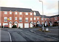
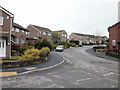
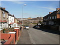
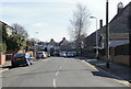
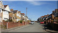
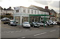
Photos of NP19 7DU


Area Information
Living in NP19 7DU offers a specific residential experience defined by its compact geography and established community. This postcode area covers exactly 7737 square metres, hosting a population of 1580 people. Such a small footprint creates a tight-knit environment where neighbours are often known by name, distinguishing it from the sprawling suburbs found further afield in Wales. The area functions as a focused residential cluster rather than a broad district, concentrating several hundred households within a very limited physical space. For those seeking a peaceful setting close to major services without the density of a city centre, this location provides that balance. The character of NP19 7DU is rooted in its proximity to key transport links and commercial hubs. Residents enjoy practical access to Newport Railway Station, Pye Corner Railway Station, and Rogerstone Railway Station, alongside retail options like Spar, Tesca Caerleon, and Asda Casnewydd. A Newport Ferry Terminal lies within practical reach, offering alternative travel methods. The area's distinctiveness stems from its manageable scale; you receive the convenience of nearby amenities without the noise and congestion of larger urban zones. You live in a place where the walk to a shop or the journey to a train station remains a local, everyday reality rather than a distant commute.
- Area Type
- Postcode
- Area Size
- 7737 m²
- Population
- 1580
- Population Density
- 10064 people/km²
The property market in NP19 7DU is defined by a legacy of home ownership rather than a transient rental sector. With 64% of the population owning their homes, this postcode represents a deeply established residential zone. The housing stock consists primarily of houses, reflecting the area's development as a place for families to settle rather than a hub for student accommodation or private rentals. This high ownership rate suggests that the properties here have been maintained by owners for significant periods, contributing to their character and condition. When you look at homes in NP19 7DU, you are entering a market where sellers often have a strong emotional and financial connection to their properties. This is not an area dominated by buy-to-let investors turning over tenants frequently. Instead, the mix is stable, with houses serving established households. The small size of the area, covering just 7737 square metres, means the total number of available properties is limited. Competition for specific homes in this cluster can be intense because the selection pool is small. You are buying into a specific cluster of residences rather than a broad marketplace found across a larger town or city.
House Prices in NP19 7DU
Showing 43 properties
| Address | Type | Beds | Baths | Last Sale Price | Last Sale Date | |
|---|---|---|---|---|---|---|
| 2 Durham Road, Newport, NP19 7DU | house | - | - | £175,000 | Sep 2024 | |
| 4 Durham Road, Newport, NP19 7DU | Terraced | 3 | 1 | £180,000 | Jun 2024 | |
| 28 Durham Road, Newport, NP19 7DU | Terraced | 3 | 1 | £187,500 | May 2024 | |
| 24 Durham Road, Newport, NP19 7DU | Terraced | 2 | 1 | £160,000 | Feb 2023 | |
| 15 Durham Road, Newport, NP19 7DU | Terraced | 2 | 1 | £152,000 | May 2022 | |
| 31 Durham Road, Newport, NP19 7DU | house | 4 | 1 | £135,000 | Dec 2021 | |
| 11 Durham Road, Newport, NP19 7DU | Terraced | - | - | £130,000 | Jun 2021 | |
| 10 Durham Road, Newport, NP19 7DU | Terraced | 2 | 1 | £155,000 | Jul 2019 | |
| 36 Durham Road, Newport, NP19 7DU | Detached | 3 | 1 | £121,000 | Feb 2019 | |
| 26 Durham Road, Newport, NP19 7DU | Terraced | 3 | 1 | £123,500 | Oct 2017 |
Energy Efficiency in NP19 7DU
Daily life in NP19 7DU is characterised by convenience and access to major retail and transport arteries. Within walking distance or short drive, you will find five sources of retail therapy, including Spar, Tesco Caerleon, and Asda Casnewydd. These stores provide essentials from groceries to general goods without the need for a lengthy journey outside the region. For commuters, the area is functionally integrated with the wider transport network, serving as a convenient residential stop near Newport Railway Station, Pye Corner Railway Station, and Rogerstone Railway Station. You can reach the Newport Ferry Terminal easily, offering another mode of transport for those needing it. The lifestyle here balances suburban comfort with urban accessibility. You enjoy the quiet of a residential cluster while remaining minutes away from the bustling shops of Caerleon and the larger offerings of Casnewydd. This proximity means you do not have to sacrifice local convenience for the sake of a peaceful home. The area functions as a practical hub where daily errands and weekly shopping coexist with easy access to wider travel networks, ensuring you remain well connected to the region.
Amenities
Schools
For families considering living in NP19 7DU, access to early years education is your primary option within the immediate vicinity. The nearest listed institution is Rockfield Nursery School, which serves as an 'other' type of nursery provision. This facility supports the childcare needs of young children in the neighbourhood. The absence of data on specific primary or secondary schools within the immediate postcode boundary means that older children often rely on institutions slightly further away or transport links to reach larger educational hubs. The presence of Rockfield Nursery School indicates a supportive foundation for families with infants and toddlers. While comprehensive data on Ofsted ratings is not included in the current information for this specific postcode, the availability of a nursery suggests local investment in early childhood development. Parents in NP19 7DU may find that the nearest larger schools for primary education are located in adjacent towns, requiring a short commute. The school landscape is therefore focused on early years care, with the broader education network accessed through the local transport links available at Newport Railway Station or Rogerstone Railway Station.
| Rank | School | Type | Entry gender | Ages |
|---|
Explore more schools in this area
Go to Schools tabDemographics
The community in NP19 7DU consists of predominantly White residents, with a median age of 47 years. The most common age range for locals falls between 30 and 64 years, indicating a population dominated by adults in their early middle age. This demographic profile suggests a neighbourhood comprised largely of established families, empty nesters, and working professionals rather than young students or retirees. Home ownership stands at a significant 64% of the population, meaning the vast majority of people in this postcode own their homes outright or have significant equity. Accommodation within NP19 7DU consists primarily of houses, aligning with the demographic trend of householders who have settled in the area. There are no records of specific data on deprivation levels for this specific postcode, so any claims about local economic challenges remain unverified by current statistics. The high rate of home ownership combined with the age profile paints a picture of stability. You will find a community where long-term residents form the core of the social fabric. This stability is evident in the high percentage of families who have put down roots, creating an environment suited to those seeking permanence rather than transient living arrangements.
Household Size
Accommodation Type
Tenure
Ethnic Group
Religion
Household Composition
Age
Household Deprivation
NS-SEC
Explore more demographic insights in this area
Go to Demographics tabPlanning
Planning Constraints
- Flood RiskPremium
- Ramsar Wetland SitesPremium
- Area of Outstanding Natural BeautyPremium
- Protected Nature ReservePremium
- Protected WoodlandPremium
- Crime RiskPremium