Area Overview for NP19 7FW
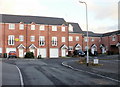
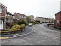
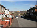
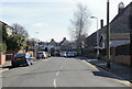
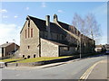
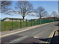
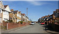
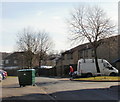
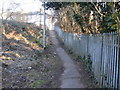
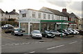
Photos of NP19 7FW

Area Information
Living in NP19 7FW means residing within a very specific residential cluster in Wales. This postcode covers a tiny geographical footprint of just 2499 m². You will find a tightly knit group of 1580 residents occupying this small space. The population density is exceptionally high at 632,285 people per km². Despite the compact nature of the area, daily life involves access to significant regional infrastructure. Major transport hubs and retail facilities lie just outside these immediate boundaries. The character of NP19 7FW is defined by its exclusivity as a defined postcode rather than a broad neighbourhood. Homebuyers looking at homes in this area are entering a market characterised by precise location constraints. You are securing a position within a minute-sized section of a larger town. This distinction matters when considering resale value or planning applications. The environment offers stability, yet the sheer density suggests a vibrant, enclosed community atmosphere.
- Area Type
- Postcode
- Area Size
- 2499 m²
- Population
- 1580
- Population Density
- 10064 people/km²
The housing stock in NP19 7FW is overwhelmingly dominated by houses. This architectural preference distinguishes the area from parts of the UK where flats or terraced properties are more common. Currently, 64% of homes in this postcode are owner-occupied. This figure signals a robust local economy where residents have achieved mortgage status. A majority of buyers in NP19 7FW are purchasing for a home rather than renting temporarily. The small area size reinforces the idea that property here is scarce and specific. You cannot find large estates or sprawling developments within these exact 2499 m² boundaries. Inventory remains constant as owners rarely sell en masse. This stability often protects residents from rapid price fluctuations typical of volatile rental markets. Buyers seeking a house in this location enjoy a community built on permanence. The market operates as a slice of the broader Caerleon real estate landscape. Ownership here means sharing the space with people invested in the long term. This environment suits those looking to downsize permanently or raise families without the hassle of short-term leases.
House Prices in NP19 7FW
Showing 15 properties
| Address | Type | Beds | Baths | Last Sale Price | Last Sale Date | |
|---|---|---|---|---|---|---|
| 151A Caerleon Road, Newport, NP19 7FW | Flat | - | - | £136,050 | May 2019 | |
| 155A Caerleon Road, Newport, NP19 7FW | Flat | - | - | - | - | |
| Flat 2, 139 Caerleon Road, Newport, NP19 7FW | Flat | - | - | - | - | |
| First Floor Flat, 153 Caerleon Road, Newport, NP19 7FW | Flat | - | - | - | - | |
| Flat 2, 157-159 Caerleon Road, Newport, NP19 7FW | Flat | - | - | - | - | |
| Flat 2, 137 Caerleon Road, Newport, NP19 7FW | Flat | 1 | - | - | - | |
| Flat 1, 157-159 Caerleon Road, Newport, NP19 7FW | Flat | - | - | - | - | |
| 147B Caerleon Road, Newport, NP19 7FW | Flat | 1 | - | - | - | |
| Flat Above, 149 Caerleon Road, Newport, NP19 7FW | Flat | - | - | - | - | |
| Flat Above, 157 Caerleon Road, Newport, NP19 7FW | Flat | - | - | - | - |
Energy Efficiency in NP19 7FW
Daily life in NP19 7FW extends quickly to a range of practical amenities. Within reach, you find five retail outlets including Spar, Tesco Caerleon, and Asda Casnewydd. These venues cover groceries and everyday shopping needs efficiently. Five railway access points lie nearby, specifically Newport Railway Station, Pye Corner Railway Station, and Rogerstone Railway Station. This rail connectivity offers flexibility for commuters travelling into Cardiff or other regional hubs. A single ferry terminal at Newport Ferry Terminal provides water transport options if required. This diversity of transport modes supports both regular commuting and occasional leisure travel. You do not need to venture far for essential goods or transit links. The proximity to major supermarkets like Tesco and Asda ensures food shopping takes minimal effort. Rail stations provide quick links to business districts and cultural centres. This balance of retail convenience and transport Links defines the practical side of living in NP19 7FW.
Amenities
Schools
Education options for residents of NP19 7FW include Rockfield Nursery School. This facility serves as the nearest school listed for the area. Rockfield operates as an "other" type of institution, likely catering to very young children or specific educational needs. For older children, you would need to look beyond the immediate 2499 m² boundaries to the wider Caerleon area. Living in NP19 7FW means relying on nursery provision locally while accessing further education facilities slightly further away. The presence of a nursery suggests families with young children reside nearby. This facility supports early development before children transition to primary care. The limited school listing indicates a need for parents to plan slightly outside the immediate cluster for comprehensive schooling. However, Rockfield provides essential childcare services within practical reach. The singlelisted school offering is a solitary fact within the educational dataset for this specific code. Families must therefore verify transport links to external primary schools if Rockfield does not meet your specific requirements. The mix remains focused on early years provision for this micro-area.
| Rank | School | Type | Entry gender | Ages |
|---|
Explore more schools in this area
Go to Schools tabDemographics
The community in NP19 7FW reflects a settled, mature population pattern. The median age sits at 47 years, placing the demographic squarely within the adult bracket of 30 to 64 years. This profile indicates a neighbourhood dominated by families and established professionals rather than students or young singles. Home ownership stands at a substantial 64%, suggesting a stable residential base with a high rate of existing equity. Most households live in houses, which aligns with the area's established character. The predominant ethnic group identifies as White, reflecting the traditional composition of many Welsh residential zones. With such a high ownership rate, tenants form a minority within this cluster. This demographic structure points to a community focused on stability and long-term settlement. Residents likely prioritise schools and quiet streets over high-energy nightlife. The age range and ownership levels create an environment where neighbours know each other well. This consistency benefits those seeking a predictable living environment in NP19 7FW.
Household Size
Accommodation Type
Tenure
Ethnic Group
Religion
Household Composition
Age
Household Deprivation
NS-SEC
Explore more demographic insights in this area
Go to Demographics tabPlanning
Planning Constraints
- Flood RiskPremium
- Ramsar Wetland SitesPremium
- Area of Outstanding Natural BeautyPremium
- Protected Nature ReservePremium
- Protected WoodlandPremium
- Crime RiskPremium