Area Overview for NP19 7DT
Photos of NP19 7DT


Area Information
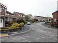
Living in NP19 7DT means residing in a specific postcode area on the edge of Newport that covers a small residential cluster. This locality occupies 2,490 square metres of land and houses a population of 1,580 individuals. The community sits at the heart of the South Wales valley, offering a setting where proximity to urban amenities meets the intimacy of a smaller residential node. Residents here enjoy a density of 634,504 people per square kilometre within this defined boundary, which reflects a concentrated living environment typical of established Welsh suburbs. The character of NP19 7DT is defined by its immediate integration into the wider Newport landscape, providing easy access to transport links and local services without the sprawl associated with larger urban zones. You will find that daily life revolves around practicality and established neighbourhood connections. The area serves as a quiet enclave for families and professionals, sitting just moments away from major rail hubs and city-centre facilities. For those seeking a home in this postcode, the location provides a balanced backdrop where large estates and local shops are within a short journey.
- Area Type
- Postcode
- Area Size
- 2490 m²
- Population
- 1580
- Population Density
- 10064 people/km²
The housing stock in NP19 7DT is characterised by a clear predominance of houses rather than flats or apartments. This accommodation type aligns perfectly with the age profile, where larger dwellings suit families or downsizers better than high-rise living. A detailed 64% home ownership rate confirms that this is primarily an owner-occupied neighbourhood, distinct from areas where rental yield drives the market. Buyers looking at homes in NP19 7DT will find a stock designed for permanent residence, avoiding the transient nature often found in rental-heavy zones. The lack of flat listings implies that the local infrastructure and neighbouring streets cater to ground-level living at street height. For sellers, the area offers stability, as owners are less likely to vacate quickly, maintaining local stability. Potential buyers in this postcode can expect standard residential properties rather than the management complexities sometimes associated with multi-unit developments. The concentration of houses supports a quiet street lifestyle, with residents often investing in their exteriors and gardens rather than shared building costs.
House Prices in NP19 7DT
Showing 12 properties
| Address | Type | Beds | Baths | Last Sale Price | Last Sale Date | |
|---|---|---|---|---|---|---|
| 10 York Road, Newport, NP19 7DT | Terraced | 3 | 1 | £195,000 | Feb 2024 | |
| 7 York Road, Newport, NP19 7DT | Terraced | 2 | 1 | £172,000 | Sep 2021 | |
| 4 York Road, Newport, NP19 7DT | house | - | - | £116,000 | Mar 2018 | |
| 8 York Road, Newport, NP19 7DT | house | - | - | £94,000 | Nov 2012 | |
| 3 York Road, Newport, NP19 7DT | Terraced | - | - | £107,950 | Apr 2004 | |
| 2 York Road, Newport, NP19 7DT | Terraced | - | - | £42,000 | Sep 1999 | |
| 16 York Road, Newport, NP19 7DT | Terraced | - | - | £22,000 | May 1998 | |
| 12 York Road, Newport, NP19 7DT | Terraced | 3 | 1 | - | - | |
| 6 York Road, Newport, NP19 7DT | Terraced | - | - | - | - | |
| 14 York Road, Newport, NP19 7DT | Terraced | - | - | - | - |
Energy Efficiency in NP19 7DT
Residents of NP19 7DT have immediate access to a mix of retail outlets and transport hubs that define their daily convenience. Within practical reach are five key retail locations, including Spar, Tesco Caerleon, and Asda Casnewydd, ensuring you can purchase groceries and essentials without a long trek. These specific venues provide a comprehensive shopping route for weekly essentials and household needs. Transport links are equally strong, with five rail stations nearby including Newport Railway Station, Pye Corner Railway Station, and Rogerstone Railway Station. Newport Railway Station offers direct links across the country, while Pye Corner and Rogerstone provide local connectivity. Additionally, one ferry terminal, Newport Ferry Terminal, operates within easy reach, adding coastal linkages to your travel options. This combination of shops and stations means your commute or shopping trip starts no more than five stops away. You can walk to a train or a supermarket without needing a dedicated journey plan.
Amenities
Schools
| Rank | School | Type | Entry gender | Ages |
|---|
Explore more schools in this area
Go to Schools tabDemographics
The community profile of NP19 7DT reflects a mature household structure dominated by adults between 30 and 64 years of age. The median age for residents is 47, indicating a population that has likely settled in the area for a significant duration rather than being transient. Home ownership stands at 64%, which suggests a stable resident base with long-term investment in properties rather than short-term tenancy arrangements. The predominant ethnic group is White, aligning with established demographic patterns for South Wales suburbs. Families and empty nesters form the core of this demographic, as the age range alongside high ownership rates implies households that value stability and local schools. About two-thirds of residents own their accommodation, which typically correlates with lower tenancy turnover and more consistent community investment. You will encounter an older resident profile compared to student-heavy university towns, or areas with high retiree concentrations. The area supports working adults and families who have chosen to stay local, contributing to a steady neighbourhood atmosphere without the fluctuation of temporary populations.
Household Size
Accommodation Type
Tenure
Ethnic Group
Religion
Household Composition
Age
Household Deprivation
NS-SEC
Explore more demographic insights in this area
Go to Demographics tabPlanning
Planning Constraints
- Flood RiskPremium
- Ramsar Wetland SitesPremium
- Area of Outstanding Natural BeautyPremium
- Protected Nature ReservePremium
- Protected WoodlandPremium
- Crime RiskPremium