Area Overview for NP26 3EF
Photos of NP26 3EF
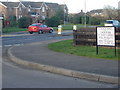

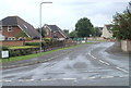
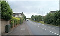
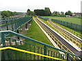
46 photos from this area
Area Information
Key information about the NP26 3EF including its size, population, and administrative classification.
- Area Type
- Postcode
- Area Size
- 2.6 hectares
- Population
- 1597
- Population Density
- 587 people/km²
House Prices in NP26 3EF
31
Properties
£264,883
Average Sold Price
£107,000
Lowest Price
£380,000
Highest Price
Showing 31 properties
| Address | Type | Beds | Baths | Last Sale Price | Last Sale Date | |
|---|---|---|---|---|---|---|
| 22 Arlington Close, Undy, NP26 3EF | Detached | 3 | 1 | £324,950 | Feb 2022 | |
| 26 Arlington Close, Undy, NP26 3EF | house | - | - | £345,000 | Feb 2022 | |
| 28 Arlington Close, Undy, NP26 3EF | house | - | - | £310,000 | Jul 2021 | |
| 17 Arlington Close, Undy, NP26 3EF | Detached | 4 | 2 | £380,000 | Apr 2021 | |
| 2 Arlington Close, Undy, NP26 3EF | Detached | 4 | 2 | £350,000 | Jan 2021 | |
| 21 Arlington Close, Undy, NP26 3EF | Detached | 4 | 1 | £365,000 | Jul 2020 | |
| 8 Arlington Close, Undy, NP26 3EF | house | - | - | £365,000 | Sep 2019 | |
| 6 Arlington Close, Undy, NP26 3EF | Detached | 3 | - | £286,000 | Jul 2019 | |
| 19 Arlington Close, Undy, NP26 3EF | house | - | - | £293,000 | Jun 2019 | |
| 16 Arlington Close, Undy, NP26 3EF | Detached | 3 | - | £215,000 | Jul 2015 |
Page 1 of 4
Energy Efficiency in NP26 3EF
Amenities
Schools
| Rank | School | Type | Entry gender | Ages |
|---|
Explore more schools in this area
Go to Schools tabDemographics
Household Size
Family (3-5 people)
most common
Accommodation Type
Houses
most common
Tenure
85
majority
Ethnic Group
White
most common
Religion
N/A
most common
Household Composition
N/A
most common
Age
47
median
Adults (30-64 years)
most common
Household Deprivation
N/A
with no deprivation
NS-SEC
48
in Lower managerial occupations
Explore more demographic insights in this area
Go to Demographics tabPlanning
Planning Constraints
- Flood RiskPremium
- Ramsar Wetland SitesPremium
- Area of Outstanding Natural BeautyPremium
- Protected Nature ReservePremium
- Protected WoodlandPremium
- Crime RiskPremium