Area Overview for NP26 3PF
Photos of NP26 3PF


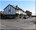
46 photos from this area
Area Information
Key information about the NP26 3PF including its size, population, and administrative classification.
- Area Type
- Postcode
- Area Size
- 5384 m²
- Population
- 1597
- Population Density
- 587 people/km²
House Prices in NP26 3PF
18
Properties
£169,809
Average Sold Price
£49,500
Lowest Price
£274,500
Highest Price
Showing 18 properties
| Address | Type | Beds | Baths | Last Sale Price | Last Sale Date | |
|---|---|---|---|---|---|---|
| 14 Park Court, Undy, NP26 3PF | Terraced | 2 | 1 | £208,000 | Aug 2025 | |
| 3 Park Court, Undy, NP26 3PF | Terraced | 2 | 1 | £200,000 | Aug 2023 | |
| 8 Park Court, Undy, NP26 3PF | house | 2 | 1 | £186,500 | Apr 2023 | |
| 15 Park Court, Undy, NP26 3PF | Terraced | 2 | 1 | £225,000 | Oct 2022 | |
| 1 Park Court, Undy, NP26 3PF | Retail | 2 | 1 | £205,000 | Mar 2022 | |
| 5 Park Court, Undy, NP26 3PF | Flat | 1 | 1 | £130,000 | Mar 2021 | |
| 7 Park Court, Undy, NP26 3PF | Terraced | 2 | 2 | £188,000 | Nov 2020 | |
| 9 Park Court, Undy, NP26 3PF | Terraced | 2 | - | £183,000 | Feb 2020 | |
| 18 Park Court, Undy, NP26 3PF | Detached | 3 | 2 | £274,500 | Feb 2020 | |
| 12 Park Court, Undy, NP26 3PF | Terraced | 2 | 1 | £199,950 | Dec 2019 |
Page 1 of 2
Energy Efficiency in NP26 3PF
Amenities
Schools
| Rank | School | Type | Entry gender | Ages |
|---|
Explore more schools in this area
Go to Schools tabDemographics
Household Size
Family (3-5 people)
most common
Accommodation Type
Houses
most common
Tenure
85
majority
Ethnic Group
White
most common
Religion
N/A
most common
Household Composition
N/A
most common
Age
47
median
Adults (30-64 years)
most common
Household Deprivation
N/A
with no deprivation
NS-SEC
48
in Lower managerial occupations
Explore more demographic insights in this area
Go to Demographics tabPlanning
Planning Constraints
- Flood RiskPremium
- Ramsar Wetland SitesPremium
- Area of Outstanding Natural BeautyPremium
- Protected Nature ReservePremium
- Protected WoodlandPremium
- Crime RiskPremium