Area Overview for NP26 3PL
Photos of NP26 3PL
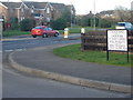

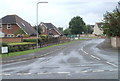
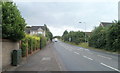
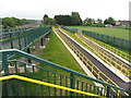
46 photos from this area
Area Information
Key information about the NP26 3PL including its size, population, and administrative classification.
- Area Type
- Postcode
- Area Size
- 1.7 hectares
- Population
- 1597
- Population Density
- 587 people/km²
House Prices in NP26 3PL
51
Properties
£162,274
Average Sold Price
£51,850
Lowest Price
£359,000
Highest Price
Showing 51 properties
| Address | Type | Beds | Baths | Last Sale Price | Last Sale Date | |
|---|---|---|---|---|---|---|
| 10 St Annes Crescent, Undy, NP26 3PL | Detached | 3 | 1 | £288,000 | Oct 2025 | |
| 27 St Annes Crescent, Undy, NP26 3PL | Semi-detached | 3 | 1 | £255,000 | Jun 2025 | |
| 6 St Annes Crescent, Undy, NP26 3PL | house | - | - | £300,000 | Mar 2025 | |
| 62 St Annes Crescent, Undy, NP26 3PL | Semi-detached | 2 | 1 | £224,000 | Feb 2025 | |
| 42 St Annes Crescent, Undy, NP26 3PL | Terraced | 2 | 1 | £215,000 | Jul 2023 | |
| 36 St Annes Crescent, Undy, NP26 3PL | Terraced | 2 | 1 | £208,000 | Jun 2023 | |
| 3 St Annes Crescent, Undy, NP26 3PL | Semi-detached | 2 | - | £240,000 | Dec 2022 | |
| 5 St Annes Crescent, Undy, NP26 3PL | Semi-detached | 3 | 1 | £310,000 | Dec 2022 | |
| 48 St Annes Crescent, Undy, NP26 3PL | Detached | 3 | 1 | £235,600 | Oct 2021 | |
| 8 St Annes Crescent, Undy, NP26 3PL | house | - | - | £267,000 | Sep 2021 |
Page 1 of 6
Energy Efficiency in NP26 3PL
Amenities
Schools
| Rank | School | Type | Entry gender | Ages |
|---|
Explore more schools in this area
Go to Schools tabDemographics
Household Size
Family (3-5 people)
most common
Accommodation Type
Houses
most common
Tenure
85
majority
Ethnic Group
White
most common
Religion
N/A
most common
Household Composition
N/A
most common
Age
47
median
Adults (30-64 years)
most common
Household Deprivation
N/A
with no deprivation
NS-SEC
48
in Lower managerial occupations
Explore more demographic insights in this area
Go to Demographics tabPlanning
Planning Constraints
- Flood RiskPremium
- Ramsar Wetland SitesPremium
- Area of Outstanding Natural BeautyPremium
- Protected Nature ReservePremium
- Protected WoodlandPremium
- Crime RiskPremium