Area Overview for CH8 8RD
Photos of CH8 8RD
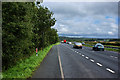
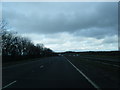
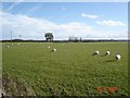
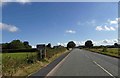

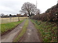
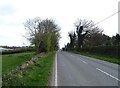
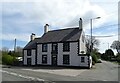
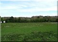
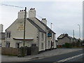
11 photos from this area
Area Information
Key information about the CH8 8RD including its size, population, and administrative classification.
- Area Type
- Postcode
- Area Size
- 42.2 hectares
- Population
- 2243
- Population Density
- 105 people/km²
House Prices in CH8 8RD
25
Properties
£286,182
Average Sold Price
£98,000
Lowest Price
£600,000
Highest Price
Showing 25 properties
| Address | Type | Beds | Baths | Last Sale Price | Last Sale Date | |
|---|---|---|---|---|---|---|
| Little Timber, A 5026 Waen Crossroads To Lloc Junction, Gorsedd, CH8 8RD | Detached | - | - | £225,000 | Jul 2025 | |
| Rock Cottage, St Asaph Road, Gorsedd, CH8 8RD | Cottage | 3 | 1 | £275,000 | Feb 2025 | |
| New Property Adj Highfield House, A 5026 Waen Crossroads To Lloc Junction, Gorsedd, CH8 8RD | Detached | - | - | £450,000 | Sep 2022 | |
| Highfield House, A 5026 Waen Crossroads To Lloc Junction, Gorsedd, CH8 8RD | Detached | 4 | 2 | £370,000 | Mar 2022 | |
| Ty Maen, A 5026 Waen Crossroads To Lloc Junction, Gorsedd, CH8 8RD | Detached | - | - | £600,000 | Sep 2021 | |
| Wharfdale, A 5026 Lloc Junction To A 5151 Junction Crossways Roundabout, Gorsedd, CH8 8RD | house | - | - | £175,000 | Apr 2020 | |
| Woodlands Rest, St Asaph Road, Gorsedd, CH8 8RD | Detached | 4 | 2 | £180,000 | Sep 2018 | |
| Elder Cottage, St Asaph Road, Gorsedd, CH8 8RD | Bungalow | - | - | £98,000 | Aug 2015 | |
| Garreg Lwyd, A 5026 Lloc Junction To A 5151 Junction Crossways Roundabout, Gorsedd, CH8 8RD | house | 4 | - | £415,000 | Nov 2013 | |
| Beeches, St Asaph Road, Gorsedd, CH8 8RD | Detached | - | - | £245,000 | Dec 2003 |
Page 1 of 3
Energy Efficiency in CH8 8RD
Amenities
Schools
| Rank | School | Type | Entry gender | Ages |
|---|
Explore more schools in this area
Go to Schools tabDemographics
Household Size
Two person
most common
Accommodation Type
Houses
most common
Tenure
88
majority
Ethnic Group
White
most common
Religion
N/A
most common
Household Composition
N/A
most common
Age
47
median
Adults (30-64 years)
most common
Household Deprivation
N/A
with no deprivation
NS-SEC
38
in Lower managerial occupations
Explore more demographic insights in this area
Go to Demographics tabPlanning
Planning Constraints
- Flood RiskPremium
- Ramsar Wetland SitesPremium
- Area of Outstanding Natural BeautyPremium
- Protected Nature ReservePremium
- Protected WoodlandPremium
- Crime RiskPremium