Area Overview for Sir y Fflint - Flintshire
Photos of Sir y Fflint - Flintshire


Area Information
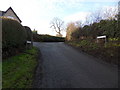
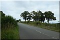
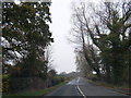
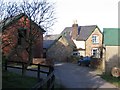
Sir y Fflint covers a vast expanse of 489.9 km² within Flintshire, offering a distinct rural character shaped by its significant natural features. This large local authority district provides space for homes in the area, detached from the busy urban centres typical of more populated regions. Daily life here is defined by an open landscape where residents enjoy a slower pace, far removed from the congestion of major cities. The sheer size of the borough means that distances between settlements are considerable, creating a sense of isolation that appeals to those seeking seclusion. You will find that living in Sir y Fflint involves managing your own transport requirements due to these wide geographical spreads. The community is stable, with a historic demographic profile that signifies long-term settlement rather than rapid shifts. While the area lacks the density of population found in urban counties, it maintains a functional infrastructure sufficient for modern needs. Homeownership rates remain high across the district, contributing to a settled atmosphere where long-time residents dominate the neighbourhoods. This stability often means stronger local networks and a slower, more predictable way of life. However, the vast area size implies that access to commercial amenities may require travel outside the immediate district. Buyers must weigh the tranquility of such a large rural setting against the practicalities of a dispersed living environment.
- Area Type
- District/Borough
- Area Size
- 489.9 km²
- Population
- Not available
- Population Density
- Not available
Demographics
The community in Sir y Fflint presents a clear demographic profile with a median age of 70 years. This figure indicates a population skewed significantly towards older adults, suggesting the area attracts retirees or those seeking a quiet lifestyle. Most common age range data reflects this concentration, confirming that the neighbourhoods are dominated by the later stages of adulthood. Household composition follows this trend, with larger proportions of single-person households or couples without children than those with young families. This specific age structure influences local demand, creating a market where smaller properties or bungalows may see higher interest. Homeownership stands at 72%, which is a notably high figure compared to national averages. This predominant rate of owner-occupied housing creates a sense of permanence and stability throughout the district. The high level of tenure security often coincides with lower turnover rates, meaning residents are likely to stay in their communities for extended periods. Accommodation types generally mirror this ownership pattern, with a legacy stock that has passed through generations. Diversity metrics, while part of the broader household composition data, do not suggest a large influx of transient populations. The environment remains consistent, with a clear focus on providing homes in Sir y Fflint for a mature demographic. This stability benefits those seeking a predictable future but may not suit younger buyers looking for dynamic social hubs.
Household Size
Accommodation Type
Tenure
Ethnic Group
Religion
Household Composition
Age
Household Deprivation
NS-SEC
Explore more demographic insights in this area
Go to Demographics tabPlanning
Planning Constraints
- Flood RiskPremium
- Ramsar Wetland SitesPremium
- Area of Outstanding Natural BeautyPremium
- Protected Nature ReservePremium
- Protected WoodlandPremium
- Crime RiskPremium