Area Overview for CH8 8QZ
Photos of CH8 8QZ


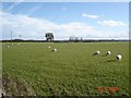


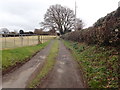
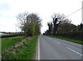
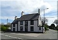
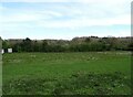
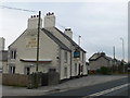

11 photos from this area
Area Information
Key information about the CH8 8QZ including its size, population, and administrative classification.
- Area Type
- Postcode
- Area Size
- 24.3 hectares
- Population
- 2243
- Population Density
- 105 people/km²
House Prices in CH8 8QZ
43
Properties
£225,212
Average Sold Price
£50,000
Lowest Price
£385,000
Highest Price
Showing 43 properties
| Address | Type | Beds | Baths | Last Sale Price | Last Sale Date | |
|---|---|---|---|---|---|---|
| Arnside, Church To A 5026 Moorlands, Gorsedd, CH8 8QZ | Bungalow | 2 | - | £375,000 | Mar 2024 | |
| Hillcot, Church To A 5026 Moorlands, Gorsedd, CH8 8QZ | Bungalow | 2 | - | £220,000 | Feb 2024 | |
| Merton, Church To A 5026 Moorlands, Gorsedd, CH8 8QZ | Retail | 3 | 1 | £265,000 | Oct 2022 | |
| The Old School Hall, Church To A 5026 Moorlands, Gorsedd, CH8 8QZ | Character Property | 3 | 2 | £181,100 | Feb 2021 | |
| Charmis, Church To A 5026 Moorlands, Gorsedd, CH8 8QZ | Bungalow | - | - | £212,000 | Jul 2020 | |
| Hilbre View, Church To A 5026 Moorlands, Gorsedd, CH8 8QZ | Bungalow | - | - | £250,000 | Nov 2019 | |
| South View Cottage, Church To A 5026 Moorlands, Gorsedd, CH8 8QZ | Detached | 4 | 2 | £295,000 | Jul 2019 | |
| Gorsefield, Church To A 5026 Moorlands, Gorsedd, CH8 8QZ | house | - | - | £385,000 | Jun 2018 | |
| Bryn Hyfryd, Church To A 5026 Moorlands, Gorsedd, CH8 8QZ | Bungalow | - | - | £150,000 | Aug 2016 | |
| Bryn Teg, Church To A 5026 Moorlands, Gorsedd, CH8 8QZ | Bungalow | 3 | - | £231,000 | Feb 2016 |
Page 1 of 5
Energy Efficiency in CH8 8QZ
Amenities
Schools
| Rank | School | Type | Entry gender | Ages |
|---|
Explore more schools in this area
Go to Schools tabDemographics
Household Size
Two person
most common
Accommodation Type
Houses
most common
Tenure
88
majority
Ethnic Group
White
most common
Religion
N/A
most common
Household Composition
N/A
most common
Age
47
median
Adults (30-64 years)
most common
Household Deprivation
N/A
with no deprivation
NS-SEC
38
in Lower managerial occupations
Explore more demographic insights in this area
Go to Demographics tabPlanning
Planning Constraints
- Flood RiskPremium
- Ramsar Wetland SitesPremium
- Area of Outstanding Natural BeautyPremium
- Protected Nature ReservePremium
- Protected WoodlandPremium
- Crime RiskPremium