Area Overview for CH5 3HG
Photos of CH5 3HG

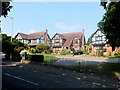
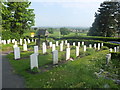
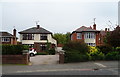
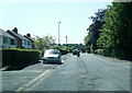
30 photos from this area
Area Information
Key information about the CH5 3HG including its size, population, and administrative classification.
- Area Type
- Postcode
- Area Size
- 10.9 hectares
- Population
- 1928
- Population Density
- 597 people/km²
House Prices in CH5 3HG
28
Properties
£393,386
Average Sold Price
£106,500
Lowest Price
£835,000
Highest Price
Showing 28 properties
| Address | Type | Beds | Baths | Last Sale Price | Last Sale Date | |
|---|---|---|---|---|---|---|
| Oakmere Bungalow, Bennetts Lane, Hawarden, CH5 3HG | hospital_care_home | - | - | £525,000 | Dec 2024 | |
| Springdale, Bennetts Lane, Hawarden, CH5 3HG | house | - | - | £580,000 | Dec 2023 | |
| Brushwood, Bennetts Lane, Hawarden, CH5 3HG | house | - | - | £475,650 | Nov 2022 | |
| Royston, Bennetts Lane, Hawarden, CH5 3HG | Detached | 4 | 1 | £410,000 | Dec 2021 | |
| Brick House Farm, Bennetts Lane, Hawarden, CH5 3HG | Farm | 4 | 2 | £835,000 | Oct 2021 | |
| Tentry Heys, Bennetts Lane, Hawarden, CH5 3HG | house | - | - | £277,000 | Dec 2019 | |
| Well House, Bennetts Lane, Hawarden, CH5 3HG | Detached | 5 | 1 | £510,000 | May 2016 | |
| Archdale, Bennetts Lane, Hawarden, CH5 3HG | Detached | 3 | - | £330,000 | Apr 2015 | |
| Plum Tree Cottage, 17 Bennetts Lane, Hawarden, CH5 3HG | Detached | - | - | £230,000 | Jun 2013 | |
| Cobblestone Cottage, Bennetts Lane, Hawarden, CH5 3HG | Detached | - | - | £490,000 | Jun 2007 |
Page 1 of 3
Energy Efficiency in CH5 3HG
Amenities
Schools
| Rank | School | Type | Entry gender | Ages |
|---|
Explore more schools in this area
Go to Schools tabDemographics
Household Size
Two person
most common
Accommodation Type
Houses
most common
Tenure
82
majority
Ethnic Group
White
most common
Religion
N/A
most common
Household Composition
N/A
most common
Age
47
median
Adults (30-64 years)
most common
Household Deprivation
N/A
with no deprivation
NS-SEC
43
in Lower managerial occupations
Explore more demographic insights in this area
Go to Demographics tabPlanning
Planning Constraints
- Flood RiskPremium
- Ramsar Wetland SitesPremium
- Area of Outstanding Natural BeautyPremium
- Protected Nature ReservePremium
- Protected WoodlandPremium
- Crime RiskPremium