Area Overview for CH5 2BR
Photos of CH5 2BR

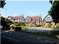

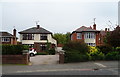
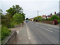


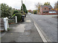


30 photos from this area
Area Information
Key information about the CH5 2BR including its size, population, and administrative classification.
- Area Type
- Postcode
- Area Size
- 13.8 hectares
- Population
- 1674
- Population Density
- 432 people/km²
House Prices in CH5 2BR
67
Properties
£129,510
Average Sold Price
£41,250
Lowest Price
£260,000
Highest Price
Showing 67 properties
| Address | Type | Beds | Baths | Last Sale Price | Last Sale Date | |
|---|---|---|---|---|---|---|
| 48 Ash Lane, Mancot, CH5 2BR | house | - | - | £172,500 | Feb 2025 | |
| 68 Ash Lane, Mancot, CH5 2BR | Semi-detached | 3 | 1 | £212,500 | Dec 2023 | |
| 70 Ash Lane, Mancot, CH5 2BR | house | - | - | £210,000 | Feb 2021 | |
| 62 Ash Lane, Mancot, CH5 2BR | house | - | - | £162,000 | Jul 2019 | |
| 64 Ash Lane, Mancot, CH5 2BR | Semi-detached | 3 | 1 | £172,000 | Apr 2019 | |
| Glamis, Ash Lane, Mancot, CH5 2BR | Bungalow | 3 | - | £260,000 | Mar 2018 | |
| 54 Ash Lane, Mancot, CH5 2BR | house | - | - | £155,000 | Dec 2016 | |
| 78 Ash Lane, Mancot, CH5 2BR | house | - | - | £166,000 | Mar 2014 | |
| 74 Ash Lane, Mancot, CH5 2BR | Detached | 3 | - | £157,500 | Dec 2013 | |
| 38 Ash Lane, Mancot, CH5 2BR | Semi-detached | 4 | - | £156,000 | Sep 2013 |
Page 1 of 7
Energy Efficiency in CH5 2BR
Amenities
Schools
| Rank | School | Type | Entry gender | Ages |
|---|
Explore more schools in this area
Go to Schools tabDemographics
Household Size
Two person
most common
Accommodation Type
Houses
most common
Tenure
61
majority
Ethnic Group
White
most common
Religion
N/A
most common
Household Composition
N/A
most common
Age
47
median
Adults (30-64 years)
most common
Household Deprivation
N/A
with no deprivation
NS-SEC
30
in Lower managerial occupations
Explore more demographic insights in this area
Go to Demographics tabPlanning
Planning Constraints
- Flood RiskPremium
- Ramsar Wetland SitesPremium
- Area of Outstanding Natural BeautyPremium
- Protected Nature ReservePremium
- Protected WoodlandPremium
- Crime RiskPremium