Area Overview for CH5 3EN
Photos of CH5 3EN
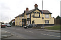
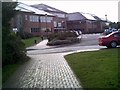
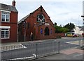
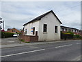
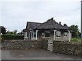
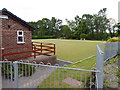
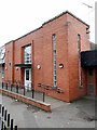
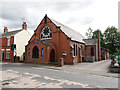

16 photos from this area
Area Information
Key information about the CH5 3EN including its size, population, and administrative classification.
- Area Type
- Postcode
- Area Size
- 7.9 hectares
- Population
- 1928
- Population Density
- 597 people/km²
House Prices in CH5 3EN
42
Properties
£185,263
Average Sold Price
£28,910
Lowest Price
£625,000
Highest Price
Showing 42 properties
| Address | Type | Beds | Baths | Last Sale Price | Last Sale Date | |
|---|---|---|---|---|---|---|
| 29 Upper Aston Hall Lane, Hawarden, CH5 3EN | house | - | - | £210,000 | Jun 2024 | |
| 13 Upper Aston Hall Lane, Hawarden, CH5 3EN | house | 3 | 1 | £235,000 | May 2024 | |
| 7 Upper Aston Hall Lane, Hawarden, CH5 3EN | house | - | - | £216,800 | Dec 2022 | |
| 45 Upper Aston Hall Lane, Hawarden, CH5 3EN | house | - | - | £229,000 | Aug 2022 | |
| 4 Upper Aston Hall Lane, Hawarden, CH5 3EN | Detached | 4 | - | £625,000 | Feb 2021 | |
| 10 Upper Aston Hall Lane, Hawarden, CH5 3EN | Bungalow | 5 | 3 | £440,000 | Nov 2020 | |
| 25 Upper Aston Hall Lane, Hawarden, CH5 3EN | house | 2 | - | £110,000 | May 2014 | |
| 63 Upper Aston Hall Lane, Hawarden, CH5 3EN | house | - | - | £234,000 | Sep 2012 | |
| 35 Upper Aston Hall Lane, Hawarden, CH5 3EN | Semi-detached | - | - | £165,000 | Mar 2008 | |
| 27 Upper Aston Hall Lane, Hawarden, CH5 3EN | Semi-detached | - | - | £28,910 | Mar 2003 |
Page 1 of 5
Energy Efficiency in CH5 3EN
Amenities
Schools
| Rank | School | Type | Entry gender | Ages |
|---|
Explore more schools in this area
Go to Schools tabDemographics
Household Size
Two person
most common
Accommodation Type
Houses
most common
Tenure
82
majority
Ethnic Group
White
most common
Religion
N/A
most common
Household Composition
N/A
most common
Age
47
median
Adults (30-64 years)
most common
Household Deprivation
N/A
with no deprivation
NS-SEC
43
in Lower managerial occupations
Explore more demographic insights in this area
Go to Demographics tabPlanning
Planning Constraints
- Flood RiskPremium
- Ramsar Wetland SitesPremium
- Area of Outstanding Natural BeautyPremium
- Protected Nature ReservePremium
- Protected WoodlandPremium
- Crime RiskPremium